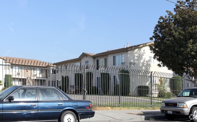
Property Record
12747 Mercer St, Pacoima, CA 91331


NEARBY LISTINGS FOR SALE OR LEASE
Property Detail
12747 Mercer St
Los Angeles-Long Beach-Glendale, CA
29370
2533-029-051
TR=29370 LOT 1
Multifamilydwelling
Los Angeles
X
California
06037C1075G
1
2024
2.85 AC
2025
Pacoima
104203
Los Angeles
55,132 SF
DEMOGRAPHICS near 12747 Mercer St
1 Mile
3 Mile
5 Mile
2024 Total Population
33,181
175,431
426,129
2029 Population
31,538
167,852
411,684
Pop Growth 2024-2029
(4.95%)
(4.32%)
(3.39%)
Average Age
36
38
38
2024 Total Households
7,773
42,670
112,808
HH Growth 2024-2029
(5.45%)
(4.62%)
(3.60%)
Median Household Inc
$59,123
$74,855
$71,306
Avg Household Size
3.80
3.80
3.60
2024 Avg HH Vehicles
2.00
2.00
2.00
Median Home Value
$516,829
$639,762
$674,066
Median Year Built
1966
1961
1965
Nearby Places
Map Layers
Map Styles
 Street
 Aerial
- Restaurants
- Banks
- Shops
- Fitness
- Groceries
PUBLIC TRANSPORTATION
COMMUTER RAIL
Sylmar/San Fernando (Antelope Valley Line - Southern California Regional Rail Authority (Metrolink))
DRIVE
WALK
Distance
Sylmar/San Fernando (Antelope Valley Line - Southern California Regional Rail Authority (Metrolink))
7 min
3.4 mi
Sun Valley (Antelope Valley Line - Southern California Regional Rail Authority (Metrolink))
DRIVE
WALK
Distance
Sun Valley (Antelope Valley Line - Southern California Regional Rail Authority (Metrolink))
8 min
5.1 mi
AIRPORT
Bob Hope
DRIVE
WALK
Distance
Bob Hope
12 min
6.9 mi
Los Angeles International
DRIVE
WALK
Distance
Los Angeles International
39 min
29.1 mi
Freight Ports
Port of Long Beach
DRIVE
WALK
Distance
Port of Long Beach
59 min
43.5 mi
Nearby Properties
Address
Land Use
TOTAL SIZE
Lot Size
Zoning
Address
Land Use
TOTAL SIZE
Lot Size
Zoning
237,451 SF
13.93 AC
LAA2
Address
Land Use
TOTAL SIZE
Lot Size
Zoning
281,288 SF
34.03 AC
LAM2
Address
Land Use
TOTAL SIZE
Lot Size
Zoning
196,404 SF
10.06 AC
LARD1.5
Address
Land Use
TOTAL SIZE
Lot Size
Zoning
185,568 SF
9.06 AC
LARD1.5
Address
Land Use
TOTAL SIZE
Lot Size
Zoning
169,259 SF
2.56 AC
LAC1
Address
Land Use
TOTAL SIZE
Lot Size
Zoning
176,704 SF
4.10 AC
LAR3
Address
Land Use
TOTAL SIZE
Lot Size
Zoning
257,802 SF
4.52 AC
LARA
Address
Land Use
TOTAL SIZE
Lot Size
Zoning
776,594 SF
16.18 AC
LAC2
Address
Land Use
TOTAL SIZE
Lot Size
Zoning
96,792 SF
5.52 AC
LARD2
Address
Land Use
TOTAL SIZE
Lot Size
Zoning
100,967 SF
11.78 AC
LAP
Address
Land Use
TOTAL SIZE
Lot Size
Zoning
150,041 SF
10.46 AC
LAA2
Address
Land Use
TOTAL SIZE
Lot Size
Zoning
146,718 SF
7.36 AC
Address
Land Use
TOTAL SIZE
Lot Size
Zoning
146,718 SF
7.11 AC
SFM
Address
Land Use
TOTAL SIZE
Lot Size
Zoning
11,067 SF
3.21 AC
LAM2
Address
Land Use
TOTAL SIZE
Lot Size
Zoning
154,575 SF
12.20 AC
LAM3
Address
Land Use
TOTAL SIZE
Lot Size
Zoning
120,590 SF
9.52 AC
SFM2-C1P*
Address
Land Use
TOTAL SIZE
Lot Size
Zoning
179,394 SF
6.44 AC
LAC1
Address
Land Use
TOTAL SIZE
Lot Size
Zoning
108,012 SF
6.40 AC
LAR3
Address
Land Use
TOTAL SIZE
Lot Size
Zoning
140,411 SF
10.79 AC
LAM3
Address
Land Use
TOTAL SIZE
Lot Size
Zoning
93,635 SF
4.97 AC
LAM2
Address
Land Use
TOTAL SIZE
Lot Size
Zoning
44,480 SF
2.72 AC
LAM2
Address
Land Use
TOTAL SIZE
Lot Size
Zoning
170,161 SF
7.76 AC
LAMR2
Address
Land Use
TOTAL SIZE
Lot Size
Zoning
79,778 SF
3.90 AC
LARD1.5
Address
Land Use
TOTAL SIZE
Lot Size
Zoning
99,966 SF
4.53 AC
LAM1
Address
Land Use
TOTAL SIZE
Lot Size
Zoning
122,868 SF
4.96 AC
LAM2
Address
Land Use
TOTAL SIZE
Lot Size
Zoning
138,229 SF
4.67 AC
SFM2*
Address
Land Use
TOTAL SIZE
Lot Size
Zoning
94,760 SF
5.01 AC
LAR3
Address
Land Use
TOTAL SIZE
Lot Size
Zoning
50,424 SF
3.32 AC
LAR3
Address
Land Use
TOTAL SIZE
Lot Size
Zoning
214,067 SF
8.50 AC
SFM2-C1P*
The World's #1 Commercial Real Estate Marketplace
Connect with us
© 2025 CoStar Group
The information above has been obtained from sources believed reliable. While we do not doubt its accuracy we have not verified it and make no guarantee, warranty or representation about it. It is your responsibility to independently confirm its accuracy and completeness. Any projections, opinions, assumptions, or estimates used are for example only and do not represent the current or future performance of the property. The value of this transaction to you depends on tax and other factors which should be evaluated by your tax, financial, and legal advisors. You and your advisors should conduct a careful, independent investigation of the property to determine to your satisfaction the suitability of the property for your needs.