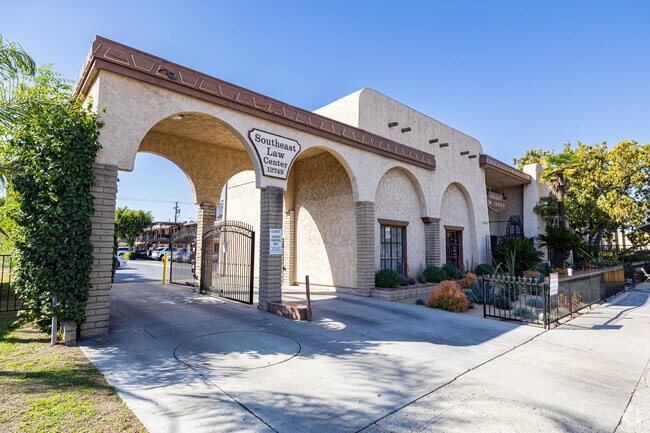
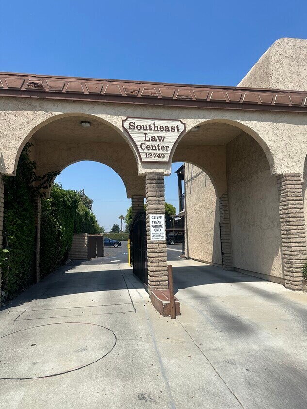
Property Record
12749 Norwalk Blvd, Norwalk, CA 90650

NEARBY LISTINGS FOR SALE OR LEASE
Property Detail
12749 Norwalk Blvd
8047-005-065
TR=38863 CONDOMINIUM UNITS 208, 209
Officecondo
Los Angeles
X
California
06037C1837F
0.87 AC
2024
Southeast Los Angeles
2025
Los Angeles
552200
Los Angeles-Long Beach-Glendale, CA
855 SF
DEMOGRAPHICS near 12749 Norwalk Blvd
1 Mile
3 Mile
5 Mile
2024 Total Population
26,421
195,333
605,923
2029 Population
25,320
187,867
585,062
Pop Growth 2024-2029
(4.17%)
(3.82%)
(3.44%)
Average Age
39
39
39
2024 Total Households
7,475
54,131
178,831
HH Growth 2024-2029
(4.49%)
(4.13%)
(3.69%)
Median Household Inc
$76,087
$86,752
$85,161
Avg Household Size
3.40
3.50
3.30
2024 Avg HH Vehicles
2.00
2.00
2.00
Median Home Value
$571,348
$662,244
$705,636
Median Year Built
1957
1958
1959
Nearby Places
Map Layers
Map Styles
 Street
 Aerial
- Restaurants
- Banks
- Shops
- Fitness
- Groceries
PUBLIC TRANSPORTATION
TRANSIT/SUBWAY
Norwalk/Santa Fe Springs (91 Line - Southern California Regional Rail Authority (Metrolink), Orange County Line - Southern California Regional Rail Authority (Metrolink))
DRIVE
WALK
Distance
Norwalk/Santa Fe Springs (91 Line - Southern California Regional Rail Authority (Metrolink), Orange County Line - Southern California Regional Rail Authority (Metrolink))
4 min
19 min
1.0 mi
COMMUTER RAIL
Norwalk/Santa Fe Springs (91 Line - Southern California Regional Rail Authority (Metrolink), Orange County Line - Southern California Regional Rail Authority (Metrolink))
DRIVE
WALK
Distance
Norwalk/Santa Fe Springs (91 Line - Southern California Regional Rail Authority (Metrolink), Orange County Line - Southern California Regional Rail Authority (Metrolink))
4 min
19 min
1.0 mi
Commerce (91 Line - Southern California Regional Rail Authority (Metrolink), Orange County Line - Southern California Regional Rail Authority (Metrolink))
DRIVE
WALK
Distance
Commerce (91 Line - Southern California Regional Rail Authority (Metrolink), Orange County Line - Southern California Regional Rail Authority (Metrolink))
12 min
7.2 mi
AIRPORT
Long Beach (Daugherty Field)
DRIVE
WALK
Distance
Long Beach (Daugherty Field)
22 min
12.4 mi
Los Angeles International
DRIVE
WALK
Distance
Los Angeles International
29 min
21.5 mi
John Wayne/Orange County
DRIVE
WALK
Distance
John Wayne/Orange County
30 min
24.3 mi
Freight Ports
Port of Long Beach
DRIVE
WALK
Distance
Port of Long Beach
28 min
18.1 mi
SALE & LEASE HISTORY
LISTING DATE
SALE/LEASE

Sep 29, 2022
For Sale
Oct 25, 2023
For Lease
May 15, 2017
For Lease
Jun 29, 2023
For Lease
Jun 05, 2017
For Lease
Jul 31, 2024
For Lease
Jul 22, 2022
For Sale
Jan 28, 2023
For Lease
Aug 05, 2017
For Sale
Apr 08, 2021
For Lease
Nearby Properties
Address
Land Use
TOTAL SIZE
Lot Size
Zoning
Address
Land Use
TOTAL SIZE
Lot Size
Zoning
1,100,900 SF
22.36 AC
SSM2*
Address
Land Use
TOTAL SIZE
Lot Size
Zoning
634,060 SF
76.06 AC
SSM2
Address
Land Use
TOTAL SIZE
Lot Size
Zoning
564,705 SF
14.35 AC
LCA25*
Address
Land Use
TOTAL SIZE
Lot Size
Zoning
383,495 SF
11.60 AC
DOR3PUD*
Address
Land Use
TOTAL SIZE
Lot Size
Zoning
369,940 SF
8.70 AC
CEM
Address
Land Use
TOTAL SIZE
Lot Size
Zoning
166,712 SF
8.53 AC
NOM1(PF)-P
Address
Land Use
TOTAL SIZE
Lot Size
Zoning
322,048 SF
15.54 AC
SSM2-M1*
Address
Land Use
TOTAL SIZE
Lot Size
Zoning
224,131 SF
9.03 AC
CEM
Address
Land Use
TOTAL SIZE
Lot Size
Zoning
304,549 SF
7.13 AC
SSM2*
Address
Land Use
TOTAL SIZE
Lot Size
Zoning
371,464 SF
9.28 AC
DOM2-P*
Address
Land Use
TOTAL SIZE
Lot Size
Zoning
518,296 SF
13.94 AC
NOCO(PF)*
Address
Land Use
TOTAL SIZE
Lot Size
Zoning
300,148 SF
13.01 AC
SSM2*
Address
Land Use
TOTAL SIZE
Lot Size
Zoning
266,337 SF
2.40 AC
CE-ADP-16
Address
Land Use
TOTAL SIZE
Lot Size
Zoning
288,000 SF
13.56 AC
SSM2-BP*
Address
Land Use
TOTAL SIZE
Lot Size
Zoning
163,350 SF
7.58 AC
CEM
Address
Land Use
TOTAL SIZE
Lot Size
Zoning
154,616 SF
7.53 AC
CEM
Address
Land Use
TOTAL SIZE
Lot Size
Zoning
176,103 SF
SSM2YY
Address
Land Use
TOTAL SIZE
Lot Size
Zoning
444,784 SF
18.92 AC
SSM2*
Address
Land Use
TOTAL SIZE
Lot Size
Zoning
41,100 SF
8.42 AC
SSM2*
Address
Land Use
TOTAL SIZE
Lot Size
Zoning
289,454 SF
13.66 AC
SSM2*
Address
Land Use
TOTAL SIZE
Lot Size
Zoning
183,000 SF
7.76 AC
SSM2*
Address
Land Use
TOTAL SIZE
Lot Size
Zoning
158,272 SF
7.09 AC
SSPF*
Address
Land Use
TOTAL SIZE
Lot Size
Zoning
657,978 SF
31.68 AC
SSM2*
Address
Land Use
TOTAL SIZE
Lot Size
Zoning
89,899 SF
SSM2*
Address
Land Use
TOTAL SIZE
Lot Size
Zoning
73,661 SF
4.25 AC
SSR1
Address
Land Use
TOTAL SIZE
Lot Size
Zoning
834,952 SF
33.06 AC
SSM2
Address
Land Use
TOTAL SIZE
Lot Size
Zoning
168,912 SF
8.09 AC
CEM
Address
Land Use
TOTAL SIZE
Lot Size
Zoning
124,820 SF
4.11 AC
NOM2*
Address
Land Use
TOTAL SIZE
Lot Size
Zoning
161,650 SF
6 AC
CEM(D1)*
Address
Land Use
TOTAL SIZE
Lot Size
Zoning
500,374 SF
9.46 AC
SSM2*
The World's #1 Commercial Real Estate Marketplace
Connect with us
© 2025 CoStar Group
The information above has been obtained from sources believed reliable. While we do not doubt its accuracy we have not verified it and make no guarantee, warranty or representation about it. It is your responsibility to independently confirm its accuracy and completeness. Any projections, opinions, assumptions, or estimates used are for example only and do not represent the current or future performance of the property. The value of this transaction to you depends on tax and other factors which should be evaluated by your tax, financial, and legal advisors. You and your advisors should conduct a careful, independent investigation of the property to determine to your satisfaction the suitability of the property for your needs.