Property Record
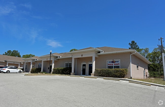
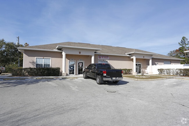
1275 Kass Cir, Spring Hill, FL 34606

Property Detail
1275 Kass Cir
R27-223-17-9048-00B0-0030
KASS STATION CONDOMINIUM BUILDING B UNIT 3
Officebuilding
HERNANDO
B and X Area of moderate flood hazard, usually the area between the limits of the 100-year and 500-year floods.
Florida
2025
0.03 AC
2025
Hernando County
041302
Tampa/St Petersburg
1,056 SF
Tampa-St. Petersburg-Clearwater, FL
NEARBY LISTINGS FOR SALE OR LEASE
DEMOGRAPHICS near 1275 Kass Cir
1 mile
3 mile
5 mile
2025 Total Population
9,453
48,721
100,012
2030 Population
10,328
53,529
110,093
Pop Growth 2025-2030
+ 9.26%
+ 9.87%
+ 10.08%
Average Age
45
48
47
2025 Total Households
4,186
21,345
42,153
HH Growth 2025-2030
+ 9.25%
+ 9.79%
+ 9.97%
Median Household Inc
$56,663
$62,117
$65,129
Avg Household Size
2.20
2.20
2.30
2025 Avg HH Vehicles
2.00
2.00
2.00
Median Home Value
$274,782
$285,421
$297,699
Median Year Built
1985
1988
1989
Nearby Places
Map Layers
Map Styles
 Street
 Aerial
Transit
 Traffic
 Biking
Places
Listings with unknown addresses are not visible on the map
- Restaurants
- Banks
- Shops
- Fitness
- Groceries
PUBLIC TRANSPORTATION
AIRPORT
Tampa International
Drive
Walk
Distance
Tampa International
67 min
47.3 mi
Freight Ports
Port of Tampa Bay
Drive
Walk
Distance
Port of Tampa Bay
78 min
45.3 mi
SALE & LEASE HISTORY
LISTING DATE
SALE/LEASE

Sep 25, 2016
For Lease
Nov 08, 2016
For Lease
Feb 04, 2019
For Lease
Nearby Properties
Address
Land Use
TOTAL SIZE
Lot Size
Zoning
Address
Land Use
TOTAL SIZE
Lot Size
Zoning
222,888 SF
7 AC
Address
Land Use
TOTAL SIZE
Lot Size
Zoning
217,451 SF
19.40 AC
Address
Land Use
TOTAL SIZE
Lot Size
Zoning
232,408 SF
24.40 AC
Address
Land Use
TOTAL SIZE
Lot Size
Zoning
212,404 SF
13.06 AC
Address
Land Use
TOTAL SIZE
Lot Size
Zoning
118,173 SF
13.60 AC
Address
Land Use
TOTAL SIZE
Lot Size
Zoning
152,713 SF
17.63 AC
Address
Land Use
TOTAL SIZE
Lot Size
Zoning
108,275 SF
1.79 AC
Address
Land Use
TOTAL SIZE
Lot Size
Zoning
115,496 SF
12.20 AC
Address
Land Use
TOTAL SIZE
Lot Size
Zoning
139,360 SF
15.50 AC
Address
Land Use
TOTAL SIZE
Lot Size
Zoning
115,277 SF
8.40 AC
Address
Land Use
TOTAL SIZE
Lot Size
Zoning
226,102 SF
15.20 AC
Address
Land Use
TOTAL SIZE
Lot Size
Zoning
137,425 SF
16.70 AC
Address
Land Use
TOTAL SIZE
Lot Size
Zoning
155,070 SF
10.69 AC
Address
Land Use
TOTAL SIZE
Lot Size
Zoning
105,534 SF
9.10 AC
Address
Land Use
TOTAL SIZE
Lot Size
Zoning
58,649 SF
5.70 AC
Address
Land Use
TOTAL SIZE
Lot Size
Zoning
82,396 SF
4.28 AC
Address
Land Use
TOTAL SIZE
Lot Size
Zoning
89,263 SF
3.54 AC
Address
Land Use
TOTAL SIZE
Lot Size
Zoning
40,066 SF
1.99 AC
Address
Land Use
TOTAL SIZE
Lot Size
Zoning
Address
Land Use
TOTAL SIZE
Lot Size
Zoning
54,136 SF
8.20 AC
Address
Land Use
TOTAL SIZE
Lot Size
Zoning
125,940 SF
4.92 AC
Address
Land Use
TOTAL SIZE
Lot Size
Zoning
103,808 SF
10.10 AC
Address
Land Use
TOTAL SIZE
Lot Size
Zoning
65,581 SF
5.77 AC
C2
Address
Land Use
TOTAL SIZE
Lot Size
Zoning
56,523 SF
7.25 AC
Address
Land Use
TOTAL SIZE
Lot Size
Zoning
6,743 SF
3.47 AC
Address
Land Use
TOTAL SIZE
Lot Size
Zoning
83,815 SF
12.10 AC
Address
Land Use
TOTAL SIZE
Lot Size
Zoning
44,369 SF
2.64 AC
Address
Land Use
TOTAL SIZE
Lot Size
Zoning
47,910 SF
0.68 AC
Address
Land Use
TOTAL SIZE
Lot Size
Zoning
8,760 SF
2.29 AC
Address
Land Use
TOTAL SIZE
Lot Size
Zoning
35,276 SF
3.55 AC
The World's #1 Commercial Real Estate Marketplace
Connect with us
© 2026 CoStar Group
The information above has been obtained from sources believed reliable. While we do not doubt its accuracy we have not verified it and make no guarantee, warranty or representation about it. It is your responsibility to independently confirm its accuracy and completeness. Any projections, opinions, assumptions, or estimates used are for example only and do not represent the current or future performance of the property. The value of this transaction to you depends on tax and other factors which should be evaluated by your tax, financial, and legal advisors. You and your advisors should conduct a careful, independent investigation of the property to determine to your satisfaction the suitability of the property for your needs.