Property Record
1275 Milwaukee Ave, Glenview, IL 60025
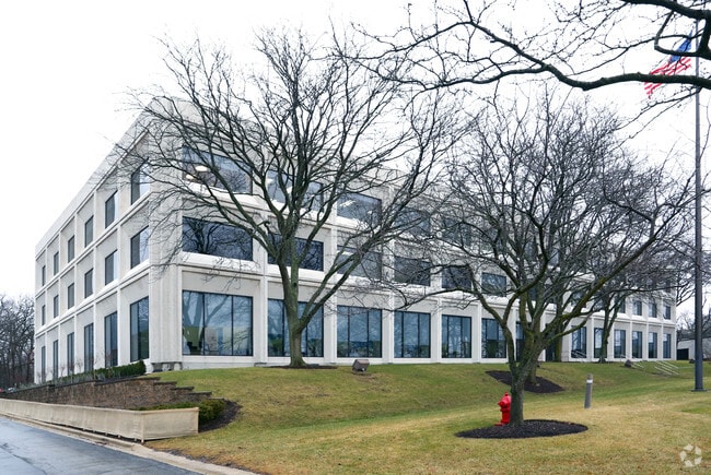

Property Detail
1275 Milwaukee Ave
04-29-300-084-0000
Cook
Storebuilding
Illinois
B and X Area of moderate flood hazard, usually the area between the limits of the 100-year and 500-year floods.
5.62 AC
2023
Near North
2025
Chicago
801607
Chicago-Naperville-Elgin, IL-IN
79,606 SF
NEARBY LISTINGS FOR SALE OR LEASE
DEMOGRAPHICS near 1275 Milwaukee Ave
1 mile
3 mile
5 mile
2025 Total Population
12,902
121,651
314,412
2030 Population
13,059
122,753
317,360
Pop Growth 2025-2030
+ 1.22%
+ 0.91%
+ 0.94%
Average Age
43
44
44
2025 Total Households
4,747
46,002
118,512
HH Growth 2025-2030
+ 1.03%
+ 0.78%
+ 0.79%
Median Household Inc
$81,473
$92,312
$105,012
Avg Household Size
2.60
2.50
2.60
2025 Avg HH Vehicles
2.00
2.00
2.00
Median Home Value
$463,946
$406,155
$408,380
Median Year Built
1975
1973
1969
Nearby Places
Map Layers
Map Styles
 Street
 Aerial
Layers
 Traffic
 Biking
Places
Listings with unknown addresses are not visible on the map
- Restaurants
- Banks
- Shops
- Fitness
- Groceries
PUBLIC TRANSPORTATION
COMMUTER RAIL
Prospect Heights Station (North Central Service - Northeast Illinois Regional Commuter Railroad (Metra))
Drive
Walk
Distance
Prospect Heights Station (North Central Service - Northeast Illinois Regional Commuter Railroad (Metra))
6 min
3.1 mi
Glenview Station (Milwaukee District North Line - Northeast Illinois Regional Commuter Railroad (Metra))
Drive
Walk
Distance
Glenview Station (Milwaukee District North Line - Northeast Illinois Regional Commuter Railroad (Metra))
8 min
3.5 mi
AIRPORT
Chicago O'Hare International
Drive
Walk
Distance
Chicago O'Hare International
41 min
15.4 mi
Chicago Midway International
Drive
Walk
Distance
Chicago Midway International
45 min
24.3 mi
Nearby Properties
Address
Land Use
TOTAL SIZE
Lot Size
Zoning
Address
Land Use
TOTAL SIZE
Lot Size
Zoning
78,600 SF
9.20 AC
Address
Land Use
TOTAL SIZE
Lot Size
Zoning
Address
Land Use
TOTAL SIZE
Lot Size
Zoning
188,728 SF
Address
Land Use
TOTAL SIZE
Lot Size
Zoning
8.04 AC
Address
Land Use
TOTAL SIZE
Lot Size
Zoning
22.72 AC
Address
Land Use
TOTAL SIZE
Lot Size
Zoning
20.79 AC
Address
Land Use
TOTAL SIZE
Lot Size
Zoning
206,160 SF
9.44 AC
Address
Land Use
TOTAL SIZE
Lot Size
Zoning
443,916 SF
5.61 AC
Address
Land Use
TOTAL SIZE
Lot Size
Zoning
76,014 SF
2.81 AC
Address
Land Use
TOTAL SIZE
Lot Size
Zoning
552,862 SF
45.76 AC
Address
Land Use
TOTAL SIZE
Lot Size
Zoning
142,300 SF
13.16 AC
Address
Land Use
TOTAL SIZE
Lot Size
Zoning
611,799 SF
17.61 AC
Address
Land Use
TOTAL SIZE
Lot Size
Zoning
98,802 SF
1.06 AC
Address
Land Use
TOTAL SIZE
Lot Size
Zoning
449,568 SF
22.73 AC
Address
Land Use
TOTAL SIZE
Lot Size
Zoning
405,484 SF
Address
Land Use
TOTAL SIZE
Lot Size
Zoning
276,112 SF
10.02 AC
Address
Land Use
TOTAL SIZE
Lot Size
Zoning
59,013 SF
1.90 AC
Address
Land Use
TOTAL SIZE
Lot Size
Zoning
23.45 AC
Address
Land Use
TOTAL SIZE
Lot Size
Zoning
73,815 SF
4.35 AC
Address
Land Use
TOTAL SIZE
Lot Size
Zoning
10,404 SF
45.11 AC
Address
Land Use
TOTAL SIZE
Lot Size
Zoning
13.13 AC
Address
Land Use
TOTAL SIZE
Lot Size
Zoning
91,505 SF
4.86 AC
Address
Land Use
TOTAL SIZE
Lot Size
Zoning
Address
Land Use
TOTAL SIZE
Lot Size
Zoning
5,769 SF
18.18 AC
Address
Land Use
TOTAL SIZE
Lot Size
Zoning
65,401 SF
5.05 AC
Address
Land Use
TOTAL SIZE
Lot Size
Zoning
89,080 SF
6.81 AC
Address
Land Use
TOTAL SIZE
Lot Size
Zoning
Address
Land Use
TOTAL SIZE
Lot Size
Zoning
186,173 SF
5.86 AC
Address
Land Use
TOTAL SIZE
Lot Size
Zoning
251,385 SF
17.46 AC
Address
Land Use
TOTAL SIZE
Lot Size
Zoning
197,191 SF
7.20 AC
The World's #1 Commercial Real Estate Marketplace
Connect with us
© 2026 CoStar Group
The information above has been obtained from sources believed reliable. While we do not doubt its accuracy we have not verified it and make no guarantee, warranty or representation about it. It is your responsibility to independently confirm its accuracy and completeness. Any projections, opinions, assumptions, or estimates used are for example only and do not represent the current or future performance of the property. The value of this transaction to you depends on tax and other factors which should be evaluated by your tax, financial, and legal advisors. You and your advisors should conduct a careful, independent investigation of the property to determine to your satisfaction the suitability of the property for your needs.