Property Record
1275 Simi Town Center Way, Simi Valley, CA 93065

NEARBY LISTINGS FOR SALE OR LEASE
Property Detail
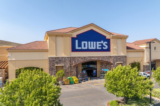
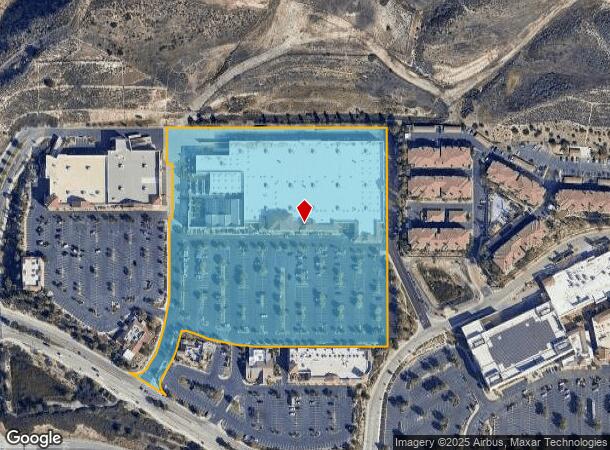
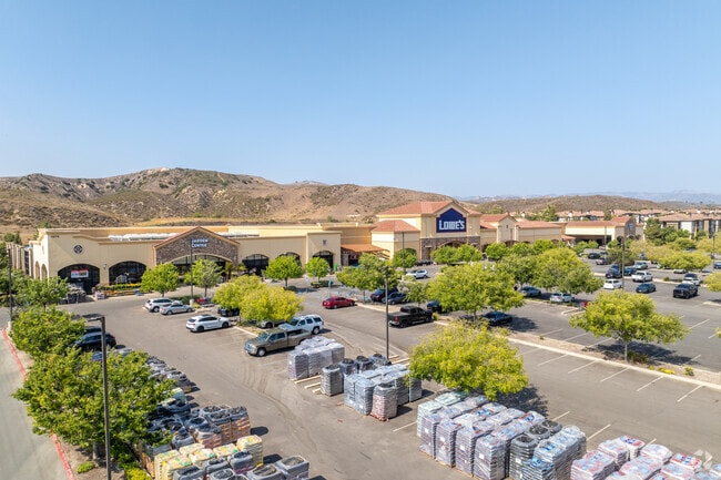
1275 Simi Town Center Way
612-0-230-045
Tract No. 5430
Storebuilding
TRACT: 543000 REF: 151MR 70
X
Ventura
06111C0842E
California
2024
11.46 AC
2025
Moorpark/Simi Valley
008502
Los Angeles
18,820 SF
Oxnard-Thousand Oaks-Ventura, CA
DEMOGRAPHICS near 1275 Simi Town Center Way
1 Mile
3 Mile
5 Mile
2024 Total Population
7,225
68,713
110,772
2029 Population
7,085
67,617
109,003
Pop Growth 2024-2029
(1.94%)
(1.60%)
(1.60%)
Average Age
38
41
41
2024 Total Households
2,388
22,520
37,010
HH Growth 2024-2029
(2.05%)
(1.75%)
(1.74%)
Median Household Inc
$97,489
$101,501
$108,643
Avg Household Size
2.90
2.90
2.90
2024 Avg HH Vehicles
2.00
2.00
2.00
Median Home Value
$716,899
$731,662
$737,896
Median Year Built
1982
1976
1979
Nearby Places
Map Layers
Map Styles
 Street
 Aerial
- Restaurants
- Banks
- Shops
- Fitness
- Groceries
PUBLIC TRANSPORTATION
COMMUTER RAIL
Simi Valley (Ventura County Line - Southern California Regional Rail Authority (Metrolink))
DRIVE
WALK
Distance
Simi Valley (Ventura County Line - Southern California Regional Rail Authority (Metrolink))
10 min
6.2 mi
Moorpark (Ventura County Line - Southern California Regional Rail Authority (Metrolink))
DRIVE
WALK
Distance
Moorpark (Ventura County Line - Southern California Regional Rail Authority (Metrolink))
11 min
7.4 mi
AIRPORT
Bob Hope
DRIVE
WALK
Distance
Bob Hope
36 min
28.3 mi
Freight Ports
The Port of Hueneme
DRIVE
WALK
Distance
The Port of Hueneme
47 min
29.8 mi
Nearby Properties
Address
Land Use
TOTAL SIZE
Lot Size
Zoning
Address
Land Use
TOTAL SIZE
Lot Size
Zoning
4.77 AC
CO
Address
Land Use
TOTAL SIZE
Lot Size
Zoning
286,132 SF
15.07 AC
RVH-.
Address
Land Use
TOTAL SIZE
Lot Size
Zoning
28,561 SF
43.55 AC
BP-S
Address
Land Use
TOTAL SIZE
Lot Size
Zoning
45,594 SF
15.99 AC
RVH-2
Address
Land Use
TOTAL SIZE
Lot Size
Zoning
265,102 SF
12.30 AC
Address
Land Use
TOTAL SIZE
Lot Size
Zoning
238,578 SF
10.85 AC
Address
Land Use
TOTAL SIZE
Lot Size
Zoning
276,943 SF
24.62 AC
RVH-
Address
Land Use
TOTAL SIZE
Lot Size
Zoning
71,166 SF
12.44 AC
GI
Address
Land Use
TOTAL SIZE
Lot Size
Zoning
21,873 SF
17.04 AC
Address
Land Use
TOTAL SIZE
Lot Size
Zoning
14.66 AC
Address
Land Use
TOTAL SIZE
Lot Size
Zoning
3.15 AC
RL-1
Address
Land Use
TOTAL SIZE
Lot Size
Zoning
89,902 SF
4.03 AC
Address
Land Use
TOTAL SIZE
Lot Size
Zoning
14,120 SF
8.22 AC
Address
Land Use
TOTAL SIZE
Lot Size
Zoning
20,660 SF
8.15 AC
Address
Land Use
TOTAL SIZE
Lot Size
Zoning
66,724 SF
2.83 AC
Address
Land Use
TOTAL SIZE
Lot Size
Zoning
18,889 SF
10.29 AC
A1
Address
Land Use
TOTAL SIZE
Lot Size
Zoning
Address
Land Use
TOTAL SIZE
Lot Size
Zoning
10,368 SF
13.36 AC
Address
Land Use
TOTAL SIZE
Lot Size
Zoning
3.27 AC
CPD
Address
Land Use
TOTAL SIZE
Lot Size
Zoning
71,396 SF
12.11 AC
GI
Address
Land Use
TOTAL SIZE
Lot Size
Zoning
78,222 SF
5.45 AC
Address
Land Use
TOTAL SIZE
Lot Size
Zoning
2.12 AC
Address
Land Use
TOTAL SIZE
Lot Size
Zoning
Address
Land Use
TOTAL SIZE
Lot Size
Zoning
2.24 AC
Address
Land Use
TOTAL SIZE
Lot Size
Zoning
3,195 SF
7.74 AC
GI
Address
Land Use
TOTAL SIZE
Lot Size
Zoning
19,884 SF
9.24 AC
Address
Land Use
TOTAL SIZE
Lot Size
Zoning
30,275 SF
12.98 AC
The World's #1 Commercial Real Estate Marketplace
Connect with us
© 2025 CoStar Group
The information above has been obtained from sources believed reliable. While we do not doubt its accuracy we have not verified it and make no guarantee, warranty or representation about it. It is your responsibility to independently confirm its accuracy and completeness. Any projections, opinions, assumptions, or estimates used are for example only and do not represent the current or future performance of the property. The value of this transaction to you depends on tax and other factors which should be evaluated by your tax, financial, and legal advisors. You and your advisors should conduct a careful, independent investigation of the property to determine to your satisfaction the suitability of the property for your needs.