Property Record
1275 Table Rock Rd, Pickens, SC 29671

Property Detail
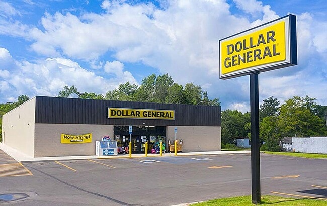
1275 Table Rock Rd
5105-00-56-2981
S/SIDE TABLE ROCK RD E/SIDE HWY 8 PLAT 606/165
Wholesaleoutletdiscountstore
PICKENS
AE The base floodplain where base flood elevations are provided. AE Zones are now used on new format FIRMs instead of A1-A30 Zones.
South Carolina
2025
2.84 AC
2025
Pickens County
010100
Greenville/Spartanburg
9,003 SF
Greenville-Anderson-Greer, SC
NEARBY LISTINGS FOR SALE OR LEASE
-
-
View all Pickens listings for sale on LoopNet.com
DEMOGRAPHICS near 1275 Table Rock Rd
1 mile
3 mile
5 mile
2025 Total Population
176
2,133
5,875
2030 Population
188
2,284
6,301
Pop Growth 2025-2030
+ 6.82%
+ 7.08%
+ 7.25%
Average Age
46
46
45
2025 Total Households
72
886
2,434
HH Growth 2025-2030
+ 6.94%
+ 7.45%
+ 7.60%
Median Household Inc
$63,750
$60,809
$61,948
Avg Household Size
2.30
2.30
2.40
2025 Avg HH Vehicles
2.00
2.00
2.00
Median Home Value
$250,000
$261,261
$248,697
Median Year Built
1993
1993
1992
Nearby Places
Map Layers
Map Styles
 Street
 Aerial
Layers
 Traffic
 Biking
Places
Listings with unknown addresses are not visible on the map
- Restaurants
- Banks
- Shops
- Fitness
- Groceries
PUBLIC TRANSPORTATION
AIRPORT
Greenville Spartanburg International
Drive
Walk
Distance
Greenville Spartanburg International
59 min
36.0 mi
Freight Ports
North Charleston Terminal
Drive
Walk
Distance
North Charleston Terminal
267 min
226.6 mi
SALE & LEASE HISTORY
LISTING DATE
SALE/LEASE

Sep 17, 2018
For Sale
Sep 05, 2018
For Sale
Nov 13, 2018
For Sale
May 04, 2018
For Sale
Mar 13, 2023
For Sale
Feb 07, 2022
For Sale
Aug 13, 2018
For Sale
Nearby Properties
Address
Land Use
TOTAL SIZE
Lot Size
Zoning
Address
Land Use
TOTAL SIZE
Lot Size
Zoning
6,816 SF
2.01 AC
Address
Land Use
TOTAL SIZE
Lot Size
Zoning
44.93 AC
Address
Land Use
TOTAL SIZE
Lot Size
Zoning
31.69 AC
Address
Land Use
TOTAL SIZE
Lot Size
Zoning
53.60 AC
Address
Land Use
TOTAL SIZE
Lot Size
Zoning
3.24 AC
Address
Land Use
TOTAL SIZE
Lot Size
Zoning
11.70 AC
Address
Land Use
TOTAL SIZE
Lot Size
Zoning
9.26 AC
Address
Land Use
TOTAL SIZE
Lot Size
Zoning
3,645 SF
27.68 AC
Address
Land Use
TOTAL SIZE
Lot Size
Zoning
6,240 SF
104.46 AC
Address
Land Use
TOTAL SIZE
Lot Size
Zoning
5.05 AC
Address
Land Use
TOTAL SIZE
Lot Size
Zoning
8.20 AC
Address
Land Use
TOTAL SIZE
Lot Size
Zoning
2,072 SF
11.97 AC
Address
Land Use
TOTAL SIZE
Lot Size
Zoning
5.20 AC
Address
Land Use
TOTAL SIZE
Lot Size
Zoning
6,536 SF
7 AC
Address
Land Use
TOTAL SIZE
Lot Size
Zoning
Address
Land Use
TOTAL SIZE
Lot Size
Zoning
3,605 SF
13.21 AC
Address
Land Use
TOTAL SIZE
Lot Size
Zoning
750 SF
0.74 AC
Address
Land Use
TOTAL SIZE
Lot Size
Zoning
Address
Land Use
TOTAL SIZE
Lot Size
Zoning
7.69 AC
Address
Land Use
TOTAL SIZE
Lot Size
Zoning
1.20 AC
Address
Land Use
TOTAL SIZE
Lot Size
Zoning
3,246 SF
13.34 AC
Address
Land Use
TOTAL SIZE
Lot Size
Zoning
1,416 SF
1.35 AC
Address
Land Use
TOTAL SIZE
Lot Size
Zoning
2,332 SF
36.92 AC
Address
Land Use
TOTAL SIZE
Lot Size
Zoning
1,526 SF
0.90 AC
Address
Land Use
TOTAL SIZE
Lot Size
Zoning
720 SF
9 AC
Address
Land Use
TOTAL SIZE
Lot Size
Zoning
1,500 SF
12.79 AC
Address
Land Use
TOTAL SIZE
Lot Size
Zoning
16.04 AC
Address
Land Use
TOTAL SIZE
Lot Size
Zoning
1,976 SF
7.30 AC
Address
Land Use
TOTAL SIZE
Lot Size
Zoning
The World's #1 Commercial Real Estate Marketplace
Connect with us
© 2026 CoStar Group
The information above has been obtained from sources believed reliable. While we do not doubt its accuracy we have not verified it and make no guarantee, warranty or representation about it. It is your responsibility to independently confirm its accuracy and completeness. Any projections, opinions, assumptions, or estimates used are for example only and do not represent the current or future performance of the property. The value of this transaction to you depends on tax and other factors which should be evaluated by your tax, financial, and legal advisors. You and your advisors should conduct a careful, independent investigation of the property to determine to your satisfaction the suitability of the property for your needs.