Property Record
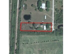
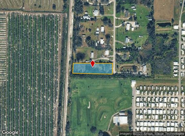
12751 Sw Lexington Pl, Arcadia, FL 34269
NEARBY LISTINGS FOR SALE OR LEASE
Property Detail
12751 Sw Lexington Pl
Arcadia, FL
Ogden Acres 1St Add
36-39-23-0256-0000-0080
OGDEN ACRES 1ST ADD PART OF LOT 8 MPDAF:BEG NE COR OF NW1/4 OF SE1/4 TH N 89D31M 10S W 471 FT TO W RD R/W TH S 0D30M10S W ALG R/W 1159.63 FT TO POB TH CONT SAME LI 123.19 FT TH N 88D36M03S W 458.42 FT TO E R/W SCL RR TH N 03D05M E ALG R/W 115.96 FT T
Vacantlandnec
DeSoto
X
Florida
12015C0087G
8
2024
1.25 AC
2024
Florida Central South Area
010405
Other Market Areas
DEMOGRAPHICS near 12751 Sw Lexington Pl
1 Mile
3 Mile
5 Mile
2024 Total Population
641
5,444
22,894
2029 Population
738
6,286
27,099
Pop Growth 2024-2029
+ 15.13%
+ 15.47%
+ 18.37%
Average Age
53
52
51
2024 Total Households
297
2,351
10,099
HH Growth 2024-2029
+ 15.49%
+ 15.61%
+ 18.68%
Median Household Inc
$46,545
$50,204
$57,105
Avg Household Size
2.10
2.20
2.20
2024 Avg HH Vehicles
2.00
2.00
2.00
Median Home Value
$205,696
$234,751
$256,735
Median Year Built
1987
1992
1992
Nearby Places
Map Layers
Map Styles
 Street
 Aerial
- Restaurants
- Banks
- Shops
- Fitness
- Groceries
PUBLIC TRANSPORTATION
AIRPORT
Punta Gorda
DRIVE
WALK
Distance
Punta Gorda
21 min
12.4 mi
Freight Ports
Port Manatee
DRIVE
WALK
Distance
Port Manatee
98 min
80.6 mi
Nearby Properties
Address
Land Use
TOTAL SIZE
Lot Size
Zoning
Address
Land Use
TOTAL SIZE
Lot Size
Zoning
1,225,024 SF
170.84 AC
IL
Address
Land Use
TOTAL SIZE
Lot Size
Zoning
2,148 SF
121.95 AC
PD
Address
Land Use
TOTAL SIZE
Lot Size
Zoning
15,866 SF
63.03 AC
TTRVC
Address
Land Use
TOTAL SIZE
Lot Size
Zoning
8,044 SF
29.55 AC
TTRVC
Address
Land Use
TOTAL SIZE
Lot Size
Zoning
2,025 SF
28.05 AC
RVC
Address
Land Use
TOTAL SIZE
Lot Size
Zoning
3,248 SF
21.20 AC
MHP
Address
Land Use
TOTAL SIZE
Lot Size
Zoning
27,214 SF
7.92 AC
A-5
Address
Land Use
TOTAL SIZE
Lot Size
Zoning
432 SF
20 AC
A-5
Address
Land Use
TOTAL SIZE
Lot Size
Zoning
4,800 SF
40.53 AC
PUD
Address
Land Use
TOTAL SIZE
Lot Size
Zoning
499.70 AC
A-5
Address
Land Use
TOTAL SIZE
Lot Size
Zoning
501.85 AC
A-5
Address
Land Use
TOTAL SIZE
Lot Size
Zoning
8,823 SF
73.60 AC
RE1
Address
Land Use
TOTAL SIZE
Lot Size
Zoning
8,838 SF
2.43 AC
RMF-6
Address
Land Use
TOTAL SIZE
Lot Size
Zoning
7,050 SF
4.49 AC
RSF-3
Address
Land Use
TOTAL SIZE
Lot Size
Zoning
6,109 SF
2 AC
RE1
Address
Land Use
TOTAL SIZE
Lot Size
Zoning
9,219 SF
1.15 AC
CG
Address
Land Use
TOTAL SIZE
Lot Size
Zoning
72.19 AC
ROI
Address
Land Use
TOTAL SIZE
Lot Size
Zoning
5,119 SF
20.72 AC
A-10
Address
Land Use
TOTAL SIZE
Lot Size
Zoning
21 AC
RMF-6
Address
Land Use
TOTAL SIZE
Lot Size
Zoning
3,462 SF
1.83 AC
IL
Address
Land Use
TOTAL SIZE
Lot Size
Zoning
5,274 SF
5 AC
RMF-M
Address
Land Use
TOTAL SIZE
Lot Size
Zoning
6.84 AC
CG
Address
Land Use
TOTAL SIZE
Lot Size
Zoning
117.80 AC
AG
Address
Land Use
TOTAL SIZE
Lot Size
Zoning
672 SF
33.58 AC
RE1
Address
Land Use
TOTAL SIZE
Lot Size
Zoning
3,526 SF
1.13 AC
RSF-3
Address
Land Use
TOTAL SIZE
Lot Size
Zoning
43.84 AC
RMF-6
Address
Land Use
TOTAL SIZE
Lot Size
Zoning
3,860 SF
5.86 AC
RE1
Address
Land Use
TOTAL SIZE
Lot Size
Zoning
3,170 SF
0.46 AC
CG
Address
Land Use
TOTAL SIZE
Lot Size
Zoning
3,558 SF
10.39 AC
A-10
Address
Land Use
TOTAL SIZE
Lot Size
Zoning
2,006 SF
10.01 AC
A-10
The World's #1 Commercial Real Estate Marketplace
Connect with us
© 2025 CoStar Group
The information above has been obtained from sources believed reliable. While we do not doubt its accuracy we have not verified it and make no guarantee, warranty or representation about it. It is your responsibility to independently confirm its accuracy and completeness. Any projections, opinions, assumptions, or estimates used are for example only and do not represent the current or future performance of the property. The value of this transaction to you depends on tax and other factors which should be evaluated by your tax, financial, and legal advisors. You and your advisors should conduct a careful, independent investigation of the property to determine to your satisfaction the suitability of the property for your needs.