Property Record
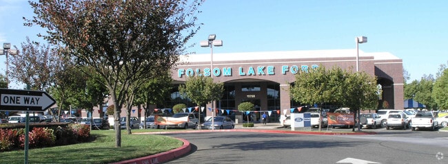
12755 Folsom Blvd, Folsom, CA 95630


NEARBY LISTINGS FOR SALE OR LEASE
Property Detail
12755 Folsom Blvd
Sacramento--Roseville--Arden-Arcade, CA
Parcel Map
069-0060-099
PARCEL MAP, LOT 2
Vehiclerentalsvehiclesales
Sacramento
AE
California
06067C0114J
2
2024
6.11 AC
2025
Highway 50 Corridor
008703
Sacramento
63,886 SF
DEMOGRAPHICS near 12755 Folsom Blvd
1 Mile
3 Mile
5 Mile
2024 Total Population
892
47,582
157,933
2029 Population
896
47,806
159,120
Pop Growth 2024-2029
+ 0.45%
+ 0.47%
+ 0.75%
Average Age
37
43
42
2024 Total Households
414
18,948
61,130
HH Growth 2024-2029
+ 0.48%
+ 0.42%
+ 0.77%
Median Household Inc
$97,321
$115,790
$103,100
Avg Household Size
1.90
2.40
2.40
2024 Avg HH Vehicles
1.00
2.00
2.00
Median Home Value
$411,111
$648,485
$634,530
Median Year Built
1989
1986
1983
Nearby Places
Map Layers
Map Styles
 Street
 Aerial
- Restaurants
- Banks
- Shops
- Fitness
- Groceries
PUBLIC TRANSPORTATION
AIRPORT
Sacramento International
DRIVE
WALK
Distance
Sacramento International
41 min
31.1 mi
Freight Ports
Port of Stockton
DRIVE
WALK
Distance
Port of Stockton
76 min
64.7 mi
Nearby Properties
Address
Land Use
TOTAL SIZE
Lot Size
Zoning
Address
Land Use
TOTAL SIZE
Lot Size
Zoning
1,686,420 SF
161.78 AC
M-1 (PD)
Address
Land Use
TOTAL SIZE
Lot Size
Zoning
278,000 SF
28.48 AC
SP-LI/BP (
Address
Land Use
TOTAL SIZE
Lot Size
Zoning
311,043 SF
10.10 AC
R-4 (PD)
Address
Land Use
TOTAL SIZE
Lot Size
Zoning
302,124 SF
13.30 AC
R-M (PD)
Address
Land Use
TOTAL SIZE
Lot Size
Zoning
SPA (ASPA)
Address
Land Use
TOTAL SIZE
Lot Size
Zoning
304,607 SF
14.70 AC
LC
Address
Land Use
TOTAL SIZE
Lot Size
Zoning
115,076 SF
22.09 AC
SP-INDUSTR
Address
Land Use
TOTAL SIZE
Lot Size
Zoning
287,131 SF
32.53 AC
C-3 (PD)
Address
Land Use
TOTAL SIZE
Lot Size
Zoning
202,776 SF
12.17 AC
RD-25 (PC)
Address
Land Use
TOTAL SIZE
Lot Size
Zoning
140,000 SF
4.12 AC
BP (PD)
Address
Land Use
TOTAL SIZE
Lot Size
Zoning
269,928 SF
246.95 AC
SPA
Address
Land Use
TOTAL SIZE
Lot Size
Zoning
2,146.73 AC
SPA
Address
Land Use
TOTAL SIZE
Lot Size
Zoning
40,447 SF
8.89 AC
M-1
Address
Land Use
TOTAL SIZE
Lot Size
Zoning
241,672 SF
18.54 AC
SC
Address
Land Use
TOTAL SIZE
Lot Size
Zoning
14.54 AC
SPA (ASPA)
Address
Land Use
TOTAL SIZE
Lot Size
Zoning
163,800 SF
9.13 AC
SP-IND/OP
Address
Land Use
TOTAL SIZE
Lot Size
Zoning
55,579 SF
44.38 AC
M-2
Address
Land Use
TOTAL SIZE
Lot Size
Zoning
52,992 SF
4.07 AC
M-1 (PD)
Address
Land Use
TOTAL SIZE
Lot Size
Zoning
153,983 SF
4.16 AC
MU
Address
Land Use
TOTAL SIZE
Lot Size
Zoning
104,750 SF
5.66 AC
RD-20
Address
Land Use
TOTAL SIZE
Lot Size
Zoning
121,416 SF
8.22 AC
SP-IND/OP
Address
Land Use
TOTAL SIZE
Lot Size
Zoning
120,556 SF
14.77 AC
C-2 (PD)
Address
Land Use
TOTAL SIZE
Lot Size
Zoning
939,277 SF
58.75 AC
SPA
Address
Land Use
TOTAL SIZE
Lot Size
Zoning
2,646.76 AC
SPA
Address
Land Use
TOTAL SIZE
Lot Size
Zoning
134,216 SF
7.79 AC
SPA
Address
Land Use
TOTAL SIZE
Lot Size
Zoning
119,310 SF
6.98 AC
BP (PD)
Address
Land Use
TOTAL SIZE
Lot Size
Zoning
99,766 SF
105.69 AC
C-3 (PD)
Address
Land Use
TOTAL SIZE
Lot Size
Zoning
97,920 SF
10.25 AC
SPA
Address
Land Use
TOTAL SIZE
Lot Size
Zoning
234.25 AC
SP-OS1 (SP
Address
Land Use
TOTAL SIZE
Lot Size
Zoning
103,943 SF
8.36 AC
SP-IND/OP
The World's #1 Commercial Real Estate Marketplace
Connect with us
© 2026 CoStar Group
The information above has been obtained from sources believed reliable. While we do not doubt its accuracy we have not verified it and make no guarantee, warranty or representation about it. It is your responsibility to independently confirm its accuracy and completeness. Any projections, opinions, assumptions, or estimates used are for example only and do not represent the current or future performance of the property. The value of this transaction to you depends on tax and other factors which should be evaluated by your tax, financial, and legal advisors. You and your advisors should conduct a careful, independent investigation of the property to determine to your satisfaction the suitability of the property for your needs.