Property Record
1276 Baker Rd, Virginia Beach, VA 23455
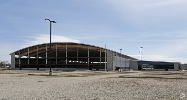
This Property Is For Sale
NEARBY LISTINGS FOR SALE OR LEASE
Property Detail
1276 Baker Rd
Virginia Beach-Norfolk-Newport News, VA-NC
Resubdivision Of Parcel 1 And Parcel 2 M
1469-01-4169
LITTLE CREEK PARCEL 1-A 14.6937 AC
Industrialgeneral
Virginia Beach
2022
Virginia
2022
14.93 AC
0402001040
Airport Industrial Park
1,600 SF
Hampton Roads
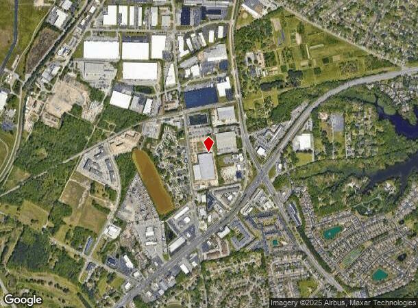
DEMOGRAPHICS near 1276 Baker Rd
1 Mile
3 Mile
5 Mile
2024 Total Population
6,909
88,566
231,476
2029 Population
6,854
87,255
227,982
Pop Growth 2024-2029
(0.80%)
(1.48%)
(1.51%)
Average Age
39
38
39
2024 Total Households
2,795
35,429
94,330
HH Growth 2024-2029
(0.89%)
(1.75%)
(1.75%)
Median Household Inc
$76,520
$65,273
$67,627
Avg Household Size
2.40
2.40
2.40
2024 Avg HH Vehicles
2.00
2.00
2.00
Median Home Value
$286,110
$260,374
$264,245
Median Year Built
1985
1977
1973
Nearby Places
Map Layers
Map Styles
 Street
 Aerial
- Restaurants
- Banks
- Shops
- Fitness
- Groceries
PUBLIC TRANSPORTATION
COMMUTER RAIL
Norfolk (Northeast Regional - Amtrak)
DRIVE
WALK
Distance
Norfolk (Northeast Regional - Amtrak)
13 min
6.6 mi
AIRPORT
Norfolk International
DRIVE
WALK
Distance
Norfolk International
10 min
4.5 mi
Newport News/Williamsburg International
DRIVE
WALK
Distance
Newport News/Williamsburg International
44 min
28.9 mi
Freight Ports
Virginia Port Authority - Portsmouth
DRIVE
WALK
Distance
Virginia Port Authority - Portsmouth
24 min
10.8 mi
Nearby Properties
Address
Land Use
TOTAL SIZE
Lot Size
Zoning
Address
Land Use
TOTAL SIZE
Lot Size
Zoning
10 SF
207.44 AC
I2
Address
Land Use
TOTAL SIZE
Lot Size
Zoning
2,301.65 AC
Address
Land Use
TOTAL SIZE
Lot Size
Zoning
223 AC
I5
Address
Land Use
TOTAL SIZE
Lot Size
Zoning
Address
Land Use
TOTAL SIZE
Lot Size
Zoning
Address
Land Use
TOTAL SIZE
Lot Size
Zoning
116,476 SF
947.43 AC
Address
Land Use
TOTAL SIZE
Lot Size
Zoning
52.36 AC
Address
Land Use
TOTAL SIZE
Lot Size
Zoning
281,816 SF
11.72 AC
Address
Land Use
TOTAL SIZE
Lot Size
Zoning
697,880 SF
200.35 AC
R15
Address
Land Use
TOTAL SIZE
Lot Size
Zoning
30,036 SF
50.39 AC
Address
Land Use
TOTAL SIZE
Lot Size
Zoning
23.51 AC
R13
Address
Land Use
TOTAL SIZE
Lot Size
Zoning
132 SF
71.89 AC
Address
Land Use
TOTAL SIZE
Lot Size
Zoning
197,812 SF
8.21 AC
Address
Land Use
TOTAL SIZE
Lot Size
Zoning
15.92 AC
A18
Address
Land Use
TOTAL SIZE
Lot Size
Zoning
95.32 AC
Address
Land Use
TOTAL SIZE
Lot Size
Zoning
15.12 AC
Address
Land Use
TOTAL SIZE
Lot Size
Zoning
434,920 SF
8.35 AC
A36
Address
Land Use
TOTAL SIZE
Lot Size
Zoning
226,775 SF
13.14 AC
B2
Address
Land Use
TOTAL SIZE
Lot Size
Zoning
7.45 AC
B4
Address
Land Use
TOTAL SIZE
Lot Size
Zoning
340,291 SF
18.77 AC
O1
Address
Land Use
TOTAL SIZE
Lot Size
Zoning
Address
Land Use
TOTAL SIZE
Lot Size
Zoning
23.96 AC
IN2
Address
Land Use
TOTAL SIZE
Lot Size
Zoning
1 SF
17.15 AC
A24
Address
Land Use
TOTAL SIZE
Lot Size
Zoning
12.85 AC
A24
Address
Land Use
TOTAL SIZE
Lot Size
Zoning
319,444 SF
19.02 AC
O1
Address
Land Use
TOTAL SIZE
Lot Size
Zoning
3,858 SF
17.85 AC
Address
Land Use
TOTAL SIZE
Lot Size
Zoning
4,197 SF
56.14 AC
C2
Address
Land Use
TOTAL SIZE
Lot Size
Zoning
6,572 SF
23.41 AC
Address
Land Use
TOTAL SIZE
Lot Size
Zoning
Address
Land Use
TOTAL SIZE
Lot Size
Zoning
318,496 SF
13.79 AC
A18
The World's #1 Commercial Real Estate Marketplace
Connect with us
© 2026 CoStar Group
The information above has been obtained from sources believed reliable. While we do not doubt its accuracy we have not verified it and make no guarantee, warranty or representation about it. It is your responsibility to independently confirm its accuracy and completeness. Any projections, opinions, assumptions, or estimates used are for example only and do not represent the current or future performance of the property. The value of this transaction to you depends on tax and other factors which should be evaluated by your tax, financial, and legal advisors. You and your advisors should conduct a careful, independent investigation of the property to determine to your satisfaction the suitability of the property for your needs.