Property Record
1276 N Main St, Crown Point, IN 46307
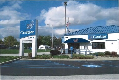

Property Detail
1276 N Main St
45-16-05-201-014.000-042
PT SW1/4 NW1/4 NE1/4 S.5 T.34 R.8 LYG W OF RR 6.847AC PER CALC
Supermarket
Lake
R33
Indiana
B and X Area of moderate flood hazard, usually the area between the limits of the 100-year and 500-year floods.
1
2024
6.85 AC
2025
Indiana
043001
Chicago
61,118 SF
Chicago-Naperville-Elgin, IL-IN
NEARBY LISTINGS FOR SALE OR LEASE
DEMOGRAPHICS near 1276 N Main St
1 mile
3 mile
5 mile
2025 Total Population
7,802
42,446
93,462
2030 Population
7,869
42,594
93,962
Pop Growth 2025-2030
+ 0.86%
+ 0.35%
+ 0.53%
Average Age
43
43
41
2025 Total Households
3,126
16,884
35,887
HH Growth 2025-2030
+ 0.90%
+ 0.36%
+ 0.52%
Median Household Inc
$84,751
$93,015
$92,974
Avg Household Size
2.40
2.40
2.50
2025 Avg HH Vehicles
2.00
2.00
2.00
Median Home Value
$261,730
$276,711
$286,294
Median Year Built
1977
1991
1990
Nearby Places
Map Layers
Map Styles
 Street
 Aerial
Layers
 Traffic
 Biking
Places
Listings with unknown addresses are not visible on the map
- Restaurants
- Banks
- Shops
- Fitness
- Groceries
SALE & LEASE HISTORY
LISTING DATE
SALE/LEASE

Dec 21, 2017
For Sale
Nearby Properties
Address
Land Use
TOTAL SIZE
Lot Size
Zoning
Address
Land Use
TOTAL SIZE
Lot Size
Zoning
1,002,000 SF
60.96 AC
Address
Land Use
TOTAL SIZE
Lot Size
Zoning
639,951 SF
37.52 AC
Address
Land Use
TOTAL SIZE
Lot Size
Zoning
598,983 SF
88 AC
Address
Land Use
TOTAL SIZE
Lot Size
Zoning
427,836 SF
54.72 AC
Address
Land Use
TOTAL SIZE
Lot Size
Zoning
536,896 SF
20.08 AC
Address
Land Use
TOTAL SIZE
Lot Size
Zoning
129,204 SF
16.57 AC
Address
Land Use
TOTAL SIZE
Lot Size
Zoning
377,878 SF
21.58 AC
Address
Land Use
TOTAL SIZE
Lot Size
Zoning
184,544 SF
16.76 AC
Address
Land Use
TOTAL SIZE
Lot Size
Zoning
365,748 SF
17.44 AC
R33
Address
Land Use
TOTAL SIZE
Lot Size
Zoning
276,540 SF
21.16 AC
Address
Land Use
TOTAL SIZE
Lot Size
Zoning
263,968 SF
27.86 AC
Address
Land Use
TOTAL SIZE
Lot Size
Zoning
111,453 SF
15.21 AC
Address
Land Use
TOTAL SIZE
Lot Size
Zoning
258,560 SF
17.30 AC
Address
Land Use
TOTAL SIZE
Lot Size
Zoning
304,425 SF
18.45 AC
Address
Land Use
TOTAL SIZE
Lot Size
Zoning
236,904 SF
11.30 AC
R33
Address
Land Use
TOTAL SIZE
Lot Size
Zoning
133,291 SF
R33
Address
Land Use
TOTAL SIZE
Lot Size
Zoning
143,060 SF
33.82 AC
Address
Land Use
TOTAL SIZE
Lot Size
Zoning
40,890 SF
11.27 AC
Address
Land Use
TOTAL SIZE
Lot Size
Zoning
89,578 SF
2.59 AC
Address
Land Use
TOTAL SIZE
Lot Size
Zoning
108,193 SF
2.42 AC
Address
Land Use
TOTAL SIZE
Lot Size
Zoning
329,040 SF
30.19 AC
Address
Land Use
TOTAL SIZE
Lot Size
Zoning
84,143 SF
14.88 AC
R33
Address
Land Use
TOTAL SIZE
Lot Size
Zoning
92,823 SF
8.56 AC
Address
Land Use
TOTAL SIZE
Lot Size
Zoning
237,291 SF
33.51 AC
R33
Address
Land Use
TOTAL SIZE
Lot Size
Zoning
94,527 SF
6.10 AC
R33
Address
Land Use
TOTAL SIZE
Lot Size
Zoning
61,318 SF
15.79 AC
R33
Address
Land Use
TOTAL SIZE
Lot Size
Zoning
125,172 SF
5.57 AC
R33
Address
Land Use
TOTAL SIZE
Lot Size
Zoning
122,908 SF
9.58 AC
Address
Land Use
TOTAL SIZE
Lot Size
Zoning
55,149 SF
2.76 AC
Address
Land Use
TOTAL SIZE
Lot Size
Zoning
59,824 SF
5.29 AC
R33
The World's #1 Commercial Real Estate Marketplace
Connect with us
© 2026 CoStar Group
The information above has been obtained from sources believed reliable. While we do not doubt its accuracy we have not verified it and make no guarantee, warranty or representation about it. It is your responsibility to independently confirm its accuracy and completeness. Any projections, opinions, assumptions, or estimates used are for example only and do not represent the current or future performance of the property. The value of this transaction to you depends on tax and other factors which should be evaluated by your tax, financial, and legal advisors. You and your advisors should conduct a careful, independent investigation of the property to determine to your satisfaction the suitability of the property for your needs.