Property Record
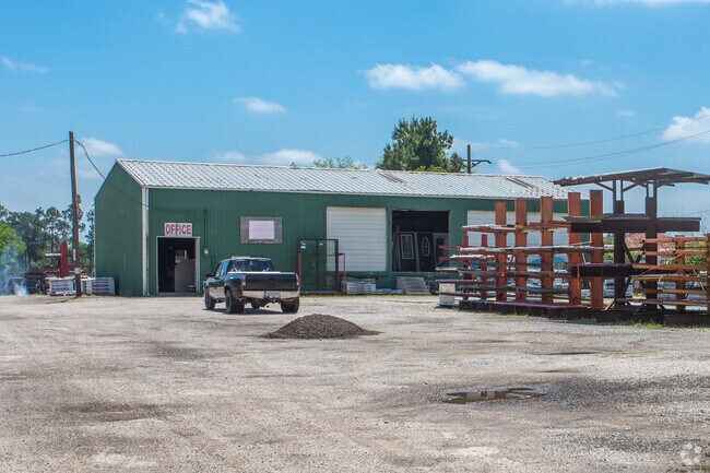
12762 Highway 105 E, Conroe, TX 77306


Property Detail
12762 Highway 105 E
0140-00-00450
A0140 - CUMMINGS JOHN R, TRACT 4-H, ACRES 10.2967
Commercialnec
Montgomery
1
Texas
B and X Area of moderate flood hazard, usually the area between the limits of the 100-year and 500-year floods.
31
2025
10.30 AC
2025
Montgomery County
693002
Houston
12,866 SF
Houston-Pasadena-The Woodlands, TX
NEARBY LISTINGS FOR SALE OR LEASE
DEMOGRAPHICS near 12762 Highway 105 E
1 mile
3 mile
5 mile
2025 Total Population
1,658
22,690
67,689
2030 Population
1,973
27,185
80,010
Pop Growth 2025-2030
+ 19.00%
+ 19.81%
+ 18.20%
Average Age
34
35
36
2025 Total Households
481
7,166
20,960
HH Growth 2025-2030
+ 19.54%
+ 20.42%
+ 19.30%
Median Household Inc
$70,644
$85,840
$71,748
Avg Household Size
3.30
3.10
3.00
2025 Avg HH Vehicles
3.00
2.00
2.00
Median Home Value
$260,218
$265,291
$226,649
Median Year Built
2006
2010
2005
Nearby Places
Map Layers
Map Styles
 Street
 Aerial
Transit
 Traffic
 Biking
Places
Listings with unknown addresses are not visible on the map
- Restaurants
- Banks
- Shops
- Fitness
- Groceries
PUBLIC TRANSPORTATION
AIRPORT
George Bush Intcntl/Houston
Drive
Walk
Distance
George Bush Intcntl/Houston
45 min
35.8 mi
Freight Ports
Port of Houston
Drive
Walk
Distance
Port of Houston
68 min
51.5 mi
Nearby Properties
Address
Land Use
TOTAL SIZE
Lot Size
Zoning
Address
Land Use
TOTAL SIZE
Lot Size
Zoning
242,944 SF
179.58 AC
Address
Land Use
TOTAL SIZE
Lot Size
Zoning
266,751 SF
12.95 AC
1
Address
Land Use
TOTAL SIZE
Lot Size
Zoning
186,100 SF
29.68 AC
1
Address
Land Use
TOTAL SIZE
Lot Size
Zoning
262,564 SF
51.89 AC
1
Address
Land Use
TOTAL SIZE
Lot Size
Zoning
124,209 SF
9.18 AC
1
Address
Land Use
TOTAL SIZE
Lot Size
Zoning
143,641 SF
14.80 AC
1
Address
Land Use
TOTAL SIZE
Lot Size
Zoning
161,142 SF
493.71 AC
Address
Land Use
TOTAL SIZE
Lot Size
Zoning
187,426 SF
61.77 AC
1
Address
Land Use
TOTAL SIZE
Lot Size
Zoning
84,192 SF
23.22 AC
1
Address
Land Use
TOTAL SIZE
Lot Size
Zoning
82,560 SF
1
Address
Land Use
TOTAL SIZE
Lot Size
Zoning
63,366 SF
17.93 AC
1
Address
Land Use
TOTAL SIZE
Lot Size
Zoning
255 SF
254.02 AC
Address
Land Use
TOTAL SIZE
Lot Size
Zoning
14,750 SF
1.66 AC
Address
Land Use
TOTAL SIZE
Lot Size
Zoning
44,182 SF
6.25 AC
1
Address
Land Use
TOTAL SIZE
Lot Size
Zoning
64,150 SF
6.41 AC
1
Address
Land Use
TOTAL SIZE
Lot Size
Zoning
65,448 SF
10 AC
1
Address
Land Use
TOTAL SIZE
Lot Size
Zoning
Address
Land Use
TOTAL SIZE
Lot Size
Zoning
163,880 SF
11 AC
Address
Land Use
TOTAL SIZE
Lot Size
Zoning
57,700 SF
5 AC
Address
Land Use
TOTAL SIZE
Lot Size
Zoning
13,143 SF
24 AC
Address
Land Use
TOTAL SIZE
Lot Size
Zoning
31,645 SF
189.42 AC
Address
Land Use
TOTAL SIZE
Lot Size
Zoning
30,204 SF
4 AC
1
Address
Land Use
TOTAL SIZE
Lot Size
Zoning
80,948 SF
15 AC
Address
Land Use
TOTAL SIZE
Lot Size
Zoning
10,710 SF
2.54 AC
1
Address
Land Use
TOTAL SIZE
Lot Size
Zoning
19.41 AC
Address
Land Use
TOTAL SIZE
Lot Size
Zoning
63,254 SF
5.17 AC
1
Address
Land Use
TOTAL SIZE
Lot Size
Zoning
75,058 SF
12.66 AC
Address
Land Use
TOTAL SIZE
Lot Size
Zoning
17,040 SF
12.79 AC
Address
Land Use
TOTAL SIZE
Lot Size
Zoning
9,965 SF
5.75 AC
Address
Land Use
TOTAL SIZE
Lot Size
Zoning
70,794 SF
25.34 AC
1
The World's #1 Commercial Real Estate Marketplace
Connect with us
© 2026 CoStar Group
The information above has been obtained from sources believed reliable. While we do not doubt its accuracy we have not verified it and make no guarantee, warranty or representation about it. It is your responsibility to independently confirm its accuracy and completeness. Any projections, opinions, assumptions, or estimates used are for example only and do not represent the current or future performance of the property. The value of this transaction to you depends on tax and other factors which should be evaluated by your tax, financial, and legal advisors. You and your advisors should conduct a careful, independent investigation of the property to determine to your satisfaction the suitability of the property for your needs.