Property Record
12770 Cimarron Path, San Antonio, TX 78249
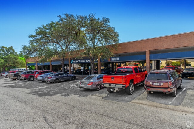


Property Detail
12770 Cimarron Path
San Antonio-New Braunfels, TX
NCB 17454 BLK 5 LOT 11 DE ZAVALA BUS PARK SUBD
17454-005-0110
BEXAR
Officebuilding
Texas
AE The base floodplain where base flood elevations are provided. AE Zones are now used on new format FIRMs instead of A1-A30 Zones.
11
2024
8.54 AC
2025
Northwest
181816
San Antonio
114,996 SF
NEARBY LISTINGS FOR SALE OR LEASE
DEMOGRAPHICS near 12770 Cimarron Path
1 mile
3 mile
5 mile
2025 Total Population
9,606
115,482
289,639
2030 Population
10,060
121,657
304,342
Pop Growth 2025-2030
+ 4.73%
+ 5.35%
+ 5.08%
Average Age
38
36
37
2025 Total Households
3,972
49,724
124,462
HH Growth 2025-2030
+ 5.04%
+ 5.68%
+ 5.37%
Median Household Inc
$83,634
$68,835
$70,724
Avg Household Size
2.40
2.20
2.30
2025 Avg HH Vehicles
2.00
2.00
2.00
Median Home Value
$306,722
$318,076
$336,134
Median Year Built
1996
1994
1993
Nearby Places
Map Layers
Map Styles
 Street
 Aerial
Layers
 Traffic
 Biking
Places
Listings with unknown addresses are not visible on the map
- Restaurants
- Banks
- Shops
- Fitness
- Groceries
PUBLIC TRANSPORTATION
AIRPORT
San Antonio International
Drive
Walk
Distance
San Antonio International
15 min
10.6 mi
Freight Ports
Calhoun Port
Drive
Walk
Distance
Calhoun Port
197 min
161.5 mi
SALE & LEASE HISTORY
LISTING DATE
SALE/LEASE

Sep 25, 2016
For Lease
Feb 13, 2024
For Lease
Nearby Properties
Address
Land Use
TOTAL SIZE
Lot Size
Zoning
Address
Land Use
TOTAL SIZE
Lot Size
Zoning
437,060 SF
91.31 AC
Address
Land Use
TOTAL SIZE
Lot Size
Zoning
335,841 SF
33.70 AC
Address
Land Use
TOTAL SIZE
Lot Size
Zoning
4,465,972 SF
231.60 AC
Address
Land Use
TOTAL SIZE
Lot Size
Zoning
940,089 SF
63.74 AC
Address
Land Use
TOTAL SIZE
Lot Size
Zoning
499,480 SF
19.57 AC
Address
Land Use
TOTAL SIZE
Lot Size
Zoning
227,586 SF
25.46 AC
Address
Land Use
TOTAL SIZE
Lot Size
Zoning
21,348 SF
14.50 AC
Address
Land Use
TOTAL SIZE
Lot Size
Zoning
462,227 SF
31.21 AC
Address
Land Use
TOTAL SIZE
Lot Size
Zoning
13,128 SF
5.23 AC
Address
Land Use
TOTAL SIZE
Lot Size
Zoning
300,264 SF
27.81 AC
Address
Land Use
TOTAL SIZE
Lot Size
Zoning
21,852 SF
5.25 AC
Address
Land Use
TOTAL SIZE
Lot Size
Zoning
331,715 SF
9.04 AC
Address
Land Use
TOTAL SIZE
Lot Size
Zoning
389,048 SF
16.25 AC
Address
Land Use
TOTAL SIZE
Lot Size
Zoning
329,050 SF
17.10 AC
Address
Land Use
TOTAL SIZE
Lot Size
Zoning
320,406 SF
12.11 AC
Address
Land Use
TOTAL SIZE
Lot Size
Zoning
515,812 SF
200.45 AC
Address
Land Use
TOTAL SIZE
Lot Size
Zoning
305,497 SF
9.99 AC
Address
Land Use
TOTAL SIZE
Lot Size
Zoning
395,039 SF
31 AC
Address
Land Use
TOTAL SIZE
Lot Size
Zoning
6,809 SF
9.04 AC
Address
Land Use
TOTAL SIZE
Lot Size
Zoning
238,999 SF
8.43 AC
Address
Land Use
TOTAL SIZE
Lot Size
Zoning
724,148 SF
18.70 AC
Address
Land Use
TOTAL SIZE
Lot Size
Zoning
306,959 SF
15.24 AC
Address
Land Use
TOTAL SIZE
Lot Size
Zoning
152,266 SF
18.72 AC
Address
Land Use
TOTAL SIZE
Lot Size
Zoning
183,249 SF
21.94 AC
Address
Land Use
TOTAL SIZE
Lot Size
Zoning
244,260 SF
5.82 AC
Address
Land Use
TOTAL SIZE
Lot Size
Zoning
520,686 SF
53.63 AC
Address
Land Use
TOTAL SIZE
Lot Size
Zoning
349,074 SF
27.84 AC
Address
Land Use
TOTAL SIZE
Lot Size
Zoning
280,198 SF
15.96 AC
Address
Land Use
TOTAL SIZE
Lot Size
Zoning
331,778 SF
20.62 AC
Address
Land Use
TOTAL SIZE
Lot Size
Zoning
352,208 SF
13.95 AC
The World's #1 Commercial Real Estate Marketplace
Connect with us
© 2026 CoStar Group
The information above has been obtained from sources believed reliable. While we do not doubt its accuracy we have not verified it and make no guarantee, warranty or representation about it. It is your responsibility to independently confirm its accuracy and completeness. Any projections, opinions, assumptions, or estimates used are for example only and do not represent the current or future performance of the property. The value of this transaction to you depends on tax and other factors which should be evaluated by your tax, financial, and legal advisors. You and your advisors should conduct a careful, independent investigation of the property to determine to your satisfaction the suitability of the property for your needs.