Property Record
12772 Wards Rd, Rustburg, VA 24588
NEARBY LISTINGS FOR SALE OR LEASE
Property Detail
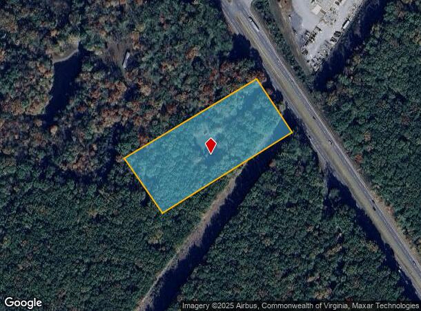
12772 Wards Rd
22E-2-2
THE RUSSELL PLACE - LOT 2
Commercialnec
Campbell
X
Virginia
51019C0400D
2
2025
5.17 AC
2025
Lynchburg
020200
Other Market Areas
1,960 SF
Lynchburg, VA
DEMOGRAPHICS near 12772 Wards Rd
1 Mile
3 Mile
5 Mile
2024 Total Population
2,147
10,228
38,824
2029 Population
2,177
10,260
38,772
Pop Growth 2024-2029
+ 1.40%
+ 0.31%
(0.13%)
Average Age
36
40
39
2024 Total Households
652
3,936
15,999
HH Growth 2024-2029
+ 1.84%
+ 0.33%
(0.13%)
Median Household Inc
$49,463
$51,544
$55,804
Avg Household Size
2.40
2.30
2.30
2024 Avg HH Vehicles
2.00
2.00
2.00
Median Home Value
$205,435
$177,511
$181,706
Median Year Built
2003
1991
1986
Nearby Places
Map Layers
Map Styles
 Street
 Aerial
- Restaurants
- Banks
- Shops
- Fitness
- Groceries
PUBLIC TRANSPORTATION
COMMUTER RAIL
Lynchburg (Crescent - Amtrak, Northeast Regional - Amtrak)
DRIVE
WALK
Distance
Lynchburg (Crescent - Amtrak, Northeast Regional - Amtrak)
15 min
8.8 mi
AIRPORT
Lynchburg Regional/Preston Glenn Field
DRIVE
WALK
Distance
Lynchburg Regional/Preston Glenn Field
9 min
4.1 mi
Freight Ports
Virginia Port Authority - Richmond
DRIVE
WALK
Distance
Virginia Port Authority - Richmond
157 min
116.2 mi
Nearby Properties
Address
Land Use
TOTAL SIZE
Lot Size
Zoning
Address
Land Use
TOTAL SIZE
Lot Size
Zoning
353,180 SF
22.86 AC
B3
Address
Land Use
TOTAL SIZE
Lot Size
Zoning
4,672 SF
905.07 AC
BHC
Address
Land Use
TOTAL SIZE
Lot Size
Zoning
163,760 SF
12 AC
Address
Land Use
TOTAL SIZE
Lot Size
Zoning
17,210 SF
14.35 AC
Address
Land Use
TOTAL SIZE
Lot Size
Zoning
173,573 SF
8.80 AC
Address
Land Use
TOTAL SIZE
Lot Size
Zoning
28,939 SF
12.20 AC
Address
Land Use
TOTAL SIZE
Lot Size
Zoning
88,286 SF
11.85 AC
Address
Land Use
TOTAL SIZE
Lot Size
Zoning
84,952 SF
3.11 AC
B5
Address
Land Use
TOTAL SIZE
Lot Size
Zoning
35,811 SF
12.19 AC
BGC
Address
Land Use
TOTAL SIZE
Lot Size
Zoning
63,560 SF
2.97 AC
Address
Land Use
TOTAL SIZE
Lot Size
Zoning
50,886 SF
2.31 AC
BGC
Address
Land Use
TOTAL SIZE
Lot Size
Zoning
58,352 SF
1.91 AC
Address
Land Use
TOTAL SIZE
Lot Size
Zoning
60,384 SF
2.37 AC
BGC
Address
Land Use
TOTAL SIZE
Lot Size
Zoning
43,545 SF
5.78 AC
Address
Land Use
TOTAL SIZE
Lot Size
Zoning
38,508 SF
2.22 AC
BGC
Address
Land Use
TOTAL SIZE
Lot Size
Zoning
27,915 SF
28.48 AC
Address
Land Use
TOTAL SIZE
Lot Size
Zoning
54,028 SF
5.20 AC
RMFC
Address
Land Use
TOTAL SIZE
Lot Size
Zoning
33,972 SF
7.04 AC
BGC
Address
Land Use
TOTAL SIZE
Lot Size
Zoning
12,798 SF
1.88 AC
B5RC
Address
Land Use
TOTAL SIZE
Lot Size
Zoning
6,700 SF
5.86 AC
BGCC
Address
Land Use
TOTAL SIZE
Lot Size
Zoning
13,249 SF
15.41 AC
B3
Address
Land Use
TOTAL SIZE
Lot Size
Zoning
91,632 SF
18.28 AC
Address
Land Use
TOTAL SIZE
Lot Size
Zoning
20,735 SF
4.44 AC
RMFC
Address
Land Use
TOTAL SIZE
Lot Size
Zoning
8,109 SF
2.96 AC
B5RC
Address
Land Use
TOTAL SIZE
Lot Size
Zoning
8,032 SF
2.44 AC
B5
Address
Land Use
TOTAL SIZE
Lot Size
Zoning
1,392 SF
30.13 AC
BGC
Address
Land Use
TOTAL SIZE
Lot Size
Zoning
19,360 SF
6.07 AC
IG
Address
Land Use
TOTAL SIZE
Lot Size
Zoning
2,550 SF
6.53 AC
Address
Land Use
TOTAL SIZE
Lot Size
Zoning
2,400 SF
26.60 AC
IH
Address
Land Use
TOTAL SIZE
Lot Size
Zoning
21,440 SF
1.68 AC
BGCC
The World's #1 Commercial Real Estate Marketplace
Connect with us
© 2025 CoStar Group
The information above has been obtained from sources believed reliable. While we do not doubt its accuracy we have not verified it and make no guarantee, warranty or representation about it. It is your responsibility to independently confirm its accuracy and completeness. Any projections, opinions, assumptions, or estimates used are for example only and do not represent the current or future performance of the property. The value of this transaction to you depends on tax and other factors which should be evaluated by your tax, financial, and legal advisors. You and your advisors should conduct a careful, independent investigation of the property to determine to your satisfaction the suitability of the property for your needs.