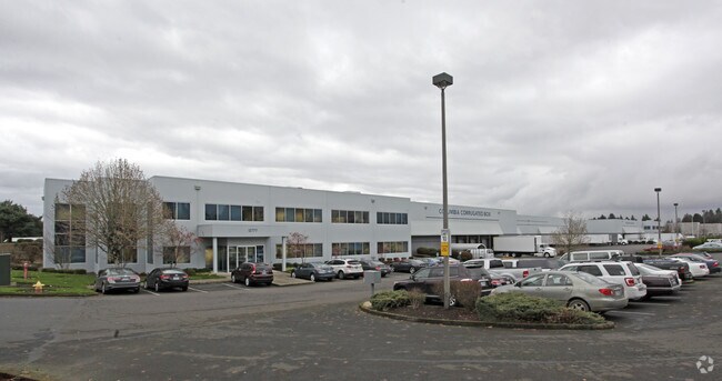
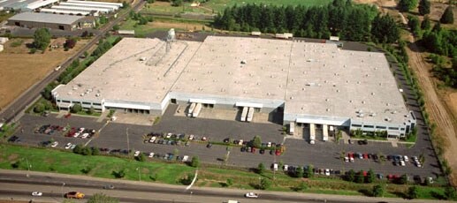
Property Record
12777 Sw Tualatin Sherwood Rd, Tualatin, OR 97062

NEARBY LISTINGS FOR SALE OR LEASE
Property Detail
12777 Sw Tualatin Sherwood Rd
R0547180
NO LEGAL
Industrialgeneral
Washington
X
Oregon
41067C0606F
18.34 AC
2024
Tualatin
2026
Portland
0320031019
Portland-Vancouver-Hillsboro, OR-WA
DEMOGRAPHICS near 12777 Sw Tualatin Sherwood Rd
1 Mile
3 Mile
5 Mile
2024 Total Population
126
63,430
162,224
2029 Population
126
63,601
163,593
Pop Growth 2024-2029
0.00%
+ 0.27%
+ 0.84%
Average Age
41
41
40
2024 Total Households
45
24,547
62,498
HH Growth 2024-2029
0.00%
+ 0.33%
+ 0.88%
Median Household Inc
$132,500
$91,874
$102,542
Avg Household Size
2.70
2.50
2.50
2024 Avg HH Vehicles
2.00
2.00
2.00
Median Home Value
$630,435
$494,793
$575,431
Median Year Built
1993
1992
1992
Nearby Places
Map Layers
Map Styles
 Street
 Aerial
- Restaurants
- Banks
- Shops
- Fitness
- Groceries
PUBLIC TRANSPORTATION
COMMUTER RAIL
Tualatin (Westside Express Service - Tri-County Metropolitan Transportation District of Oregon Rail (TriMet Rail))
DRIVE
WALK
Distance
Tualatin (Westside Express Service - Tri-County Metropolitan Transportation District of Oregon Rail (TriMet Rail))
5 min
2.8 mi
Wilsonville (Westside Express Service - Tri-County Metropolitan Transportation District of Oregon Rail (TriMet Rail))
DRIVE
WALK
Distance
Wilsonville (Westside Express Service - Tri-County Metropolitan Transportation District of Oregon Rail (TriMet Rail))
13 min
6.3 mi
AIRPORT
Portland International
DRIVE
WALK
Distance
Portland International
42 min
26.7 mi
Freight Ports
Port of Portland
DRIVE
WALK
Distance
Port of Portland
28 min
17.9 mi
Nearby Properties
Address
Land Use
TOTAL SIZE
Lot Size
Zoning
Address
Land Use
TOTAL SIZE
Lot Size
Zoning
23.98 AC
EI
Address
Land Use
TOTAL SIZE
Lot Size
Zoning
508,000 SF
69.72 AC
PFC
Address
Land Use
TOTAL SIZE
Lot Size
Zoning
43.20 AC
R-4.5
Address
Land Use
TOTAL SIZE
Lot Size
Zoning
216,381 SF
24.95 AC
CG
Address
Land Use
TOTAL SIZE
Lot Size
Zoning
216,000 SF
64.68 AC
RL
Address
Land Use
TOTAL SIZE
Lot Size
Zoning
27.23 AC
MP
Address
Land Use
TOTAL SIZE
Lot Size
Zoning
0.14 AC
MG
Address
Land Use
TOTAL SIZE
Lot Size
Zoning
27.85 AC
IP
Address
Land Use
TOTAL SIZE
Lot Size
Zoning
183,133 SF
8.17 AC
R-25
Address
Land Use
TOTAL SIZE
Lot Size
Zoning
174,043 SF
20.35 AC
CC
Address
Land Use
TOTAL SIZE
Lot Size
Zoning
1,232 SF
27.77 AC
EI
Address
Land Use
TOTAL SIZE
Lot Size
Zoning
294,220 SF
15.10 AC
RH
Address
Land Use
TOTAL SIZE
Lot Size
Zoning
18.06 AC
Address
Land Use
TOTAL SIZE
Lot Size
Zoning
71,930 SF
22.68 AC
CO
Address
Land Use
TOTAL SIZE
Lot Size
Zoning
127,476 SF
13.48 AC
RC
Address
Land Use
TOTAL SIZE
Lot Size
Zoning
68,450 SF
19.39 AC
ML
Address
Land Use
TOTAL SIZE
Lot Size
Zoning
139,356 SF
13.99 AC
LI_PUD
Address
Land Use
TOTAL SIZE
Lot Size
Zoning
15,000 SF
21.08 AC
MG
Address
Land Use
TOTAL SIZE
Lot Size
Zoning
18.55 AC
EI
Address
Land Use
TOTAL SIZE
Lot Size
Zoning
22.05 AC
MP
Address
Land Use
TOTAL SIZE
Lot Size
Zoning
168,065 SF
5.09 AC
HDR_PUD
Address
Land Use
TOTAL SIZE
Lot Size
Zoning
225,780 SF
10.01 AC
R-24
Address
Land Use
TOTAL SIZE
Lot Size
Zoning
261,104 SF
13.52 AC
HDR_PUD
Address
Land Use
TOTAL SIZE
Lot Size
Zoning
13.76 AC
RMH
Address
Land Use
TOTAL SIZE
Lot Size
Zoning
22.41 AC
RML
Address
Land Use
TOTAL SIZE
Lot Size
Zoning
220,472 SF
8.99 AC
RH
Address
Land Use
TOTAL SIZE
Lot Size
Zoning
9.68 AC
R-25
Address
Land Use
TOTAL SIZE
Lot Size
Zoning
1,360 SF
7.41 AC
HDR
The World's #1 Commercial Real Estate Marketplace
Connect with us
© 2026 CoStar Group
The information above has been obtained from sources believed reliable. While we do not doubt its accuracy we have not verified it and make no guarantee, warranty or representation about it. It is your responsibility to independently confirm its accuracy and completeness. Any projections, opinions, assumptions, or estimates used are for example only and do not represent the current or future performance of the property. The value of this transaction to you depends on tax and other factors which should be evaluated by your tax, financial, and legal advisors. You and your advisors should conduct a careful, independent investigation of the property to determine to your satisfaction the suitability of the property for your needs.