Property Record
1278 Mt Holly Rd, Rock Hill, SC 29730

NEARBY LISTINGS FOR SALE OR LEASE
-
-
-
No Photo
-
-
-
View all Rock Hill listings for sale on LoopNet.com
Property Detail
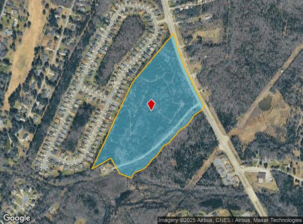
1278 Mt Holly Rd
Charlotte-Concord-Gastonia, NC-SC
Oakdale Woods Subdivision
6190101007
TRACT C HWY 901 28.04 LESS.825 AC
Vacantlandexempt
York
AE
South Carolina
45091C0319E
27.22 AC
0
York County
2025
Charlotte
061301
DEMOGRAPHICS near 1278 Mt Holly Rd
1 Mile
3 Mile
5 Mile
2024 Total Population
3,320
21,389
53,933
2029 Population
3,721
24,167
60,622
Pop Growth 2024-2029
+ 12.08%
+ 12.99%
+ 12.40%
Average Age
40
39
39
2024 Total Households
1,237
8,262
21,090
HH Growth 2024-2029
+ 12.45%
+ 13.41%
+ 13.24%
Median Household Inc
$65,349
$45,670
$50,194
Avg Household Size
2.60
2.50
2.40
2024 Avg HH Vehicles
2.00
2.00
2.00
Median Home Value
$230,000
$167,482
$185,297
Median Year Built
1990
1978
1986
Nearby Places
Map Layers
Map Styles
 Street
 Aerial
- Restaurants
- Banks
- Shops
- Fitness
- Groceries
PUBLIC TRANSPORTATION
AIRPORT
Charlotte/Douglas International
DRIVE
WALK
Distance
Charlotte/Douglas International
44 min
28.2 mi
Freight Ports
North Charleston Terminal
DRIVE
WALK
Distance
North Charleston Terminal
194 min
173.1 mi
SALE & LEASE HISTORY
LISTING DATE
SALE/LEASE

Apr 03, 2020
For Sale
Nearby Properties
Address
Land Use
TOTAL SIZE
Lot Size
Zoning
Address
Land Use
TOTAL SIZE
Lot Size
Zoning
5,380 SF
5.62 AC
MF15
Address
Land Use
TOTAL SIZE
Lot Size
Zoning
290,145 SF
40.53 AC
PD
Address
Land Use
TOTAL SIZE
Lot Size
Zoning
471,456 SF
26 AC
ID
Address
Land Use
TOTAL SIZE
Lot Size
Zoning
22 AC
OI
Address
Land Use
TOTAL SIZE
Lot Size
Zoning
144.70 AC
Address
Land Use
TOTAL SIZE
Lot Size
Zoning
118.42 AC
OI
Address
Land Use
TOTAL SIZE
Lot Size
Zoning
83.76 AC
RUD
Address
Land Use
TOTAL SIZE
Lot Size
Zoning
107.91 AC
RUD
Address
Land Use
TOTAL SIZE
Lot Size
Zoning
103.02 AC
RDI
Address
Land Use
TOTAL SIZE
Lot Size
Zoning
91.87 AC
UD
Address
Land Use
TOTAL SIZE
Lot Size
Zoning
74.58 AC
SF5
Address
Land Use
TOTAL SIZE
Lot Size
Zoning
464,857 SF
38.80 AC
ID
Address
Land Use
TOTAL SIZE
Lot Size
Zoning
60,193 SF
17.71 AC
UD
Address
Land Use
TOTAL SIZE
Lot Size
Zoning
1,240 SF
18.27 AC
ID
Address
Land Use
TOTAL SIZE
Lot Size
Zoning
49.77 AC
PUD
Address
Land Use
TOTAL SIZE
Lot Size
Zoning
7,740 SF
5.34 AC
RDI
Address
Land Use
TOTAL SIZE
Lot Size
Zoning
47.33 AC
OI
Address
Land Use
TOTAL SIZE
Lot Size
Zoning
3,710 SF
2.38 AC
RCI
Address
Land Use
TOTAL SIZE
Lot Size
Zoning
2,990 SF
1 AC
RCI
Address
Land Use
TOTAL SIZE
Lot Size
Zoning
44.26 AC
OI
Address
Land Use
TOTAL SIZE
Lot Size
Zoning
2,969 SF
1 AC
RCI
Address
Land Use
TOTAL SIZE
Lot Size
Zoning
2,709 SF
1 AC
SF3
Address
Land Use
TOTAL SIZE
Lot Size
Zoning
2,179 SF
1 AC
RCI
Address
Land Use
TOTAL SIZE
Lot Size
Zoning
7,052 SF
0.32 AC
DTWN
Address
Land Use
TOTAL SIZE
Lot Size
Zoning
50,628 SF
0.99 AC
DTWN
Address
Land Use
TOTAL SIZE
Lot Size
Zoning
3,567 SF
0.14 AC
Address
Land Use
TOTAL SIZE
Lot Size
Zoning
2,995 SF
1 AC
Address
Land Use
TOTAL SIZE
Lot Size
Zoning
32 AC
SF5
Address
Land Use
TOTAL SIZE
Lot Size
Zoning
3,594 SF
1 AC
PUD
The World's #1 Commercial Real Estate Marketplace
Connect with us
© 2026 CoStar Group
The information above has been obtained from sources believed reliable. While we do not doubt its accuracy we have not verified it and make no guarantee, warranty or representation about it. It is your responsibility to independently confirm its accuracy and completeness. Any projections, opinions, assumptions, or estimates used are for example only and do not represent the current or future performance of the property. The value of this transaction to you depends on tax and other factors which should be evaluated by your tax, financial, and legal advisors. You and your advisors should conduct a careful, independent investigation of the property to determine to your satisfaction the suitability of the property for your needs.