Property Record
1278 N Main St, Brewer, ME 04412

Save to a Folder
{{folder.Name}}
{{folder.ListingIds.length}} Properties
{{folder.ListingIds.length}} Property
Create a New Folder
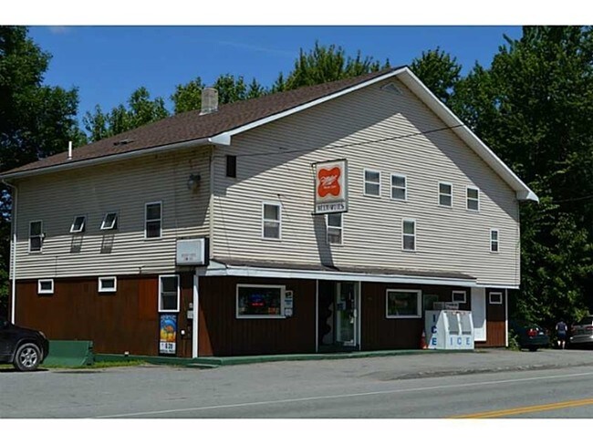
Property Detail
1278 N Main St
BRER-000019-000000-000019
Penobscot
Departmentstore
Maine
LDR
19
AE The base floodplain where base flood elevations are provided. AE Zones are now used on new format FIRMs instead of A1-A30 Zones.
0.78 AC
2025
Maine North & Bangor
2025
Other Market Areas
004300
Bangor, ME
3,910 SF
NEARBY LISTINGS FOR SALE OR LEASE
-
-
View all Brewer listings for sale on LoopNet.com
DEMOGRAPHICS near 1278 N Main St
1 mile
3 mile
5 mile
2025 Total Population
1,204
8,612
41,843
2030 Population
1,200
8,668
42,105
Pop Growth 2025-2030
(0.33%)
+ 0.65%
+ 0.63%
Average Age
44
44
43
2025 Total Households
516
3,568
18,799
HH Growth 2025-2030
(0.39%)
+ 0.56%
+ 0.54%
Median Household Inc
$74,166
$76,339
$64,495
Avg Household Size
2.20
2.20
2.00
2025 Avg HH Vehicles
2.00
2.00
2.00
Median Home Value
$292,783
$311,464
$260,597
Median Year Built
1976
1977
1963
Nearby Places
Map Layers
Map Styles
 Street
 Aerial
Layers
 Traffic
 Biking
Places
Listings with unknown addresses are not visible on the map
- Restaurants
- Banks
- Shops
- Fitness
- Groceries
PUBLIC TRANSPORTATION
AIRPORT
Bangor International
Drive
Walk
Distance
Bangor International
16 min
9.4 mi
Freight Ports
Searsport, ME
Drive
Walk
Distance
Searsport, ME
51 min
34.0 mi
SALE & LEASE HISTORY
LISTING DATE
SALE/LEASE

Sep 23, 2016
For Sale
Nearby Properties
Address
Land Use
TOTAL SIZE
Lot Size
Zoning
Address
Land Use
TOTAL SIZE
Lot Size
Zoning
307,200 SF
99.21 AC
G&ISD
Address
Land Use
TOTAL SIZE
Lot Size
Zoning
11,000 SF
188.98 AC
LDR
Address
Land Use
TOTAL SIZE
Lot Size
Zoning
241,898 SF
62.50 AC
G&ISD
Address
Land Use
TOTAL SIZE
Lot Size
Zoning
226,625 SF
S&PS
Address
Land Use
TOTAL SIZE
Lot Size
Zoning
94,081 SF
17.56 AC
G&ISD
Address
Land Use
TOTAL SIZE
Lot Size
Zoning
208,790 SF
50.33 AC
S&PS
Address
Land Use
TOTAL SIZE
Lot Size
Zoning
29.50 AC
Address
Land Use
TOTAL SIZE
Lot Size
Zoning
G&ISD
Address
Land Use
TOTAL SIZE
Lot Size
Zoning
104,534 SF
5 AC
GC&S
Address
Land Use
TOTAL SIZE
Lot Size
Zoning
604,872 SF
67.61 AC
S&PS
Address
Land Use
TOTAL SIZE
Lot Size
Zoning
44,318 SF
23.67 AC
G&ISD
Address
Land Use
TOTAL SIZE
Lot Size
Zoning
140,059 SF
15.38 AC
S&PS
Address
Land Use
TOTAL SIZE
Lot Size
Zoning
130,786 SF
17.33 AC
GC&S
Address
Land Use
TOTAL SIZE
Lot Size
Zoning
123,814 SF
11.23 AC
GC&S
Address
Land Use
TOTAL SIZE
Lot Size
Zoning
107,000 SF
10.40 AC
GC&S
Address
Land Use
TOTAL SIZE
Lot Size
Zoning
87,386 SF
13.50 AC
G&ISD
Address
Land Use
TOTAL SIZE
Lot Size
Zoning
72,377 SF
11.97 AC
GC&S
Address
Land Use
TOTAL SIZE
Lot Size
Zoning
122,390 SF
13 AC
S&PS
Address
Land Use
TOTAL SIZE
Lot Size
Zoning
74,596 SF
5.66 AC
GC&S
Address
Land Use
TOTAL SIZE
Lot Size
Zoning
94,280 SF
2.25 AC
G&ISD
Address
Land Use
TOTAL SIZE
Lot Size
Zoning
74,456 SF
S&PS
Address
Land Use
TOTAL SIZE
Lot Size
Zoning
Address
Land Use
TOTAL SIZE
Lot Size
Zoning
83 AC
Address
Land Use
TOTAL SIZE
Lot Size
Zoning
33,634 SF
6.27 AC
G&ISD
Address
Land Use
TOTAL SIZE
Lot Size
Zoning
94,280 SF
2.25 AC
G&ISD
Address
Land Use
TOTAL SIZE
Lot Size
Zoning
25,010 SF
30 AC
G&ISD
Address
Land Use
TOTAL SIZE
Lot Size
Zoning
116,064 SF
S&PS
Address
Land Use
TOTAL SIZE
Lot Size
Zoning
26,899 SF
GC&S
Address
Land Use
TOTAL SIZE
Lot Size
Zoning
110,816 SF
16.22 AC
GC&S
Address
Land Use
TOTAL SIZE
Lot Size
Zoning
37,991 SF
7.11 AC
G&ISD
The World's #1 Commercial Real Estate Marketplace
Connect with us
© 2026 CoStar Group
The information above has been obtained from sources believed reliable. While we do not doubt its accuracy we have not verified it and make no guarantee, warranty or representation about it. It is your responsibility to independently confirm its accuracy and completeness. Any projections, opinions, assumptions, or estimates used are for example only and do not represent the current or future performance of the property. The value of this transaction to you depends on tax and other factors which should be evaluated by your tax, financial, and legal advisors. You and your advisors should conduct a careful, independent investigation of the property to determine to your satisfaction the suitability of the property for your needs.