Property Record
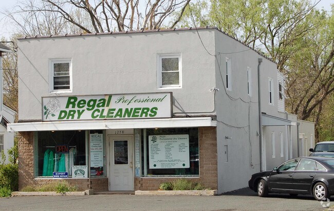
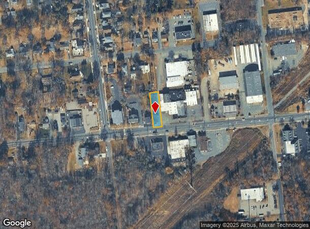
1278 Valley Rd, Stirling, NJ 07980
NEARBY LISTINGS FOR SALE OR LEASE
Property Detail
1278 Valley Rd
Newark, NJ-PA
Morris
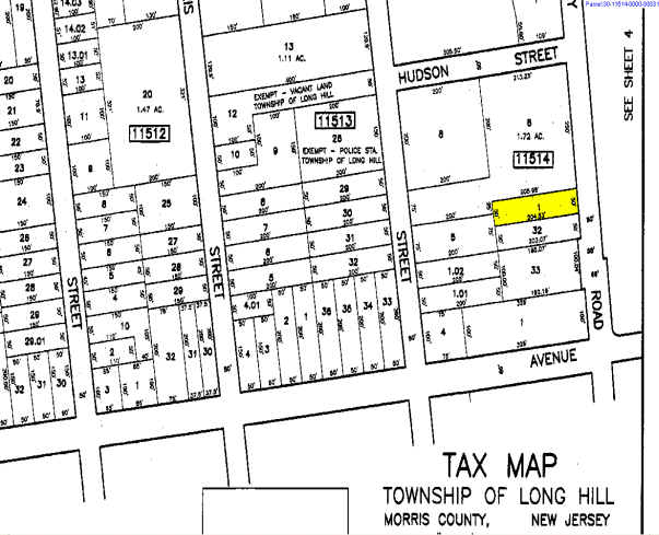
30-11514-0000-00031
New Jersey
Storemultistory
31
2024
0.24 AC
2025
Morristown Region
044102
Northern New Jersey
DEMOGRAPHICS near 1278 Valley Rd
1 Mile
3 Mile
5 Mile
2024 Total Population
2,931
27,814
109,101
2029 Population
2,928
27,947
108,623
Pop Growth 2024-2029
(0.10%)
+ 0.48%
(0.44%)
Average Age
42
43
42
2024 Total Households
1,059
9,981
37,919
HH Growth 2024-2029
(0.09%)
+ 0.43%
(0.47%)
Median Household Inc
$139,090
$154,218
$129,591
Avg Household Size
2.80
2.70
2.80
2024 Avg HH Vehicles
2.00
2.00
2.00
Median Home Value
$676,087
$703,082
$652,926
Median Year Built
1960
1977
1967
Nearby Places
Map Layers
Map Styles
 Street
 Aerial
- Restaurants
- Banks
- Shops
- Fitness
- Groceries
PUBLIC TRANSPORTATION
COMMUTER RAIL
Stirling (Morris & Essex Gladstone Branch - NJ Transit Commuter Rail (NJ Transit))
DRIVE
WALK
Distance
Stirling (Morris & Essex Gladstone Branch - NJ Transit Commuter Rail (NJ Transit))
2 min
11 min
0.6 mi
Gillette (Morris & Essex Gladstone Branch - NJ Transit Commuter Rail (NJ Transit))
DRIVE
WALK
Distance
Gillette (Morris & Essex Gladstone Branch - NJ Transit Commuter Rail (NJ Transit))
4 min
1.8 mi
AIRPORT
Newark Liberty International
DRIVE
WALK
Distance
Newark Liberty International
31 min
22.5 mi
LaGuardia
DRIVE
WALK
Distance
LaGuardia
66 min
41.8 mi
Trenton Mercer
DRIVE
WALK
Distance
Trenton Mercer
72 min
42.8 mi
Freight Ports
Maher Terminal
DRIVE
WALK
Distance
Maher Terminal
36 min
23.6 mi
SALE & LEASE HISTORY
LISTING DATE
SALE/LEASE

Sep 24, 2016
For Sale
Nearby Properties
Address
Land Use
TOTAL SIZE
Lot Size
Zoning
Address
Land Use
TOTAL SIZE
Lot Size
Zoning
52.31 AC
OR
Address
Land Use
TOTAL SIZE
Lot Size
Zoning
1,976 SF
22.03 AC
B5
Address
Land Use
TOTAL SIZE
Lot Size
Zoning
34.27 AC
R65
Address
Land Use
TOTAL SIZE
Lot Size
Zoning
67.22 AC
R65
Address
Land Use
TOTAL SIZE
Lot Size
Zoning
23.93 AC
B2
Address
Land Use
TOTAL SIZE
Lot Size
Zoning
Address
Land Use
TOTAL SIZE
Lot Size
Zoning
18.66 AC
CR
Address
Land Use
TOTAL SIZE
Lot Size
Zoning
8.64 AC
AH-4
Address
Land Use
TOTAL SIZE
Lot Size
Zoning
11.66 AC
R6
Address
Land Use
TOTAL SIZE
Lot Size
Zoning
1,096 SF
15.12 AC
R5
Address
Land Use
TOTAL SIZE
Lot Size
Zoning
8.09 AC
B3
Address
Land Use
TOTAL SIZE
Lot Size
Zoning
30.84 AC
OR
Address
Land Use
TOTAL SIZE
Lot Size
Zoning
40.36 AC
OR
Address
Land Use
TOTAL SIZE
Lot Size
Zoning
2,765 SF
9.10 AC
R6
Address
Land Use
TOTAL SIZE
Lot Size
Zoning
40.73 AC
OR
Address
Land Use
TOTAL SIZE
Lot Size
Zoning
1,950 SF
10.56 AC
CR
Address
Land Use
TOTAL SIZE
Lot Size
Zoning
15.73 AC
GI
Address
Land Use
TOTAL SIZE
Lot Size
Zoning
22.61 AC
GI
Address
Land Use
TOTAL SIZE
Lot Size
Zoning
Address
Land Use
TOTAL SIZE
Lot Size
Zoning
1.59 AC
GI
Address
Land Use
TOTAL SIZE
Lot Size
Zoning
2.71 AC
CR
Address
Land Use
TOTAL SIZE
Lot Size
Zoning
5,120 SF
179.76 AC
M-1
Address
Land Use
TOTAL SIZE
Lot Size
Zoning
Address
Land Use
TOTAL SIZE
Lot Size
Zoning
1.21 AC
GI
Address
Land Use
TOTAL SIZE
Lot Size
Zoning
19.20 AC
GI
Address
Land Use
TOTAL SIZE
Lot Size
Zoning
24.29 AC
GI
Address
Land Use
TOTAL SIZE
Lot Size
Zoning
7.46 AC
BR80
Address
Land Use
TOTAL SIZE
Lot Size
Zoning
6.43 AC
CB
Address
Land Use
TOTAL SIZE
Lot Size
Zoning
23.61 AC
R65
Address
Land Use
TOTAL SIZE
Lot Size
Zoning
30.26 AC
C
The World's #1 Commercial Real Estate Marketplace
Connect with us
© 2025 CoStar Group
The information above has been obtained from sources believed reliable. While we do not doubt its accuracy we have not verified it and make no guarantee, warranty or representation about it. It is your responsibility to independently confirm its accuracy and completeness. Any projections, opinions, assumptions, or estimates used are for example only and do not represent the current or future performance of the property. The value of this transaction to you depends on tax and other factors which should be evaluated by your tax, financial, and legal advisors. You and your advisors should conduct a careful, independent investigation of the property to determine to your satisfaction the suitability of the property for your needs.