Property Record
12790 Primrose Ln, Eden Prairie, MN 55344

NEARBY LISTINGS FOR SALE OR LEASE
-
-
View all Eden Prairie listings for sale on LoopNet.com
Property Detail
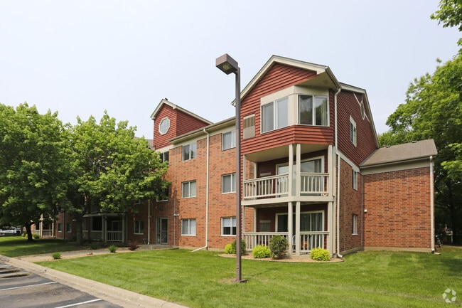
12790 Primrose Ln
Minneapolis-St. Paul-Bloomington, MN-WI
Fountain Place Apartments
14-116-22-33-0018
LOT 001 BLOCK 002 B FOUNTAIN PLACE APARTMENTS IRREGULAR
Apartment
Hennepin
A
Minnesota
27053C0430F
1
2024
7.30 AC
2024
Eden Prairie
026019
Minneapolis/St Paul
247,618 SF
DEMOGRAPHICS near 12790 Primrose Ln
1 Mile
3 Mile
5 Mile
2024 Total Population
11,311
51,499
139,477
2029 Population
11,187
50,680
139,111
Pop Growth 2024-2029
(1.10%)
(1.59%)
(0.26%)
Average Age
36
41
42
2024 Total Households
4,929
20,314
57,080
HH Growth 2024-2029
(1.24%)
(1.75%)
(0.35%)
Median Household Inc
$92,411
$112,833
$107,469
Avg Household Size
2.20
2.50
2.40
2024 Avg HH Vehicles
2.00
2.00
2.00
Median Home Value
$327,457
$425,800
$416,470
Median Year Built
1988
1987
1984
Nearby Places
Map Layers
Map Styles
 Street
 Aerial
- Restaurants
- Banks
- Shops
- Fitness
- Groceries
PUBLIC TRANSPORTATION
AIRPORT
Minneapolis-St Paul International/Wold-Chamberlain
DRIVE
WALK
Distance
Minneapolis-St Paul International/Wold-Chamberlain
20 min
13.0 mi
Freight Ports
Port Milwaukee
DRIVE
WALK
Distance
Port Milwaukee
389 min
350.1 mi
Nearby Properties
Address
Land Use
TOTAL SIZE
Lot Size
Zoning
Address
Land Use
TOTAL SIZE
Lot Size
Zoning
49,799 SF
4.96 AC
Address
Land Use
TOTAL SIZE
Lot Size
Zoning
Address
Land Use
TOTAL SIZE
Lot Size
Zoning
49,757 SF
2.88 AC
Address
Land Use
TOTAL SIZE
Lot Size
Zoning
136,782 SF
6.17 AC
Address
Land Use
TOTAL SIZE
Lot Size
Zoning
216,984 SF
14.48 AC
RM25
Address
Land Use
TOTAL SIZE
Lot Size
Zoning
226,252 SF
5.40 AC
Address
Land Use
TOTAL SIZE
Lot Size
Zoning
175,506 SF
14.32 AC
Address
Land Use
TOTAL SIZE
Lot Size
Zoning
10.01 AC
RM25
Address
Land Use
TOTAL SIZE
Lot Size
Zoning
314,234 SF
2.31 AC
RM25
Address
Land Use
TOTAL SIZE
Lot Size
Zoning
327,536 SF
4.76 AC
CCOM
Address
Land Use
TOTAL SIZE
Lot Size
Zoning
166,989 SF
9.70 AC
RM25
Address
Land Use
TOTAL SIZE
Lot Size
Zoning
181,201 SF
8.30 AC
OFC
Address
Land Use
TOTAL SIZE
Lot Size
Zoning
122,801 SF
8.41 AC
RM25
Address
Land Use
TOTAL SIZE
Lot Size
Zoning
88,213 SF
3.77 AC
Address
Land Use
TOTAL SIZE
Lot Size
Zoning
9.94 AC
RM25
Address
Land Use
TOTAL SIZE
Lot Size
Zoning
12.57 AC
RM25
Address
Land Use
TOTAL SIZE
Lot Size
Zoning
5.77 AC
RM25
Address
Land Use
TOTAL SIZE
Lot Size
Zoning
325,341 SF
35.31 AC
C-REG
Address
Land Use
TOTAL SIZE
Lot Size
Zoning
298,582 SF
31.71 AC
OFC
Address
Land Use
TOTAL SIZE
Lot Size
Zoning
107,652 SF
9.82 AC
OFC
Address
Land Use
TOTAL SIZE
Lot Size
Zoning
130,990 SF
18.27 AC
C-REG
Address
Land Use
TOTAL SIZE
Lot Size
Zoning
536,598 SF
53.84 AC
I-5
Address
Land Use
TOTAL SIZE
Lot Size
Zoning
70,129 SF
13.03 AC
RM25
Address
Land Use
TOTAL SIZE
Lot Size
Zoning
129,037 SF
16.73 AC
RM25
Address
Land Use
TOTAL SIZE
Lot Size
Zoning
191,179 SF
22.62 AC
Address
Land Use
TOTAL SIZE
Lot Size
Zoning
206,200 SF
8.97 AC
RM25
Address
Land Use
TOTAL SIZE
Lot Size
Zoning
8.19 AC
RM25
Address
Land Use
TOTAL SIZE
Lot Size
Zoning
56,718 SF
2.43 AC
Address
Land Use
TOTAL SIZE
Lot Size
Zoning
202,782 SF
15.75 AC
I-5
The World's #1 Commercial Real Estate Marketplace
Connect with us
© 2026 CoStar Group
The information above has been obtained from sources believed reliable. While we do not doubt its accuracy we have not verified it and make no guarantee, warranty or representation about it. It is your responsibility to independently confirm its accuracy and completeness. Any projections, opinions, assumptions, or estimates used are for example only and do not represent the current or future performance of the property. The value of this transaction to you depends on tax and other factors which should be evaluated by your tax, financial, and legal advisors. You and your advisors should conduct a careful, independent investigation of the property to determine to your satisfaction the suitability of the property for your needs.