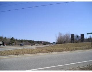
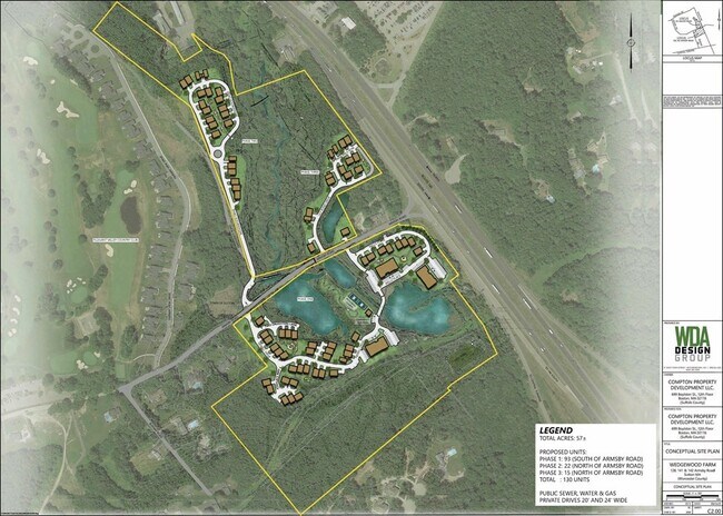
Property Record
128 Armsby Rd, Sutton, MA 01590


Property Detail
128 Armsby Rd
SUTT-000018-000000-000017
WORCESTER
Commercialacreage
Massachusetts
B2
34.75 AC
C and X Area of minimal flood hazard, usually depicted on FIRMs as above the 500-year flood level.
Outlying Worcester
2025
Boston
2025
Worcester, MA
751102
NEARBY LISTINGS FOR SALE OR LEASE
DEMOGRAPHICS near 128 Armsby Rd
1 mile
3 mile
5 mile
2025 Total Population
1,089
14,102
52,424
2030 Population
1,118
14,476
53,839
Pop Growth 2025-2030
+ 2.66%
+ 2.65%
+ 2.70%
Average Age
44
42
42
2025 Total Households
415
5,407
20,488
HH Growth 2025-2030
+ 2.89%
+ 2.79%
+ 2.80%
Median Household Inc
$154,861
$141,016
$125,816
Avg Household Size
2.60
2.60
2.50
2025 Avg HH Vehicles
2.00
2.00
2.00
Median Home Value
$657,051
$543,014
$505,479
Median Year Built
1983
1979
1976
Nearby Places
Map Layers
Map Styles
 Street
 Aerial
Layers
 Traffic
 Biking
Places
Listings with unknown addresses are not visible on the map
- Restaurants
- Banks
- Shops
- Fitness
- Groceries
PUBLIC TRANSPORTATION
AIRPORT
Worcester Regional
Drive
Walk
Distance
Worcester Regional
24 min
15.1 mi
Freight Ports
Port of Boston
Drive
Walk
Distance
Port of Boston
66 min
49.7 mi
SALE & LEASE HISTORY
LISTING DATE
SALE/LEASE

Aug 21, 2023
For Sale
Nearby Properties
Address
Land Use
TOTAL SIZE
Lot Size
Zoning
Address
Land Use
TOTAL SIZE
Lot Size
Zoning
423,649 SF
33.23 AC
B2
Address
Land Use
TOTAL SIZE
Lot Size
Zoning
200,557 SF
13.09 AC
R1
Address
Land Use
TOTAL SIZE
Lot Size
Zoning
Address
Land Use
TOTAL SIZE
Lot Size
Zoning
42.92 AC
R1
Address
Land Use
TOTAL SIZE
Lot Size
Zoning
10.19 AC
B2
Address
Land Use
TOTAL SIZE
Lot Size
Zoning
336,046 SF
36.36 AC
Address
Land Use
TOTAL SIZE
Lot Size
Zoning
109,500 SF
7.40 AC
V
Address
Land Use
TOTAL SIZE
Lot Size
Zoning
32,573 SF
8.25 AC
R2
Address
Land Use
TOTAL SIZE
Lot Size
Zoning
9.60 AC
I
Address
Land Use
TOTAL SIZE
Lot Size
Zoning
107.27 AC
Address
Land Use
TOTAL SIZE
Lot Size
Zoning
185,400 SF
16.35 AC
OLI
Address
Land Use
TOTAL SIZE
Lot Size
Zoning
59,950 SF
6.66 AC
OLI
Address
Land Use
TOTAL SIZE
Lot Size
Zoning
7.47 AC
Address
Land Use
TOTAL SIZE
Lot Size
Zoning
18,450 SF
3.77 AC
B2
Address
Land Use
TOTAL SIZE
Lot Size
Zoning
138.50 AC
I1
Address
Land Use
TOTAL SIZE
Lot Size
Zoning
136.75 AC
R1
Address
Land Use
TOTAL SIZE
Lot Size
Zoning
1,950 SF
506 AC
R1
Address
Land Use
TOTAL SIZE
Lot Size
Zoning
255.31 AC
R1
Address
Land Use
TOTAL SIZE
Lot Size
Zoning
160.37 AC
Address
Land Use
TOTAL SIZE
Lot Size
Zoning
7.50 AC
R2
Address
Land Use
TOTAL SIZE
Lot Size
Zoning
3.50 AC
R1
Address
Land Use
TOTAL SIZE
Lot Size
Zoning
Address
Land Use
TOTAL SIZE
Lot Size
Zoning
32,618 SF
4.36 AC
B2
Address
Land Use
TOTAL SIZE
Lot Size
Zoning
32,390 SF
1.90 AC
I
Address
Land Use
TOTAL SIZE
Lot Size
Zoning
6.84 AC
I
Address
Land Use
TOTAL SIZE
Lot Size
Zoning
6,230 SF
2.52 AC
R1
Address
Land Use
TOTAL SIZE
Lot Size
Zoning
1.54 AC
V
Address
Land Use
TOTAL SIZE
Lot Size
Zoning
1.70 AC
R2
Address
Land Use
TOTAL SIZE
Lot Size
Zoning
86.84 AC
Address
Land Use
TOTAL SIZE
Lot Size
Zoning
40,000 SF
17.63 AC
I
The World's #1 Commercial Real Estate Marketplace
Connect with us
© 2026 CoStar Group
The information above has been obtained from sources believed reliable. While we do not doubt its accuracy we have not verified it and make no guarantee, warranty or representation about it. It is your responsibility to independently confirm its accuracy and completeness. Any projections, opinions, assumptions, or estimates used are for example only and do not represent the current or future performance of the property. The value of this transaction to you depends on tax and other factors which should be evaluated by your tax, financial, and legal advisors. You and your advisors should conduct a careful, independent investigation of the property to determine to your satisfaction the suitability of the property for your needs.