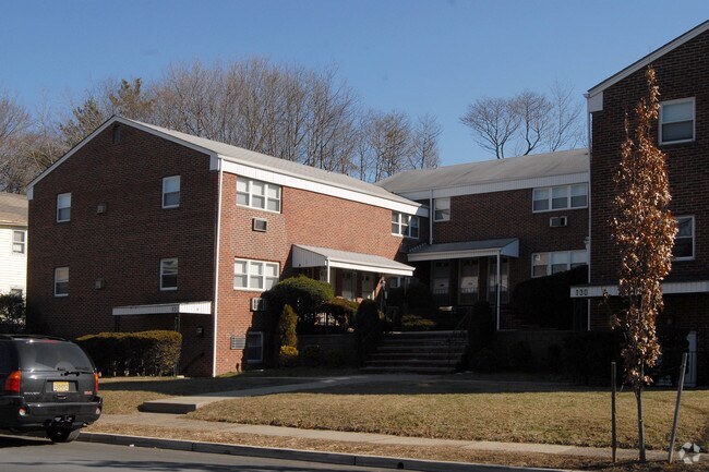
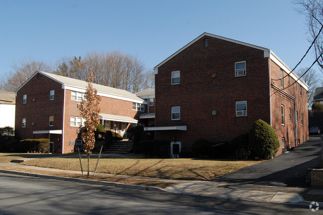
Property Record
128 Bloomfield Ave, Nutley, NJ 07110


NEARBY LISTINGS FOR SALE OR LEASE
Property Detail
128 Bloomfield Ave
Newark, NJ
141X164 IRR
16-08900-0000-00024
Essex
Apartment
New Jersey
X
24
34031C0258G
0.53 AC
2023
Upper Essex County
2025
Northern New Jersey
013900
DEMOGRAPHICS near 128 Bloomfield Ave
1 Mile
3 Mile
5 Mile
2024 Total Population
27,101
248,451
694,779
2029 Population
26,351
242,590
677,145
Pop Growth 2024-2029
(2.77%)
(2.36%)
(2.54%)
Average Age
42
40
39
2024 Total Households
10,569
95,282
254,375
HH Growth 2024-2029
(3.05%)
(2.51%)
(2.62%)
Median Household Inc
$86,572
$88,724
$72,919
Avg Household Size
2.50
2.50
2.60
2024 Avg HH Vehicles
2.00
2.00
1.00
Median Home Value
$378,869
$430,524
$430,071
Median Year Built
1952
1951
1954
Nearby Places
Map Layers
Map Styles
 Street
 Aerial
- Restaurants
- Banks
- Shops
- Fitness
- Groceries
PUBLIC TRANSPORTATION
COMMUTER RAIL
Bay Street (Montclair-Boonton Line - NJ Transit Commuter Rail (NJ Transit))
DRIVE
WALK
Distance
Bay Street (Montclair-Boonton Line - NJ Transit Commuter Rail (NJ Transit))
8 min
2.6 mi
Walnut Street (Montclair-Boonton Line - NJ Transit Commuter Rail (NJ Transit))
DRIVE
WALK
Distance
Walnut Street (Montclair-Boonton Line - NJ Transit Commuter Rail (NJ Transit))
8 min
2.6 mi
AIRPORT
Newark Liberty International
DRIVE
WALK
Distance
Newark Liberty International
22 min
11.1 mi
LaGuardia
DRIVE
WALK
Distance
LaGuardia
44 min
22.7 mi
John F Kennedy International
DRIVE
WALK
Distance
John F Kennedy International
53 min
30.6 mi
Freight Ports
Maher Terminal
DRIVE
WALK
Distance
Maher Terminal
26 min
12.6 mi
Nearby Properties
Address
Land Use
TOTAL SIZE
Lot Size
Zoning
Address
Land Use
TOTAL SIZE
Lot Size
Zoning
3,956 SF
250 AC
C2
Address
Land Use
TOTAL SIZE
Lot Size
Zoning
5 AC
H
Address
Land Use
TOTAL SIZE
Lot Size
Zoning
17.97 AC
Address
Land Use
TOTAL SIZE
Lot Size
Zoning
1,589 SF
R4
Address
Land Use
TOTAL SIZE
Lot Size
Zoning
12.54 AC
OPRP
Address
Land Use
TOTAL SIZE
Lot Size
Zoning
Address
Land Use
TOTAL SIZE
Lot Size
Zoning
1.12 AC
M-O
Address
Land Use
TOTAL SIZE
Lot Size
Zoning
2.64 AC
Address
Land Use
TOTAL SIZE
Lot Size
Zoning
Address
Land Use
TOTAL SIZE
Lot Size
Zoning
11.49 AC
M-1
Address
Land Use
TOTAL SIZE
Lot Size
Zoning
3.26 AC
PR
Address
Land Use
TOTAL SIZE
Lot Size
Zoning
0.17 AC
BCR1
Address
Land Use
TOTAL SIZE
Lot Size
Zoning
71,634 SF
12.31 AC
M1
Address
Land Use
TOTAL SIZE
Lot Size
Zoning
1.67 AC
BCR1
Address
Land Use
TOTAL SIZE
Lot Size
Zoning
860 SF
0.96 AC
R100
Address
Land Use
TOTAL SIZE
Lot Size
Zoning
3.20 AC
BSRD
Address
Land Use
TOTAL SIZE
Lot Size
Zoning
224 SF
0.94 AC
BCR1
Address
Land Use
TOTAL SIZE
Lot Size
Zoning
1.50 AC
RA
Address
Land Use
TOTAL SIZE
Lot Size
Zoning
1.95 AC
RA
Address
Land Use
TOTAL SIZE
Lot Size
Zoning
9.98 AC
R-1
Address
Land Use
TOTAL SIZE
Lot Size
Zoning
0.22 AC
Address
Land Use
TOTAL SIZE
Lot Size
Zoning
7.22 AC
M-3
Address
Land Use
TOTAL SIZE
Lot Size
Zoning
9.38 AC
B-A
Address
Land Use
TOTAL SIZE
Lot Size
Zoning
228,736 SF
48.25 AC
Address
Land Use
TOTAL SIZE
Lot Size
Zoning
10.40 AC
Address
Land Use
TOTAL SIZE
Lot Size
Zoning
4.09 AC
M-O
Address
Land Use
TOTAL SIZE
Lot Size
Zoning
17.90 AC
R-G
Address
Land Use
TOTAL SIZE
Lot Size
Zoning
12.52 AC
Address
Land Use
TOTAL SIZE
Lot Size
Zoning
53,100 SF
6.60 AC
Address
Land Use
TOTAL SIZE
Lot Size
Zoning
17.50 AC
The World's #1 Commercial Real Estate Marketplace
Connect with us
© 2026 CoStar Group
The information above has been obtained from sources believed reliable. While we do not doubt its accuracy we have not verified it and make no guarantee, warranty or representation about it. It is your responsibility to independently confirm its accuracy and completeness. Any projections, opinions, assumptions, or estimates used are for example only and do not represent the current or future performance of the property. The value of this transaction to you depends on tax and other factors which should be evaluated by your tax, financial, and legal advisors. You and your advisors should conduct a careful, independent investigation of the property to determine to your satisfaction the suitability of the property for your needs.