Property Record
128 Chase High Rd, Forest City, NC 28043


NEARBY LISTINGS FOR SALE OR LEASE
-
-
View all Forest City listings for sale on LoopNet.com
Property Detail
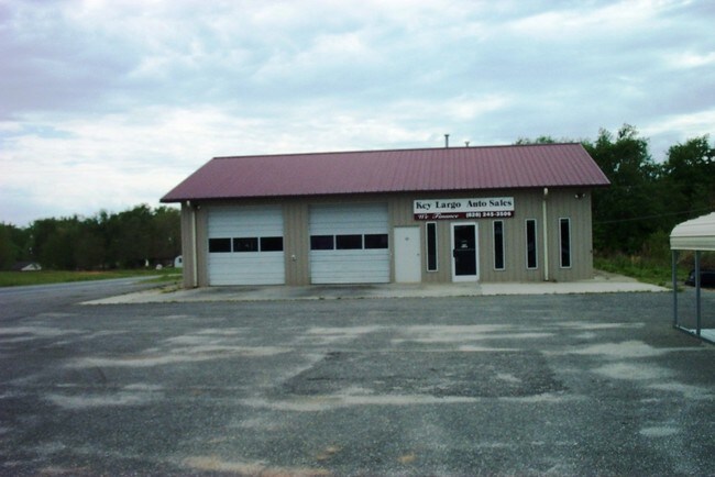
128 Chase High Rd
Autorepair
PL:41-114
X
Rutherford
3710155700J
North Carolina
2025
1.64 AC
2025
Other Market Areas
960900
Forest City, NC
2,000 SF
1647951
DEMOGRAPHICS near 128 Chase High Rd
1 mile
3 mile
5 mile
2024 Total Population
1,572
8,656
22,083
2029 Population
1,589
8,706
22,214
Pop Growth 2024-2029
+ 1.08%
+ 0.58%
+ 0.59%
Average Age
41
40
41
2024 Total Households
662
3,524
8,972
HH Growth 2024-2029
+ 1.06%
+ 0.48%
+ 0.50%
Median Household Inc
$35,833
$40,769
$40,496
Avg Household Size
2.30
2.40
2.40
2024 Avg HH Vehicles
2.00
2.00
2.00
Median Home Value
$118,182
$130,508
$133,918
Median Year Built
1976
1972
1973
Nearby Places
Map Layers
Map Styles
 Street
 Aerial
Transit
 Traffic
 Biking
Places
Listings with unknown addresses are not visible on the map
- Restaurants
- Banks
- Shops
- Fitness
- Groceries
PUBLIC TRANSPORTATION
AIRPORT
Greenville Spartanburg International
Drive
Walk
Distance
Greenville Spartanburg International
63 min
44.1 mi
SALE & LEASE HISTORY
LISTING DATE
SALE/LEASE

Jun 09, 2017
For Sale
Nearby Properties
Address
Land Use
TOTAL SIZE
Lot Size
Zoning
Address
Land Use
TOTAL SIZE
Lot Size
Zoning
26,465 SF
61.74 AC
M1
Address
Land Use
TOTAL SIZE
Lot Size
Zoning
24,095 SF
72.22 AC
M1
Address
Land Use
TOTAL SIZE
Lot Size
Zoning
109,472 SF
40.17 AC
Address
Land Use
TOTAL SIZE
Lot Size
Zoning
124,707 SF
30.99 AC
C3
Address
Land Use
TOTAL SIZE
Lot Size
Zoning
15,128 SF
81 AC
Address
Land Use
TOTAL SIZE
Lot Size
Zoning
12,957 SF
109.70 AC
Address
Land Use
TOTAL SIZE
Lot Size
Zoning
64,697 SF
18.07 AC
R8
Address
Land Use
TOTAL SIZE
Lot Size
Zoning
343,372 SF
49.89 AC
M1ETJ
Address
Land Use
TOTAL SIZE
Lot Size
Zoning
483 SF
6.26 AC
C3
Address
Land Use
TOTAL SIZE
Lot Size
Zoning
488.84 AC
Address
Land Use
TOTAL SIZE
Lot Size
Zoning
25,219 SF
20.12 AC
Address
Land Use
TOTAL SIZE
Lot Size
Zoning
1,444 SF
5.06 AC
C3
Address
Land Use
TOTAL SIZE
Lot Size
Zoning
6,320 SF
10.50 AC
R6
Address
Land Use
TOTAL SIZE
Lot Size
Zoning
9,900 SF
16.51 AC
Address
Land Use
TOTAL SIZE
Lot Size
Zoning
5,504 SF
4.14 AC
R8
Address
Land Use
TOTAL SIZE
Lot Size
Zoning
1,728 SF
10.29 AC
M1
Address
Land Use
TOTAL SIZE
Lot Size
Zoning
3,430 SF
12.49 AC
R20ETJ
Address
Land Use
TOTAL SIZE
Lot Size
Zoning
2,490 SF
24.55 AC
R8
Address
Land Use
TOTAL SIZE
Lot Size
Zoning
31,350 SF
5.59 AC
Address
Land Use
TOTAL SIZE
Lot Size
Zoning
20,000 SF
9.10 AC
Address
Land Use
TOTAL SIZE
Lot Size
Zoning
5,278 SF
8.80 AC
Address
Land Use
TOTAL SIZE
Lot Size
Zoning
3,456 SF
3.06 AC
R6
Address
Land Use
TOTAL SIZE
Lot Size
Zoning
5,834 SF
4.48 AC
R15ETJ
Address
Land Use
TOTAL SIZE
Lot Size
Zoning
17,792 SF
5.60 AC
R15ETJ
Address
Land Use
TOTAL SIZE
Lot Size
Zoning
106,875 SF
10.12 AC
M1
Address
Land Use
TOTAL SIZE
Lot Size
Zoning
4,577 SF
5.05 AC
Address
Land Use
TOTAL SIZE
Lot Size
Zoning
15,652 SF
20.06 AC
Address
Land Use
TOTAL SIZE
Lot Size
Zoning
21,600 SF
3.33 AC
C3
Address
Land Use
TOTAL SIZE
Lot Size
Zoning
2,308 SF
3.63 AC
C2
Address
Land Use
TOTAL SIZE
Lot Size
Zoning
12,532 SF
3.06 AC
R6
The World's #1 Commercial Real Estate Marketplace
Connect with us
© 2026 CoStar Group
The information above has been obtained from sources believed reliable. While we do not doubt its accuracy we have not verified it and make no guarantee, warranty or representation about it. It is your responsibility to independently confirm its accuracy and completeness. Any projections, opinions, assumptions, or estimates used are for example only and do not represent the current or future performance of the property. The value of this transaction to you depends on tax and other factors which should be evaluated by your tax, financial, and legal advisors. You and your advisors should conduct a careful, independent investigation of the property to determine to your satisfaction the suitability of the property for your needs.