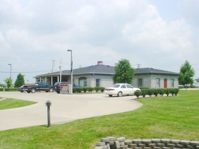
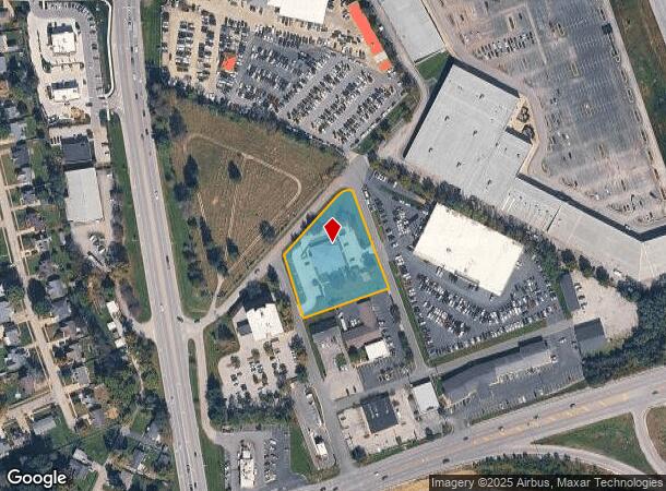
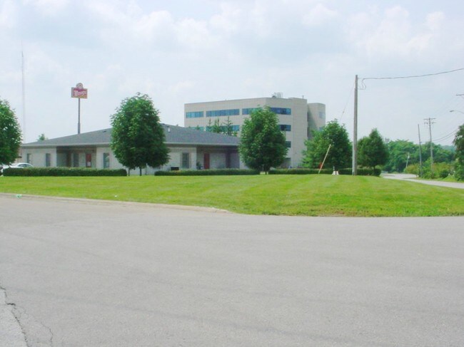
Property Record
128 Edwards Ave, Georgetown, KY 40324
NEARBY LISTINGS FOR SALE OR LEASE
Property Detail
128 Edwards Ave
190-10-106.000
Farmers Bank
Daycare
COMM DAYCARE
X
Scott
21209C0183D
Kentucky
2024
1.36 AC
2024
Scott County
040101
Lexington/Fayette
5,897 SF
Lexington-Fayette, KY
DEMOGRAPHICS near 128 Edwards Ave
1 Mile
3 Mile
5 Mile
2024 Total Population
8,939
40,758
46,015
2029 Population
9,966
45,172
51,008
Pop Growth 2024-2029
+ 11.49%
+ 10.83%
+ 10.85%
Average Age
34
36
36
2024 Total Households
3,365
15,585
17,449
HH Growth 2024-2029
+ 11.89%
+ 11.22%
+ 11.23%
Median Household Inc
$55,223
$69,050
$70,603
Avg Household Size
2.50
2.50
2.50
2024 Avg HH Vehicles
2.00
2.00
2.00
Median Home Value
$209,339
$206,604
$218,488
Median Year Built
2000
1999
1998
Nearby Places
Map Layers
Map Styles
 Street
 Aerial
- Restaurants
- Banks
- Shops
- Fitness
- Groceries
PUBLIC TRANSPORTATION
AIRPORT
Blue Grass
DRIVE
WALK
Distance
Blue Grass
30 min
20.9 mi
Nearby Properties
Address
Land Use
TOTAL SIZE
Lot Size
Zoning
Address
Land Use
TOTAL SIZE
Lot Size
Zoning
317,572 SF
2.49 AC
Address
Land Use
TOTAL SIZE
Lot Size
Zoning
312,633 SF
40.29 AC
Address
Land Use
TOTAL SIZE
Lot Size
Zoning
4,104 SF
25.48 AC
Address
Land Use
TOTAL SIZE
Lot Size
Zoning
192,944 SF
16.03 AC
Address
Land Use
TOTAL SIZE
Lot Size
Zoning
228,770 SF
19.05 AC
Address
Land Use
TOTAL SIZE
Lot Size
Zoning
585,571 SF
69.99 AC
Address
Land Use
TOTAL SIZE
Lot Size
Zoning
263,265 SF
13.62 AC
Address
Land Use
TOTAL SIZE
Lot Size
Zoning
10.63 AC
Address
Land Use
TOTAL SIZE
Lot Size
Zoning
208,400 SF
14.39 AC
Address
Land Use
TOTAL SIZE
Lot Size
Zoning
1,248 SF
15.31 AC
Address
Land Use
TOTAL SIZE
Lot Size
Zoning
158,779 SF
17.69 AC
Address
Land Use
TOTAL SIZE
Lot Size
Zoning
97,000 SF
20.28 AC
Address
Land Use
TOTAL SIZE
Lot Size
Zoning
1,664 SF
27.52 AC
Address
Land Use
TOTAL SIZE
Lot Size
Zoning
Address
Land Use
TOTAL SIZE
Lot Size
Zoning
108,392 SF
26.32 AC
Address
Land Use
TOTAL SIZE
Lot Size
Zoning
194,790 SF
21.97 AC
Address
Land Use
TOTAL SIZE
Lot Size
Zoning
217,560 SF
9.43 AC
Address
Land Use
TOTAL SIZE
Lot Size
Zoning
28,750 SF
3.42 AC
Address
Land Use
TOTAL SIZE
Lot Size
Zoning
Address
Land Use
TOTAL SIZE
Lot Size
Zoning
130,600 SF
12.18 AC
Address
Land Use
TOTAL SIZE
Lot Size
Zoning
115,500 SF
7.24 AC
Address
Land Use
TOTAL SIZE
Lot Size
Zoning
266,311 SF
54.15 AC
Address
Land Use
TOTAL SIZE
Lot Size
Zoning
51,992 SF
10 AC
Address
Land Use
TOTAL SIZE
Lot Size
Zoning
1,540 SF
52.10 AC
Address
Land Use
TOTAL SIZE
Lot Size
Zoning
194 SF
38.23 AC
Address
Land Use
TOTAL SIZE
Lot Size
Zoning
79,599 SF
30.74 AC
Address
Land Use
TOTAL SIZE
Lot Size
Zoning
99,586 SF
6 AC
Address
Land Use
TOTAL SIZE
Lot Size
Zoning
96,273 SF
12.24 AC
Address
Land Use
TOTAL SIZE
Lot Size
Zoning
Address
Land Use
TOTAL SIZE
Lot Size
Zoning
56,298 SF
2.10 AC
The World's #1 Commercial Real Estate Marketplace
Connect with us
© 2026 CoStar Group
The information above has been obtained from sources believed reliable. While we do not doubt its accuracy we have not verified it and make no guarantee, warranty or representation about it. It is your responsibility to independently confirm its accuracy and completeness. Any projections, opinions, assumptions, or estimates used are for example only and do not represent the current or future performance of the property. The value of this transaction to you depends on tax and other factors which should be evaluated by your tax, financial, and legal advisors. You and your advisors should conduct a careful, independent investigation of the property to determine to your satisfaction the suitability of the property for your needs.