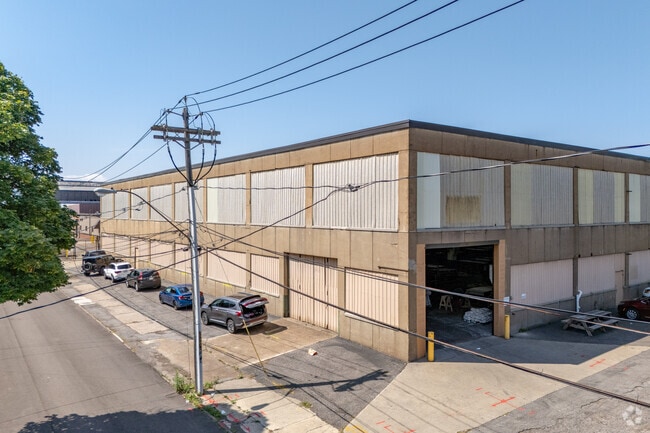
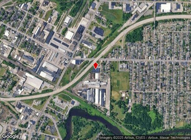
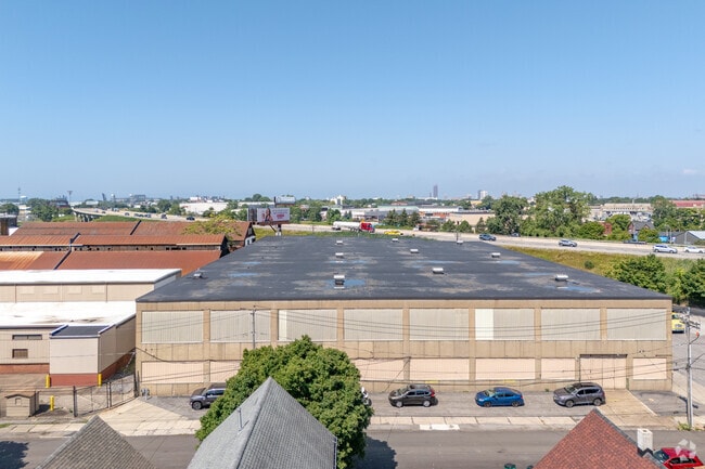
Property Record
128 Roberts Ave, Buffalo, NY 14206
NEARBY LISTINGS FOR SALE OR LEASE
Property Detail
128 Roberts Ave
140200-123-100-0002-005-000-A
ON WORTHINGTON CORP LAND SUBSTATION ONLY
Privateutilityelectricwatergasnuclearsolarwindetc
Erie
X
New York
36029C0327J
5.000
2025
Greater Buffalo
2024
Buffalo/Niagara Falls
001900
Buffalo-Cheektowaga-Niagara Falls, NY
DEMOGRAPHICS near 128 Roberts Ave
1 Mile
3 Mile
5 Mile
2024 Total Population
11,200
107,475
286,859
2029 Population
10,725
104,391
281,166
Pop Growth 2024-2029
(4.24%)
(2.87%)
(1.98%)
Average Age
39
40
40
2024 Total Households
4,818
46,297
126,102
HH Growth 2024-2029
(4.42%)
(2.80%)
(1.86%)
Median Household Inc
$42,323
$43,104
$47,007
Avg Household Size
2.20
2.20
2.20
2024 Avg HH Vehicles
1.00
1.00
1.00
Median Home Value
$101,301
$121,213
$146,445
Median Year Built
1947
1948
1948
Nearby Places
- Restaurants
- Banks
- Shops
- Fitness
- Groceries
PUBLIC TRANSPORTATION
COMMUTER RAIL
DRIVE
WALK
Distance
8 min
4.0 mi
DRIVE
WALK
Distance
13 min
7.0 mi
AIRPORT
Buffalo Niagara International
DRIVE
WALK
Distance
Buffalo Niagara International
18 min
10.1 mi
Niagara Falls International
DRIVE
WALK
Distance
Niagara Falls International
35 min
23.9 mi
Nearby Properties
Address
Land Use
TOTAL SIZE
Lot Size
Zoning
Address
Land Use
TOTAL SIZE
Lot Size
Zoning
1,053,391 SF
88.26 AC
D-IL
Address
Land Use
TOTAL SIZE
Lot Size
Zoning
425,796 SF
7.10 AC
D-M
Address
Land Use
TOTAL SIZE
Lot Size
Zoning
421,249 SF
10.62 AC
N-1D
Address
Land Use
TOTAL SIZE
Lot Size
Zoning
611,620 SF
2.20 AC
N-1S
Address
Land Use
TOTAL SIZE
Lot Size
Zoning
320,576 SF
1.90 AC
N-1S
Address
Land Use
TOTAL SIZE
Lot Size
Zoning
137,180 SF
4.28 AC
SPLIT ZONE
Address
Land Use
TOTAL SIZE
Lot Size
Zoning
2,832 SF
2.54 AC
N-1C
Address
Land Use
TOTAL SIZE
Lot Size
Zoning
Address
Land Use
TOTAL SIZE
Lot Size
Zoning
1,322,238 SF
5.81 AC
N-1S
Address
Land Use
TOTAL SIZE
Lot Size
Zoning
615,144 SF
110.90 AC
N-1S
Address
Land Use
TOTAL SIZE
Lot Size
Zoning
286,674 SF
8.60 AC
N-1C
Address
Land Use
TOTAL SIZE
Lot Size
Zoning
268,851 SF
1.90 AC
N-3R
Address
Land Use
TOTAL SIZE
Lot Size
Zoning
362,095 SF
25.40 AC
D-IL
Address
Land Use
TOTAL SIZE
Lot Size
Zoning
260,250 SF
2.35 AC
N-1C
Address
Land Use
TOTAL SIZE
Lot Size
Zoning
171,589 SF
55.49 AC
D-OG
Address
Land Use
TOTAL SIZE
Lot Size
Zoning
35,000 SF
30.13 AC
Address
Land Use
TOTAL SIZE
Lot Size
Zoning
972 SF
194.01 AC
D-OG
Address
Land Use
TOTAL SIZE
Lot Size
Zoning
6,720 SF
11.10 AC
03RA
Address
Land Use
TOTAL SIZE
Lot Size
Zoning
5,340 SF
233.33 AC
D-ON
Address
Land Use
TOTAL SIZE
Lot Size
Zoning
236,005 SF
1.67 AC
N-1C
Address
Land Use
TOTAL SIZE
Lot Size
Zoning
92,350 SF
9.20 AC
05C
Address
Land Use
TOTAL SIZE
Lot Size
Zoning
102,386 SF
7.20 AC
D-C
Address
Land Use
TOTAL SIZE
Lot Size
Zoning
104,881 SF
24.43 AC
12
Address
Land Use
TOTAL SIZE
Lot Size
Zoning
6,514 SF
68.20 AC
D-OG
Address
Land Use
TOTAL SIZE
Lot Size
Zoning
2,600 SF
14.80 AC
D-IL
Address
Land Use
TOTAL SIZE
Lot Size
Zoning
178,610 SF
6.53 AC
D-C
Address
Land Use
TOTAL SIZE
Lot Size
Zoning
Address
Land Use
TOTAL SIZE
Lot Size
Zoning
111,801 SF
1.59 AC
N-1C
Address
Land Use
TOTAL SIZE
Lot Size
Zoning
42,396 SF
6.48 AC
Address
Land Use
TOTAL SIZE
Lot Size
Zoning
232,570 SF
10.44 AC
D-IL
The World's #1 Commercial Real Estate Marketplace
Connect with us
© 2025 CoStar Group
The information above has been obtained from sources believed reliable. While we do not doubt its accuracy we have not verified it and make no guarantee, warranty or representation about it. It is your responsibility to independently confirm its accuracy and completeness. Any projections, opinions, assumptions, or estimates used are for example only and do not represent the current or future performance of the property. The value of this transaction to you depends on tax and other factors which should be evaluated by your tax, financial, and legal advisors. You and your advisors should conduct a careful, independent investigation of the property to determine to your satisfaction the suitability of the property for your needs.