Property Record
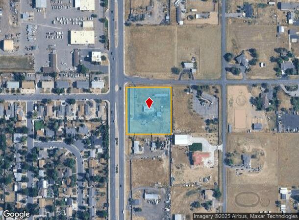
1280 Airport Blvd, Aurora, CO 80011


This Property Is For Sale
NEARBY LISTINGS FOR SALE OR LEASE
Property Detail
1280 Airport Blvd
Denver-Aurora-Lakewood, CO
Kirkegaard Acres
1975-04-2-04-011
Arapahoe
Sfr
Colorado
X
1.81 AC
08005C0181L
Aurora
1,006 SF
Denver
DEMOGRAPHICS near 1280 Airport Blvd
1 Mile
3 Mile
5 Mile
2024 Total Population
11,236
90,723
322,977
2029 Population
11,509
93,301
331,285
Pop Growth 2024-2029
+ 2.43%
+ 2.84%
+ 2.57%
Average Age
36
35
36
2024 Total Households
3,698
31,868
110,535
HH Growth 2024-2029
+ 2.79%
+ 3.07%
+ 2.67%
Median Household Inc
$69,103
$69,023
$78,933
Avg Household Size
2.90
2.70
2.80
2024 Avg HH Vehicles
2.00
2.00
2.00
Median Home Value
$383,602
$414,996
$438,420
Median Year Built
1982
1985
1985
Nearby Places
- Restaurants
- Banks
- Shops
- Fitness
- Groceries
PUBLIC TRANSPORTATION
COMMUTER RAIL
DRIVE
WALK
Distance
7 min
3.3 mi
DRIVE
WALK
Distance
11 min
5.6 mi
AIRPORT
Denver International
DRIVE
WALK
Distance
Denver International
18 min
13.8 mi
Nearby Properties
Address
Land Use
TOTAL SIZE
Lot Size
Zoning
Address
Land Use
TOTAL SIZE
Lot Size
Zoning
368,450 SF
48.59 AC
Address
Land Use
TOTAL SIZE
Lot Size
Zoning
353,829 SF
4.51 AC
Address
Land Use
TOTAL SIZE
Lot Size
Zoning
1,078,683 SF
68.01 AC
Address
Land Use
TOTAL SIZE
Lot Size
Zoning
525,050 SF
105.06 AC
Address
Land Use
TOTAL SIZE
Lot Size
Zoning
876,549 SF
46.65 AC
Address
Land Use
TOTAL SIZE
Lot Size
Zoning
868,780 SF
105.02 AC
Address
Land Use
TOTAL SIZE
Lot Size
Zoning
704,978 SF
36.17 AC
Address
Land Use
TOTAL SIZE
Lot Size
Zoning
691,200 SF
38.09 AC
Address
Land Use
TOTAL SIZE
Lot Size
Zoning
273,184 SF
1.89 AC
Address
Land Use
TOTAL SIZE
Lot Size
Zoning
512,720 SF
42.32 AC
Address
Land Use
TOTAL SIZE
Lot Size
Zoning
550,031 SF
37.73 AC
Address
Land Use
TOTAL SIZE
Lot Size
Zoning
522,120 SF
27.70 AC
Address
Land Use
TOTAL SIZE
Lot Size
Zoning
500,358 SF
23.59 AC
Address
Land Use
TOTAL SIZE
Lot Size
Zoning
140.42 AC
Address
Land Use
TOTAL SIZE
Lot Size
Zoning
548,510 SF
27.26 AC
Address
Land Use
TOTAL SIZE
Lot Size
Zoning
315,058 SF
36.85 AC
RPCZD
Address
Land Use
TOTAL SIZE
Lot Size
Zoning
433,280 SF
23.46 AC
Address
Land Use
TOTAL SIZE
Lot Size
Zoning
461,580 SF
23.56 AC
Address
Land Use
TOTAL SIZE
Lot Size
Zoning
593,928 SF
32.25 AC
Address
Land Use
TOTAL SIZE
Lot Size
Zoning
452,400 SF
20.99 AC
Address
Land Use
TOTAL SIZE
Lot Size
Zoning
432,600 SF
30.98 AC
Address
Land Use
TOTAL SIZE
Lot Size
Zoning
419,630 SF
24.34 AC
Address
Land Use
TOTAL SIZE
Lot Size
Zoning
672,521 SF
0.61 AC
RB3
Address
Land Use
TOTAL SIZE
Lot Size
Zoning
277,985 SF
19.07 AC
Address
Land Use
TOTAL SIZE
Lot Size
Zoning
385,187 SF
26.62 AC
Address
Land Use
TOTAL SIZE
Lot Size
Zoning
178,235 SF
1.38 AC
RFBAD
Address
Land Use
TOTAL SIZE
Lot Size
Zoning
355,740 SF
18.20 AC
Address
Land Use
TOTAL SIZE
Lot Size
Zoning
347,840 SF
19.95 AC
Address
Land Use
TOTAL SIZE
Lot Size
Zoning
331,923 SF
16.83 AC
Address
Land Use
TOTAL SIZE
Lot Size
Zoning
111,358 SF
1.21 AC
The World's #1 Commercial Real Estate Marketplace
Connect with us
© 2025 CoStar Group
The information above has been obtained from sources believed reliable. While we do not doubt its accuracy we have not verified it and make no guarantee, warranty or representation about it. It is your responsibility to independently confirm its accuracy and completeness. Any projections, opinions, assumptions, or estimates used are for example only and do not represent the current or future performance of the property. The value of this transaction to you depends on tax and other factors which should be evaluated by your tax, financial, and legal advisors. You and your advisors should conduct a careful, independent investigation of the property to determine to your satisfaction the suitability of the property for your needs.