Property Record
1280 Boardman Canfield Rd, Youngstown, OH 44512


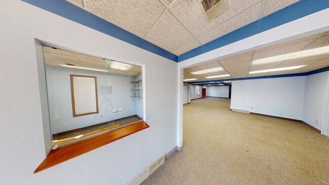
Property Detail
1280 Boardman Canfield Rd
Youngstown-Warren, OH
LOT 3 150 X 300 ROYCE CIRCLE PLAT 2
29-090-0-024.04-0
MAHONING
Officebuilding
Ohio
C
3
2025
1.03 AC
2025
Boardman
811500
Youngstown/Warren/Boardman
13,107 SF
NEARBY LISTINGS FOR SALE OR LEASE
DEMOGRAPHICS near 1280 Boardman Canfield Rd
1 mile
3 mile
5 mile
2025 Total Population
5,206
37,833
102,452
2030 Population
5,135
37,320
101,634
Pop Growth 2025-2030
(1.36%)
(1.36%)
(0.80%)
Average Age
45
44
43
2025 Total Households
2,453
17,109
45,206
HH Growth 2025-2030
(1.30%)
(1.36%)
(0.83%)
Median Household Inc
$74,804
$68,643
$57,965
Avg Household Size
2.10
2.20
2.20
2025 Avg HH Vehicles
2.00
2.00
2.00
Median Home Value
$237,555
$182,998
$156,474
Median Year Built
1984
1969
1963
Nearby Places
Map Layers
Map Styles
 Street
 Aerial
Transit
 Traffic
 Biking
Places
Listings with unknown addresses are not visible on the map
- Restaurants
- Banks
- Shops
- Fitness
- Groceries
SALE & LEASE HISTORY
LISTING DATE
SALE/LEASE

Sep 17, 2018
For Lease
Sep 02, 2020
For Lease
Nov 06, 2025
For Lease
Jul 20, 2017
For Lease
Aug 09, 2022
For Lease
Apr 27, 2017
For Lease
Nearby Properties
Address
Land Use
TOTAL SIZE
Lot Size
Zoning
Address
Land Use
TOTAL SIZE
Lot Size
Zoning
252,909 SF
22.37 AC
C
Address
Land Use
TOTAL SIZE
Lot Size
Zoning
436,605 SF
64.24 AC
C
Address
Land Use
TOTAL SIZE
Lot Size
Zoning
Address
Land Use
TOTAL SIZE
Lot Size
Zoning
318,339 SF
14.66 AC
R1
Address
Land Use
TOTAL SIZE
Lot Size
Zoning
88,996 SF
10.94 AC
C
Address
Land Use
TOTAL SIZE
Lot Size
Zoning
41,835 SF
7.46 AC
I
Address
Land Use
TOTAL SIZE
Lot Size
Zoning
47,538 SF
16.14 AC
C
Address
Land Use
TOTAL SIZE
Lot Size
Zoning
41,443 SF
0.93 AC
C
Address
Land Use
TOTAL SIZE
Lot Size
Zoning
91,900 SF
7.60 AC
C
Address
Land Use
TOTAL SIZE
Lot Size
Zoning
57,178 SF
16.42 AC
R2
Address
Land Use
TOTAL SIZE
Lot Size
Zoning
100,565 SF
15.03 AC
R3
Address
Land Use
TOTAL SIZE
Lot Size
Zoning
Address
Land Use
TOTAL SIZE
Lot Size
Zoning
36,466 SF
6.49 AC
C
Address
Land Use
TOTAL SIZE
Lot Size
Zoning
332.96 AC
A
Address
Land Use
TOTAL SIZE
Lot Size
Zoning
71,842 SF
2.10 AC
Address
Land Use
TOTAL SIZE
Lot Size
Zoning
106,276 SF
10.86 AC
Address
Land Use
TOTAL SIZE
Lot Size
Zoning
23,583 SF
9.76 AC
C
Address
Land Use
TOTAL SIZE
Lot Size
Zoning
69,651 SF
2.82 AC
Address
Land Use
TOTAL SIZE
Lot Size
Zoning
51,967 SF
10.60 AC
C
Address
Land Use
TOTAL SIZE
Lot Size
Zoning
59,999 SF
6.07 AC
B
Address
Land Use
TOTAL SIZE
Lot Size
Zoning
102,699 SF
39.18 AC
R1
Address
Land Use
TOTAL SIZE
Lot Size
Zoning
60,854 SF
12.28 AC
R1
Address
Land Use
TOTAL SIZE
Lot Size
Zoning
61,506 SF
9.51 AC
C
Address
Land Use
TOTAL SIZE
Lot Size
Zoning
142,279 SF
19.33 AC
R1
Address
Land Use
TOTAL SIZE
Lot Size
Zoning
31,512 SF
5.25 AC
R3
Address
Land Use
TOTAL SIZE
Lot Size
Zoning
52,876 SF
30.60 AC
MFR
Address
Land Use
TOTAL SIZE
Lot Size
Zoning
56,432 SF
8.42 AC
B3
Address
Land Use
TOTAL SIZE
Lot Size
Zoning
41,788 SF
7.90 AC
I
Address
Land Use
TOTAL SIZE
Lot Size
Zoning
55,042 SF
5.72 AC
C
Address
Land Use
TOTAL SIZE
Lot Size
Zoning
115,719 SF
8.70 AC
I
The World's #1 Commercial Real Estate Marketplace
Connect with us
© 2026 CoStar Group
The information above has been obtained from sources believed reliable. While we do not doubt its accuracy we have not verified it and make no guarantee, warranty or representation about it. It is your responsibility to independently confirm its accuracy and completeness. Any projections, opinions, assumptions, or estimates used are for example only and do not represent the current or future performance of the property. The value of this transaction to you depends on tax and other factors which should be evaluated by your tax, financial, and legal advisors. You and your advisors should conduct a careful, independent investigation of the property to determine to your satisfaction the suitability of the property for your needs.