Property Record
1280 E West Hwy, Silver Spring, MD 20910

Property Detail
1280 E West Hwy
13-03369652
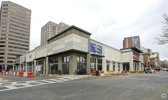
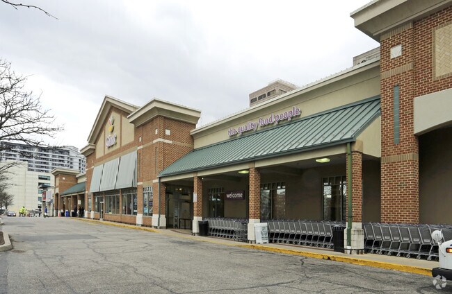
LU 1 BLAIR SHOPPING
Storebuilding
Montgomery
CR5.0
Maryland
B and X Area of moderate flood hazard, usually the area between the limits of the 100-year and 500-year floods.
1.75 AC
2024
Silver Spring
2025
Washington, DC
702603
Washington-Arlington-Alexandria, DC-VA-MD-WV
64,905 SF
NEARBY LISTINGS FOR SALE OR LEASE
DEMOGRAPHICS near 1280 E West Hwy
1 mile
3 mile
5 mile
2025 Total Population
42,746
234,737
653,831
2030 Population
44,716
242,947
676,588
Pop Growth 2025-2030
+ 4.61%
+ 3.50%
+ 3.48%
Average Age
39
39
39
2025 Total Households
21,507
88,866
258,215
HH Growth 2025-2030
+ 4.72%
+ 3.88%
+ 4.02%
Median Household Inc
$102,463
$115,560
$116,822
Avg Household Size
1.90
2.60
2.40
2025 Avg HH Vehicles
1.00
1.00
1.00
Median Home Value
$594,061
$612,327
$540,418
Median Year Built
1969
1956
1958
Nearby Places
Map Layers
Map Styles
 Street
 Aerial
Transit
 Traffic
 Biking
Places
Listings with unknown addresses are not visible on the map
- Restaurants
- Banks
- Shops
- Fitness
- Groceries
PUBLIC TRANSPORTATION
TRANSIT/SUBWAY
Silver Spring (Red Line - Washington Metropolitan Area Transit Authority Metrorail (Metrorail))
Drive
Walk
Distance
Silver Spring (Red Line - Washington Metropolitan Area Transit Authority Metrorail (Metrorail))
1 min
3 min
0.2 mi
COMMUTER RAIL
Silver Spring Marc Eb (BRUNSWICK - WASHINGTON - Maryland Transit Administration)
Drive
Walk
Distance
Silver Spring Marc Eb (BRUNSWICK - WASHINGTON - Maryland Transit Administration)
2 min
4 min
0.2 mi
Kensington Marc Eb (BRUNSWICK - WASHINGTON - Maryland Transit Administration)
Drive
Walk
Distance
Kensington Marc Eb (BRUNSWICK - WASHINGTON - Maryland Transit Administration)
10 min
3.9 mi
AIRPORT
Ronald Reagan Washington Ntl
Drive
Walk
Distance
Ronald Reagan Washington Ntl
22 min
11.6 mi
Washington Dulles International
Drive
Walk
Distance
Washington Dulles International
47 min
30.1 mi
Baltimore/Washington International Thurgood Marshall
Drive
Walk
Distance
Baltimore/Washington International Thurgood Marshall
41 min
30.6 mi
Freight Ports
Port of Baltimore
Drive
Walk
Distance
Port of Baltimore
45 min
33.5 mi
Nearby Properties
Address
Land Use
TOTAL SIZE
Lot Size
Zoning
Address
Land Use
TOTAL SIZE
Lot Size
Zoning
70,860 SF
1,616.16 AC
R-1A;UNZON
Address
Land Use
TOTAL SIZE
Lot Size
Zoning
775,490 SF
14.21 AC
R60
Address
Land Use
TOTAL SIZE
Lot Size
Zoning
1,144,541 SF
30.46 AC
CR2.5
Address
Land Use
TOTAL SIZE
Lot Size
Zoning
919,016 SF
3.25 AC
CR5.0
Address
Land Use
TOTAL SIZE
Lot Size
Zoning
316,393 SF
13.61 AC
R-1A
Address
Land Use
TOTAL SIZE
Lot Size
Zoning
505,000 SF
1.97 AC
CR8.0
Address
Land Use
TOTAL SIZE
Lot Size
Zoning
487,112 SF
3.19 AC
CR3.0
Address
Land Use
TOTAL SIZE
Lot Size
Zoning
302,861 SF
16.30 AC
R-1A
Address
Land Use
TOTAL SIZE
Lot Size
Zoning
400,000 SF
0.93 AC
CR5.0
Address
Land Use
TOTAL SIZE
Lot Size
Zoning
383,000 SF
2.29 AC
WR-3;WR-4
Address
Land Use
TOTAL SIZE
Lot Size
Zoning
14.89 AC
R-1A
Address
Land Use
TOTAL SIZE
Lot Size
Zoning
305,000 SF
1.62 AC
CR5.0
Address
Land Use
TOTAL SIZE
Lot Size
Zoning
247,494 SF
WR-3;WR-5;
Address
Land Use
TOTAL SIZE
Lot Size
Zoning
134,394 SF
6.05 AC
WR-7;WR-8
Address
Land Use
TOTAL SIZE
Lot Size
Zoning
756,363 SF
2.66 AC
CR8.0
Address
Land Use
TOTAL SIZE
Lot Size
Zoning
403,200 SF
1.41 AC
CR5.0
Address
Land Use
TOTAL SIZE
Lot Size
Zoning
406,784 SF
1.75 AC
CR3.0
Address
Land Use
TOTAL SIZE
Lot Size
Zoning
590 SF
20.11 AC
LTOE
Address
Land Use
TOTAL SIZE
Lot Size
Zoning
386,567 SF
29.70 AC
R60
Address
Land Use
TOTAL SIZE
Lot Size
Zoning
301,045 SF
13.51 AC
R-1B
Address
Land Use
TOTAL SIZE
Lot Size
Zoning
304,888 SF
1.72 AC
CR5.0
Address
Land Use
TOTAL SIZE
Lot Size
Zoning
310,000 SF
1.01 AC
CR8.0
Address
Land Use
TOTAL SIZE
Lot Size
Zoning
269,319 SF
2.26 AC
MU-4;RA-1
Address
Land Use
TOTAL SIZE
Lot Size
Zoning
347,098 SF
7.27 AC
R60
Address
Land Use
TOTAL SIZE
Lot Size
Zoning
480,733 SF
2.10 AC
CR8.0
Address
Land Use
TOTAL SIZE
Lot Size
Zoning
524,982 SF
7.90 AC
R10
Address
Land Use
TOTAL SIZE
Lot Size
Zoning
111,525 SF
5.29 AC
R-1B
Address
Land Use
TOTAL SIZE
Lot Size
Zoning
468 SF
9.75 AC
RMF48
Address
Land Use
TOTAL SIZE
Lot Size
Zoning
5.03 AC
WR-4
Address
Land Use
TOTAL SIZE
Lot Size
Zoning
664,858 SF
106.79 AC
R90
The World's #1 Commercial Real Estate Marketplace
Connect with us
© 2026 CoStar Group
The information above has been obtained from sources believed reliable. While we do not doubt its accuracy we have not verified it and make no guarantee, warranty or representation about it. It is your responsibility to independently confirm its accuracy and completeness. Any projections, opinions, assumptions, or estimates used are for example only and do not represent the current or future performance of the property. The value of this transaction to you depends on tax and other factors which should be evaluated by your tax, financial, and legal advisors. You and your advisors should conduct a careful, independent investigation of the property to determine to your satisfaction the suitability of the property for your needs.