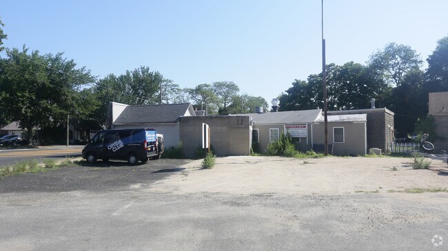
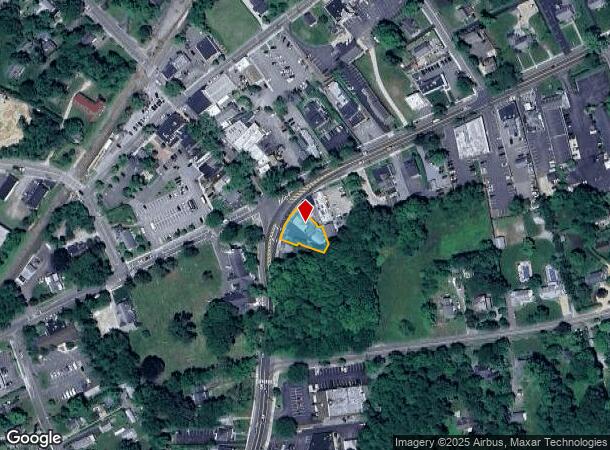
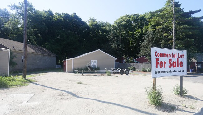
Property Record
12800 Main Rd, Mattituck, NY 11952
NEARBY LISTINGS FOR SALE OR LEASE
Property Detail
12800 Main Rd
Nassau County-Suffolk County, NY
BOOK 12506 PAGE 478 BILL 014465
1000-114-00-11-00-015-000
Suffolk
Commercialacreage
New York
X
15
36103C0481H
0.16 AC
2024
Eastern Suffolk
2024
Long Island (New York)
170004
DEMOGRAPHICS near 12800 Main Rd
1 Mile
3 Mile
5 Mile
2024 Total Population
2,496
8,380
14,140
2029 Population
2,518
8,500
14,294
Pop Growth 2024-2029
+ 0.88%
+ 1.43%
+ 1.09%
Average Age
46
46
47
2024 Total Households
1,002
3,298
5,705
HH Growth 2024-2029
+ 0.70%
+ 1.12%
+ 0.93%
Median Household Inc
$97,036
$99,112
$104,315
Avg Household Size
2.40
2.40
2.40
2024 Avg HH Vehicles
2.00
2.00
2.00
Median Home Value
$688,061
$726,125
$744,398
Median Year Built
1974
1974
1975
Nearby Places
- Restaurants
- Banks
- Shops
- Fitness
- Groceries
PUBLIC TRANSPORTATION
COMMUTER RAIL
Mattituck Station (Greenport Branch - Long Island Rail Road)
DRIVE
WALK
Distance
Mattituck Station (Greenport Branch - Long Island Rail Road)
1 min
3 min
0.2 mi
Southold Station (Greenport Branch - Long Island Rail Road)
DRIVE
WALK
Distance
Southold Station (Greenport Branch - Long Island Rail Road)
12 min
8.5 mi
Freight Ports
Port of New Haven
DRIVE
WALK
Distance
Port of New Haven
160 min
67.3 mi
Nearby Properties
Address
Land Use
TOTAL SIZE
Lot Size
Zoning
Address
Land Use
TOTAL SIZE
Lot Size
Zoning
30.40 AC
R-80
Address
Land Use
TOTAL SIZE
Lot Size
Zoning
5.01 AC
10
Address
Land Use
TOTAL SIZE
Lot Size
Zoning
5,338 SF
159.30 AC
4
Address
Land Use
TOTAL SIZE
Lot Size
Zoning
11.39 AC
10
Address
Land Use
TOTAL SIZE
Lot Size
Zoning
1,980 SF
63.11 AC
09
Address
Land Use
TOTAL SIZE
Lot Size
Zoning
2,928 SF
85.90 AC
04
Address
Land Use
TOTAL SIZE
Lot Size
Zoning
392 SF
52.39 AC
09
Address
Land Use
TOTAL SIZE
Lot Size
Zoning
2,392 SF
26.20 AC
09
Address
Land Use
TOTAL SIZE
Lot Size
Zoning
392 SF
19.31 AC
09
Address
Land Use
TOTAL SIZE
Lot Size
Zoning
0.79 AC
VILLA
Address
Land Use
TOTAL SIZE
Lot Size
Zoning
8.75 AC
B
Address
Land Use
TOTAL SIZE
Lot Size
Zoning
5,483 SF
18.43 AC
04
Address
Land Use
TOTAL SIZE
Lot Size
Zoning
82.20 AC
04
Address
Land Use
TOTAL SIZE
Lot Size
Zoning
3,620 SF
11.50 AC
04
Address
Land Use
TOTAL SIZE
Lot Size
Zoning
41.20 AC
03
Address
Land Use
TOTAL SIZE
Lot Size
Zoning
Address
Land Use
TOTAL SIZE
Lot Size
Zoning
2,699 SF
21 AC
04
Address
Land Use
TOTAL SIZE
Lot Size
Zoning
63.50 AC
04
Address
Land Use
TOTAL SIZE
Lot Size
Zoning
2,237 SF
12.50 AC
04
Address
Land Use
TOTAL SIZE
Lot Size
Zoning
1,834 SF
10.70 AC
04
Address
Land Use
TOTAL SIZE
Lot Size
Zoning
3.50 AC
04
Address
Land Use
TOTAL SIZE
Lot Size
Zoning
2,946 SF
8.50 AC
04
Address
Land Use
TOTAL SIZE
Lot Size
Zoning
3,676 SF
1.80 AC
04
Address
Land Use
TOTAL SIZE
Lot Size
Zoning
Address
Land Use
TOTAL SIZE
Lot Size
Zoning
1,352 SF
12.10 AC
04
Address
Land Use
TOTAL SIZE
Lot Size
Zoning
60.61 AC
04
Address
Land Use
TOTAL SIZE
Lot Size
Zoning
2,622 SF
4.02 AC
04
Address
Land Use
TOTAL SIZE
Lot Size
Zoning
5.60 AC
RO R-40
Address
Land Use
TOTAL SIZE
Lot Size
Zoning
1.34 AC
HB
Address
Land Use
TOTAL SIZE
Lot Size
Zoning
2,097 SF
10.50 AC
04
The World's #1 Commercial Real Estate Marketplace
Connect with us
© 2025 CoStar Group
The information above has been obtained from sources believed reliable. While we do not doubt its accuracy we have not verified it and make no guarantee, warranty or representation about it. It is your responsibility to independently confirm its accuracy and completeness. Any projections, opinions, assumptions, or estimates used are for example only and do not represent the current or future performance of the property. The value of this transaction to you depends on tax and other factors which should be evaluated by your tax, financial, and legal advisors. You and your advisors should conduct a careful, independent investigation of the property to determine to your satisfaction the suitability of the property for your needs.