Property Record
12800 Ne Sandy Blvd, Portland, OR 97230


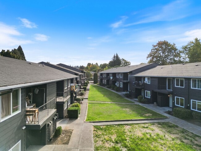
Property Detail
12800 Ne Sandy Blvd
R318504
SECTION 23 1N 2E, TL 900 1.77 ACRES
Multifamilydwelling
Multnomah
RM1
Oregon
B and X Area of moderate flood hazard, usually the area between the limits of the 100-year and 500-year floods.
1.77 AC
2025
Argay
2025
Portland
009502
Portland-Vancouver-Hillsboro, OR-WA
43,056 SF
NEARBY LISTINGS FOR SALE OR LEASE
DEMOGRAPHICS near 12800 Ne Sandy Blvd
1 mile
3 mile
5 mile
2025 Total Population
9,101
87,198
323,066
2030 Population
8,909
85,926
320,406
Pop Growth 2025-2030
(2.11%)
(1.46%)
(0.82%)
Average Age
42
42
41
2025 Total Households
3,335
33,636
123,663
HH Growth 2025-2030
(2.46%)
(1.76%)
(0.99%)
Median Household Inc
$65,084
$66,512
$79,175
Avg Household Size
2.50
2.40
2.50
2025 Avg HH Vehicles
2.00
2.00
2.00
Median Home Value
$472,430
$456,630
$483,632
Median Year Built
1968
1971
1973
Nearby Places
Map Layers
Map Styles
 Street
 Aerial
Transit
 Traffic
 Biking
Places
Listings with unknown addresses are not visible on the map
- Restaurants
- Banks
- Shops
- Fitness
- Groceries
PUBLIC TRANSPORTATION
AIRPORT
Portland International
Drive
Walk
Distance
Portland International
10 min
4.6 mi
Freight Ports
Port of Portland
Drive
Walk
Distance
Port of Portland
21 min
12.4 mi
SALE & LEASE HISTORY
LISTING DATE
SALE/LEASE

Nov 28, 2022
For Sale
Jun 27, 2023
For Sale
Nearby Properties
Address
Land Use
TOTAL SIZE
Lot Size
Zoning
Address
Land Use
TOTAL SIZE
Lot Size
Zoning
273,811 SF
6.39 AC
NULL
Address
Land Use
TOTAL SIZE
Lot Size
Zoning
236,035 SF
13.01 AC
R7
Address
Land Use
TOTAL SIZE
Lot Size
Zoning
197,027 SF
28.54 AC
R7H
Address
Land Use
TOTAL SIZE
Lot Size
Zoning
296,039 SF
11.70 AC
R5
Address
Land Use
TOTAL SIZE
Lot Size
Zoning
361,549 SF
39.26 AC
IR
Address
Land Use
TOTAL SIZE
Lot Size
Zoning
356,805 SF
27.10 AC
EG2
Address
Land Use
TOTAL SIZE
Lot Size
Zoning
140,000 SF
14.53 AC
R7
Address
Land Use
TOTAL SIZE
Lot Size
Zoning
126.40 AC
IG2
Address
Land Use
TOTAL SIZE
Lot Size
Zoning
365,000 SF
38.87 AC
GI
Address
Land Use
TOTAL SIZE
Lot Size
Zoning
698,484 SF
34.21 AC
GI
Address
Land Use
TOTAL SIZE
Lot Size
Zoning
42,839,055 SF
19.25 AC
CI1
Address
Land Use
TOTAL SIZE
Lot Size
Zoning
152,575 SF
5.32 AC
EG1
Address
Land Use
TOTAL SIZE
Lot Size
Zoning
257,560 SF
NULL
Address
Land Use
TOTAL SIZE
Lot Size
Zoning
60,788 SF
10.21 AC
GI
Address
Land Use
TOTAL SIZE
Lot Size
Zoning
184,000 SF
18.88 AC
EG2
Address
Land Use
TOTAL SIZE
Lot Size
Zoning
58,843 SF
4.53 AC
EG2
Address
Land Use
TOTAL SIZE
Lot Size
Zoning
53.15 AC
IG2
Address
Land Use
TOTAL SIZE
Lot Size
Zoning
118,040 SF
10.29 AC
EG2
Address
Land Use
TOTAL SIZE
Lot Size
Zoning
489,695 SF
23.76 AC
IG2P
Address
Land Use
TOTAL SIZE
Lot Size
Zoning
1,566 SF
51.74 AC
IG2
Address
Land Use
TOTAL SIZE
Lot Size
Zoning
175,276 SF
13.05 AC
IG2
Address
Land Use
TOTAL SIZE
Lot Size
Zoning
99,100 SF
1.31 AC
CS
Address
Land Use
TOTAL SIZE
Lot Size
Zoning
492,161 SF
28.13 AC
IG2
Address
Land Use
TOTAL SIZE
Lot Size
Zoning
Address
Land Use
TOTAL SIZE
Lot Size
Zoning
357,603 SF
22.69 AC
GI
Address
Land Use
TOTAL SIZE
Lot Size
Zoning
225,640 SF
5.51 AC
EG2
Address
Land Use
TOTAL SIZE
Lot Size
Zoning
45.53 AC
IG2
Address
Land Use
TOTAL SIZE
Lot Size
Zoning
126,776 SF
5.07 AC
RH
Address
Land Use
TOTAL SIZE
Lot Size
Zoning
Address
Land Use
TOTAL SIZE
Lot Size
Zoning
3,998 SF
26.98 AC
IG2
The World's #1 Commercial Real Estate Marketplace
Connect with us
© 2026 CoStar Group
The information above has been obtained from sources believed reliable. While we do not doubt its accuracy we have not verified it and make no guarantee, warranty or representation about it. It is your responsibility to independently confirm its accuracy and completeness. Any projections, opinions, assumptions, or estimates used are for example only and do not represent the current or future performance of the property. The value of this transaction to you depends on tax and other factors which should be evaluated by your tax, financial, and legal advisors. You and your advisors should conduct a careful, independent investigation of the property to determine to your satisfaction the suitability of the property for your needs.