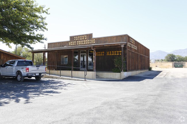
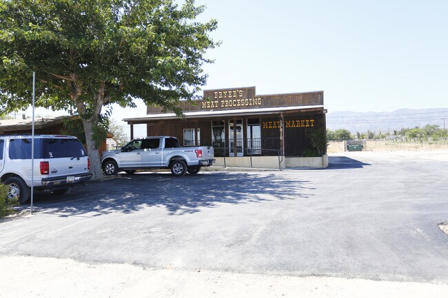
Property Record
12800 Pearblossom Hwy, Pearblossom, CA 93553
NEARBY LISTINGS FOR SALE OR LEASE
-
-
View all Pearblossom listings for sale on LoopNet.com
Property Detail
12800 Pearblossom Hwy
Los Angeles-Long Beach-Glendale, CA
15065
3038-007-001
TRACT # 15065 LOT 2
Storemultistory
Los Angeles
X
California
06037C0720F
2
2024
0.26 AC
2025
NE LA County Outlying
911001
Los Angeles
1,101 SF
DEMOGRAPHICS near 12800 Pearblossom Hwy
1 Mile
3 Mile
5 Mile
2024 Total Population
674
1,544
11,750
2029 Population
629
1,454
11,412
Pop Growth 2024-2029
(6.68%)
(5.83%)
(2.88%)
Average Age
43
43
39
2024 Total Households
252
561
3,454
HH Growth 2024-2029
(7.14%)
(6.24%)
(3.33%)
Median Household Inc
$42,812
$61,091
$62,131
Avg Household Size
2.60
2.60
3.20
2024 Avg HH Vehicles
2.00
2.00
2.00
Median Home Value
$261,403
$273,008
$252,614
Median Year Built
1974
1976
1982
Nearby Places
Map Layers
Map Styles
 Street
 Aerial
- Restaurants
- Banks
- Shops
- Fitness
- Groceries
Nearby Properties
Address
Land Use
TOTAL SIZE
Lot Size
Zoning
Address
Land Use
TOTAL SIZE
Lot Size
Zoning
9,100 SF
1.16 AC
LCC3*
Address
Land Use
TOTAL SIZE
Lot Size
Zoning
139.80 AC
LCA25*
Address
Land Use
TOTAL SIZE
Lot Size
Zoning
158.82 AC
LCA25*
Address
Land Use
TOTAL SIZE
Lot Size
Zoning
134.01 AC
LCA25*
Address
Land Use
TOTAL SIZE
Lot Size
Zoning
5,127 SF
12.51 AC
LCA11*
Address
Land Use
TOTAL SIZE
Lot Size
Zoning
4,191 SF
1.18 AC
LCC3*
Address
Land Use
TOTAL SIZE
Lot Size
Zoning
9,125 SF
0.48 AC
LCC3*
Address
Land Use
TOTAL SIZE
Lot Size
Zoning
132.63 AC
LCRA7500-C
Address
Land Use
TOTAL SIZE
Lot Size
Zoning
98.23 AC
LCA25*
Address
Land Use
TOTAL SIZE
Lot Size
Zoning
4,440 SF
0.78 AC
LCR3*
Address
Land Use
TOTAL SIZE
Lot Size
Zoning
4,440 SF
0.80 AC
LCR3*
Address
Land Use
TOTAL SIZE
Lot Size
Zoning
1,887 SF
0.62 AC
LCC3*
Address
Land Use
TOTAL SIZE
Lot Size
Zoning
7,095 SF
1.44 AC
LCRA7500*
Address
Land Use
TOTAL SIZE
Lot Size
Zoning
1,971 SF
0.82 AC
LCC3*
Address
Land Use
TOTAL SIZE
Lot Size
Zoning
2,701 SF
0.41 AC
LCC3*
Address
Land Use
TOTAL SIZE
Lot Size
Zoning
4,256 SF
0.85 AC
LCR3*
Address
Land Use
TOTAL SIZE
Lot Size
Zoning
77.42 AC
LCRA10000*
Address
Land Use
TOTAL SIZE
Lot Size
Zoning
124.17 AC
LCA2
Address
Land Use
TOTAL SIZE
Lot Size
Zoning
44.45 AC
LCRA1*
Address
Land Use
TOTAL SIZE
Lot Size
Zoning
92.17 AC
LCM1
Address
Land Use
TOTAL SIZE
Lot Size
Zoning
11,622 SF
1.29 AC
LCC3
Address
Land Use
TOTAL SIZE
Lot Size
Zoning
4,400 SF
0.82 AC
LCC3*
Address
Land Use
TOTAL SIZE
Lot Size
Zoning
3,442 SF
1.23 AC
LCC3*
Address
Land Use
TOTAL SIZE
Lot Size
Zoning
16.55 AC
LCC3-R3-RA
Address
Land Use
TOTAL SIZE
Lot Size
Zoning
900 SF
4.64 AC
LCC3-RA100
Address
Land Use
TOTAL SIZE
Lot Size
Zoning
20.01 AC
LCA11*
Address
Land Use
TOTAL SIZE
Lot Size
Zoning
78.51 AC
LCA25*
Address
Land Use
TOTAL SIZE
Lot Size
Zoning
1,775 SF
0.97 AC
LCA21*
Address
Land Use
TOTAL SIZE
Lot Size
Zoning
99.38 AC
LCA21*
The World's #1 Commercial Real Estate Marketplace
Connect with us
© 2026 CoStar Group
The information above has been obtained from sources believed reliable. While we do not doubt its accuracy we have not verified it and make no guarantee, warranty or representation about it. It is your responsibility to independently confirm its accuracy and completeness. Any projections, opinions, assumptions, or estimates used are for example only and do not represent the current or future performance of the property. The value of this transaction to you depends on tax and other factors which should be evaluated by your tax, financial, and legal advisors. You and your advisors should conduct a careful, independent investigation of the property to determine to your satisfaction the suitability of the property for your needs.