Property Record
12800 Spruce Tree Way, Raleigh, NC 27614

NEARBY LISTINGS FOR SALE OR LEASE
-
-
View all Raleigh listings for sale on LoopNet.com
Property Detail
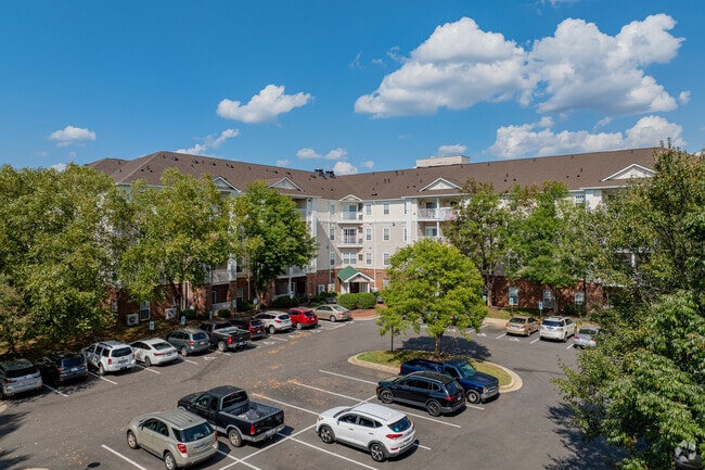
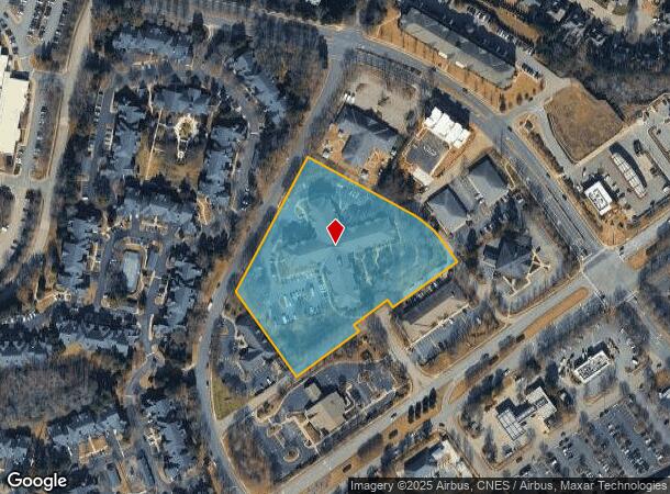
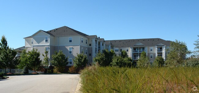
12800 Spruce Tree Way
Raleigh, NC
Wakefield Commer/Crsng Ph 2
1729.02-98-6327-000
LO69 WAKEFIELD COMMER/CRSNG PH2 BM2001-0
Apartment
Wake
X
North Carolina
3720172900K
69
0
4.80 AC
2025
Highland Park
054213
Raleigh/Durham
139,376 SF
DEMOGRAPHICS near 12800 Spruce Tree Way
1 Mile
3 Mile
5 Mile
2024 Total Population
7,959
45,767
124,368
2029 Population
8,585
49,580
135,191
Pop Growth 2024-2029
+ 7.87%
+ 8.33%
+ 8.70%
Average Age
40
40
39
2024 Total Households
3,264
17,726
46,361
HH Growth 2024-2029
+ 7.94%
+ 8.34%
+ 8.70%
Median Household Inc
$89,779
$111,497
$105,061
Avg Household Size
2.40
2.60
2.60
2024 Avg HH Vehicles
2.00
2.00
2.00
Median Home Value
$434,687
$401,594
$382,411
Median Year Built
2003
2004
2003
Nearby Places
Map Layers
Map Styles
 Street
 Aerial
- Restaurants
- Banks
- Shops
- Fitness
- Groceries
PUBLIC TRANSPORTATION
AIRPORT
Raleigh-Durham International
DRIVE
WALK
Distance
Raleigh-Durham International
26 min
17.1 mi
Freight Ports
Virginia Port Authority - Richmond
DRIVE
WALK
Distance
Virginia Port Authority - Richmond
165 min
137.5 mi
Nearby Properties
Address
Land Use
TOTAL SIZE
Lot Size
Zoning
Address
Land Use
TOTAL SIZE
Lot Size
Zoning
7,128 SF
17,955.26 AC
R-80W
Address
Land Use
TOTAL SIZE
Lot Size
Zoning
497,619 SF
109.80 AC
R-6
Address
Land Use
TOTAL SIZE
Lot Size
Zoning
1,125,127 SF
104.26 AC
R-1
Address
Land Use
TOTAL SIZE
Lot Size
Zoning
362,583 SF
26.53 AC
RX-3
Address
Land Use
TOTAL SIZE
Lot Size
Zoning
383,266 SF
52.30 AC
CX-3
Address
Land Use
TOTAL SIZE
Lot Size
Zoning
356,168 SF
26.68 AC
RMX
Address
Land Use
TOTAL SIZE
Lot Size
Zoning
323,530 SF
37.96 AC
RX-3
Address
Land Use
TOTAL SIZE
Lot Size
Zoning
306,712 SF
14.03 AC
PUD
Address
Land Use
TOTAL SIZE
Lot Size
Zoning
357,933 SF
16.02 AC
PD
Address
Land Use
TOTAL SIZE
Lot Size
Zoning
263,777 SF
93.84 AC
GR3
Address
Land Use
TOTAL SIZE
Lot Size
Zoning
317,685 SF
20.15 AC
CUD O
Address
Land Use
TOTAL SIZE
Lot Size
Zoning
286,520 SF
22.55 AC
R-6
Address
Land Use
TOTAL SIZE
Lot Size
Zoning
232,734 SF
57.28 AC
GR3
Address
Land Use
TOTAL SIZE
Lot Size
Zoning
306,050 SF
30.45 AC
GR10
Address
Land Use
TOTAL SIZE
Lot Size
Zoning
194,593 SF
13.09 AC
CX-3
Address
Land Use
TOTAL SIZE
Lot Size
Zoning
188,828 SF
19.91 AC
OX-3
Address
Land Use
TOTAL SIZE
Lot Size
Zoning
248,945 SF
16.41 AC
GR10
Address
Land Use
TOTAL SIZE
Lot Size
Zoning
225,390 SF
14.95 AC
GR10
Address
Land Use
TOTAL SIZE
Lot Size
Zoning
177,165 SF
9.74 AC
OX-4
Address
Land Use
TOTAL SIZE
Lot Size
Zoning
166,192 SF
13.59 AC
GR10
Address
Land Use
TOTAL SIZE
Lot Size
Zoning
106,730 SF
11.73 AC
IX-3
Address
Land Use
TOTAL SIZE
Lot Size
Zoning
141,674 SF
8.31 AC
RX-4
Address
Land Use
TOTAL SIZE
Lot Size
Zoning
109,190 SF
1.46 AC
CX-5
Address
Land Use
TOTAL SIZE
Lot Size
Zoning
139,600 SF
23.64 AC
LI
Address
Land Use
TOTAL SIZE
Lot Size
Zoning
170,334 SF
23.99 AC
GR10
Address
Land Use
TOTAL SIZE
Lot Size
Zoning
104,919 SF
29.07 AC
GR3
Address
Land Use
TOTAL SIZE
Lot Size
Zoning
137,650 SF
36.63 AC
GR5
Address
Land Use
TOTAL SIZE
Lot Size
Zoning
84,528 SF
14.44 AC
NB
Address
Land Use
TOTAL SIZE
Lot Size
Zoning
85,312 SF
21.37 AC
HB
The World's #1 Commercial Real Estate Marketplace
Connect with us
© 2025 CoStar Group
The information above has been obtained from sources believed reliable. While we do not doubt its accuracy we have not verified it and make no guarantee, warranty or representation about it. It is your responsibility to independently confirm its accuracy and completeness. Any projections, opinions, assumptions, or estimates used are for example only and do not represent the current or future performance of the property. The value of this transaction to you depends on tax and other factors which should be evaluated by your tax, financial, and legal advisors. You and your advisors should conduct a careful, independent investigation of the property to determine to your satisfaction the suitability of the property for your needs.