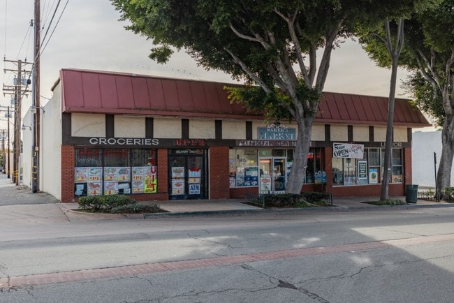
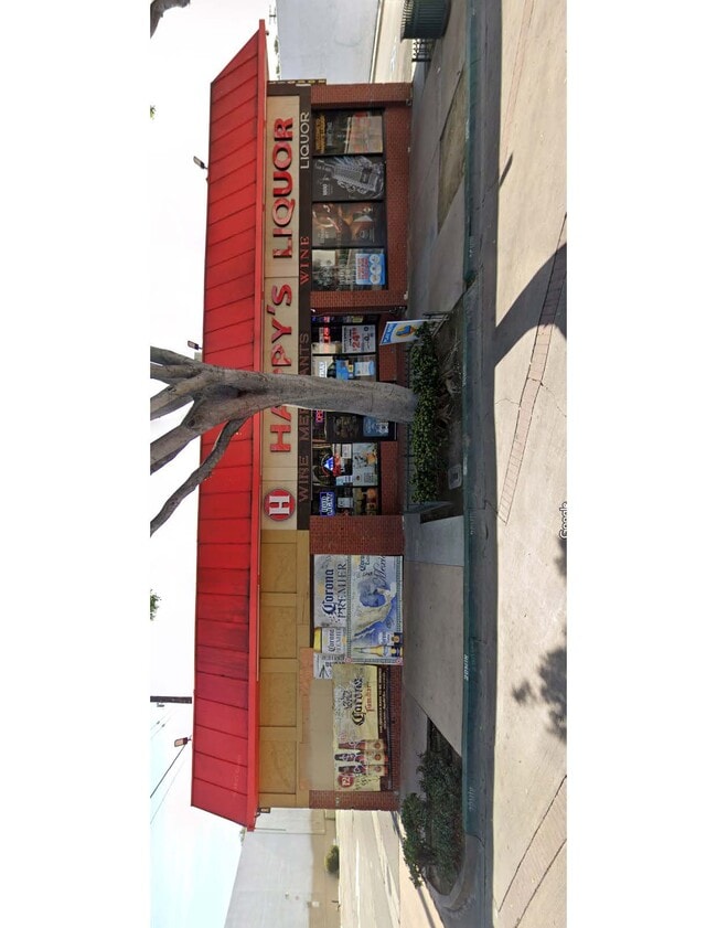
Property Record
12810 Philadelphia St, Whittier, CA 90601

NEARBY LISTINGS FOR SALE OR LEASE
Property Detail
12810 Philadelphia St
Los Angeles-Long Beach-Glendale, CA
Lewis And Hammonds Subdivision
8139-024-028
LOTS 2 THRU 6 MR 33-44 AND LOT 22 WHITTIER
Storemultistory
Los Angeles
X
California
06037C1835F
2
2024
0.43 AC
2025
Southeast Los Angeles
501504
Los Angeles
7,820 SF
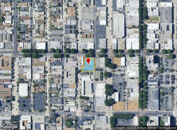
DEMOGRAPHICS near 12810 Philadelphia St
1 Mile
3 Mile
5 Mile
2024 Total Population
31,630
135,111
410,324
2029 Population
30,633
130,179
395,018
Pop Growth 2024-2029
(3.15%)
(3.65%)
(3.73%)
Average Age
38
40
40
2024 Total Households
11,148
40,879
120,221
HH Growth 2024-2029
(3.40%)
(3.89%)
(3.99%)
Median Household Inc
$59,299
$82,146
$86,675
Avg Household Size
2.70
3.20
3.30
2024 Avg HH Vehicles
2.00
2.00
2.00
Median Home Value
$714,845
$702,840
$703,091
Median Year Built
1955
1955
1957
Nearby Places
Map Layers
Map Styles
 Street
 Aerial
- Restaurants
- Banks
- Shops
- Fitness
- Groceries
PUBLIC TRANSPORTATION
COMMUTER RAIL
Norwalk/Santa Fe Springs (91 Line - Southern California Regional Rail Authority (Metrolink), Orange County Line - Southern California Regional Rail Authority (Metrolink))
DRIVE
WALK
Distance
Norwalk/Santa Fe Springs (91 Line - Southern California Regional Rail Authority (Metrolink), Orange County Line - Southern California Regional Rail Authority (Metrolink))
12 min
5.6 mi
Montebello/Commerce (Riverside Line - Southern California Regional Rail Authority (Metrolink))
DRIVE
WALK
Distance
Montebello/Commerce (Riverside Line - Southern California Regional Rail Authority (Metrolink))
15 min
6.0 mi
AIRPORT
Long Beach (Daugherty Field)
DRIVE
WALK
Distance
Long Beach (Daugherty Field)
29 min
18.9 mi
Los Angeles International
DRIVE
WALK
Distance
Los Angeles International
37 min
27.1 mi
John Wayne/Orange County
DRIVE
WALK
Distance
John Wayne/Orange County
40 min
28.1 mi
Freight Ports
Port of Long Beach
DRIVE
WALK
Distance
Port of Long Beach
36 min
24.6 mi
SALE & LEASE HISTORY
LISTING DATE
SALE/LEASE

May 06, 2025
For Lease
Jan 21, 2021
For Lease
Dec 17, 2019
For Sale
Nearby Properties
Address
Land Use
TOTAL SIZE
Lot Size
Zoning
Address
Land Use
TOTAL SIZE
Lot Size
Zoning
519,516 SF
25.37 AC
WHR3*
Address
Land Use
TOTAL SIZE
Lot Size
Zoning
1,100,900 SF
22.36 AC
SSM2*
Address
Land Use
TOTAL SIZE
Lot Size
Zoning
347,306 SF
14.37 AC
LCA25-CPD*
Address
Land Use
TOTAL SIZE
Lot Size
Zoning
613,248 SF
24.45 AC
LCA25-CPD*
Address
Land Use
TOTAL SIZE
Lot Size
Zoning
304,520 SF
14.18 AC
LCA25-CPD*
Address
Land Use
TOTAL SIZE
Lot Size
Zoning
260,528 SF
11.98 AC
LCA25-CPD*
Address
Land Use
TOTAL SIZE
Lot Size
Zoning
304,549 SF
7.13 AC
SSM2*
Address
Land Use
TOTAL SIZE
Lot Size
Zoning
234,324 SF
10.05 AC
SSM2*
Address
Land Use
TOTAL SIZE
Lot Size
Zoning
300,148 SF
13.01 AC
SSM2*
Address
Land Use
TOTAL SIZE
Lot Size
Zoning
183,000 SF
7.76 AC
SSM2*
Address
Land Use
TOTAL SIZE
Lot Size
Zoning
657,978 SF
31.68 AC
SSM2*
Address
Land Use
TOTAL SIZE
Lot Size
Zoning
89,899 SF
SSM2*
Address
Land Use
TOTAL SIZE
Lot Size
Zoning
183,034 SF
19.57 AC
IDM11/2*
Address
Land Use
TOTAL SIZE
Lot Size
Zoning
74,018 SF
14.92 AC
WHM1*
Address
Land Use
TOTAL SIZE
Lot Size
Zoning
89,514 SF
21.28 AC
WHC2*
Address
Land Use
TOTAL SIZE
Lot Size
Zoning
425,816 SF
30.02 AC
SSM2*
Address
Land Use
TOTAL SIZE
Lot Size
Zoning
320,030 SF
8.81 AC
WHM2*
Address
Land Use
TOTAL SIZE
Lot Size
Zoning
184,230 SF
4.55 AC
SSM2*
Address
Land Use
TOTAL SIZE
Lot Size
Zoning
312,052 SF
6.78 AC
SSM2
Address
Land Use
TOTAL SIZE
Lot Size
Zoning
161,861 SF
17.50 AC
SSC4PD*
Address
Land Use
TOTAL SIZE
Lot Size
Zoning
108,296 SF
8.81 AC
WHM2*
Address
Land Use
TOTAL SIZE
Lot Size
Zoning
216,952 SF
23.54 AC
WHR4*
Address
Land Use
TOTAL SIZE
Lot Size
Zoning
14,452 SF
13.52 AC
PRIG*
Address
Land Use
TOTAL SIZE
Lot Size
Zoning
393,696 SF
12.73 AC
WHM2*
Address
Land Use
TOTAL SIZE
Lot Size
Zoning
4.48 AC
LCR171/2
Address
Land Use
TOTAL SIZE
Lot Size
Zoning
112,619 SF
4.97 AC
SSC4-R3*
Address
Land Use
TOTAL SIZE
Lot Size
Zoning
67,692 SF
2.34 AC
WHC2*
Address
Land Use
TOTAL SIZE
Lot Size
Zoning
138,400 SF
3.49 AC
SSM2*
The World's #1 Commercial Real Estate Marketplace
Connect with us
© 2025 CoStar Group
The information above has been obtained from sources believed reliable. While we do not doubt its accuracy we have not verified it and make no guarantee, warranty or representation about it. It is your responsibility to independently confirm its accuracy and completeness. Any projections, opinions, assumptions, or estimates used are for example only and do not represent the current or future performance of the property. The value of this transaction to you depends on tax and other factors which should be evaluated by your tax, financial, and legal advisors. You and your advisors should conduct a careful, independent investigation of the property to determine to your satisfaction the suitability of the property for your needs.