Property Record
1282 Us Route 1, Freeport, ME 04032


NEARBY LISTINGS FOR SALE OR LEASE
Property Detail
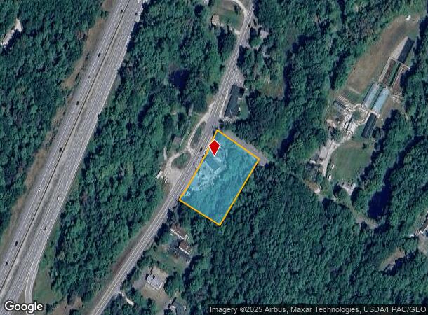
1282 Us Route 1
Autorepair
Cumberland
X
Maine
23005C0340F
1 AC
2024
NE Cumberland County
2024
Portland/South Portland
004502
Portland-South Portland, ME
1,769 SF
FPRT-000018-000056
DEMOGRAPHICS near 1282 Us Route 1
1 Mile
3 Mile
5 Mile
2024 Total Population
810
6,291
13,318
2029 Population
840
6,549
13,795
Pop Growth 2024-2029
+ 3.70%
+ 4.10%
+ 3.58%
Average Age
42
43
45
2024 Total Households
312
2,522
5,409
HH Growth 2024-2029
+ 3.53%
+ 4.16%
+ 3.62%
Median Household Inc
$89,830
$85,166
$88,314
Avg Household Size
2.50
2.40
2.30
2024 Avg HH Vehicles
2.00
2.00
2.00
Median Home Value
$427,586
$403,200
$397,803
Median Year Built
1984
1980
1982
Nearby Places
Map Layers
Map Styles
 Street
 Aerial
- Restaurants
- Banks
- Shops
- Fitness
- Groceries
PUBLIC TRANSPORTATION
COMMUTER RAIL
DRIVE
WALK
Distance
4 min
2.2 mi
DRIVE
WALK
Distance
12 min
6.9 mi
AIRPORT
Portland International Jetport
DRIVE
WALK
Distance
Portland International Jetport
32 min
22.7 mi
Nearby Properties
Address
Land Use
TOTAL SIZE
Lot Size
Zoning
Address
Land Use
TOTAL SIZE
Lot Size
Zoning
90 AC
CM03
Address
Land Use
TOTAL SIZE
Lot Size
Zoning
3.63 AC
CM01
Address
Land Use
TOTAL SIZE
Lot Size
Zoning
7.53 AC
CM01
Address
Land Use
TOTAL SIZE
Lot Size
Zoning
24 AC
CM02
Address
Land Use
TOTAL SIZE
Lot Size
Zoning
5.15 AC
CM03
Address
Land Use
TOTAL SIZE
Lot Size
Zoning
1.46 AC
CM03
Address
Land Use
TOTAL SIZE
Lot Size
Zoning
45,829 SF
0.94 AC
CM01
Address
Land Use
TOTAL SIZE
Lot Size
Zoning
58,718 SF
13 AC
CM04
Address
Land Use
TOTAL SIZE
Lot Size
Zoning
60,270 SF
21.80 AC
550
Address
Land Use
TOTAL SIZE
Lot Size
Zoning
Address
Land Use
TOTAL SIZE
Lot Size
Zoning
29,680 SF
0.79 AC
CM01
Address
Land Use
TOTAL SIZE
Lot Size
Zoning
1.01 AC
CM02
Address
Land Use
TOTAL SIZE
Lot Size
Zoning
38,209 SF
2.26 AC
CM02
Address
Land Use
TOTAL SIZE
Lot Size
Zoning
5.11 AC
CM02
Address
Land Use
TOTAL SIZE
Lot Size
Zoning
2,189 SF
3.63 AC
CM01
Address
Land Use
TOTAL SIZE
Lot Size
Zoning
0.62 AC
CM01
Address
Land Use
TOTAL SIZE
Lot Size
Zoning
3.89 AC
CM03
Address
Land Use
TOTAL SIZE
Lot Size
Zoning
16,089 SF
0.33 AC
CM02
Address
Land Use
TOTAL SIZE
Lot Size
Zoning
5,029 SF
0.17 AC
CM01
Address
Land Use
TOTAL SIZE
Lot Size
Zoning
35 AC
550
Address
Land Use
TOTAL SIZE
Lot Size
Zoning
4.18 AC
CM03
Address
Land Use
TOTAL SIZE
Lot Size
Zoning
64 AC
500
Address
Land Use
TOTAL SIZE
Lot Size
Zoning
4,995 SF
0.40 AC
CM01
Address
Land Use
TOTAL SIZE
Lot Size
Zoning
0.39 AC
CM01
Address
Land Use
TOTAL SIZE
Lot Size
Zoning
26,954 SF
5.56 AC
CM03
Address
Land Use
TOTAL SIZE
Lot Size
Zoning
4.16 AC
500
Address
Land Use
TOTAL SIZE
Lot Size
Zoning
13.40 AC
CM03
Address
Land Use
TOTAL SIZE
Lot Size
Zoning
14 AC
CM03
Address
Land Use
TOTAL SIZE
Lot Size
Zoning
6,088 SF
1.28 AC
CM02
Address
Land Use
TOTAL SIZE
Lot Size
Zoning
37 AC
500
The World's #1 Commercial Real Estate Marketplace
Connect with us
© 2026 CoStar Group
The information above has been obtained from sources believed reliable. While we do not doubt its accuracy we have not verified it and make no guarantee, warranty or representation about it. It is your responsibility to independently confirm its accuracy and completeness. Any projections, opinions, assumptions, or estimates used are for example only and do not represent the current or future performance of the property. The value of this transaction to you depends on tax and other factors which should be evaluated by your tax, financial, and legal advisors. You and your advisors should conduct a careful, independent investigation of the property to determine to your satisfaction the suitability of the property for your needs.