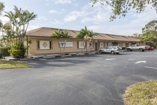
Property Record
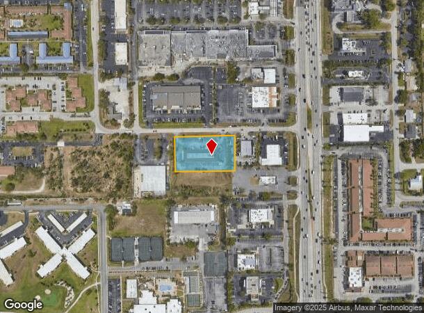
12820 Kenwood Ln, Fort Myers, FL 33907

Current Lease Availabilities
NEARBY LISTINGS FOR SALE OR LEASE
Property Detail
12820 Kenwood Ln
Cape Coral-Fort Myers, FL
S. 41 Corridor
14-45-24-00-00004.012B
N 175 FT OF WRLY 300 FT OF ESTRLY 932.25 FR OF S 302.76 OF SEC DESC OR 1996/3418
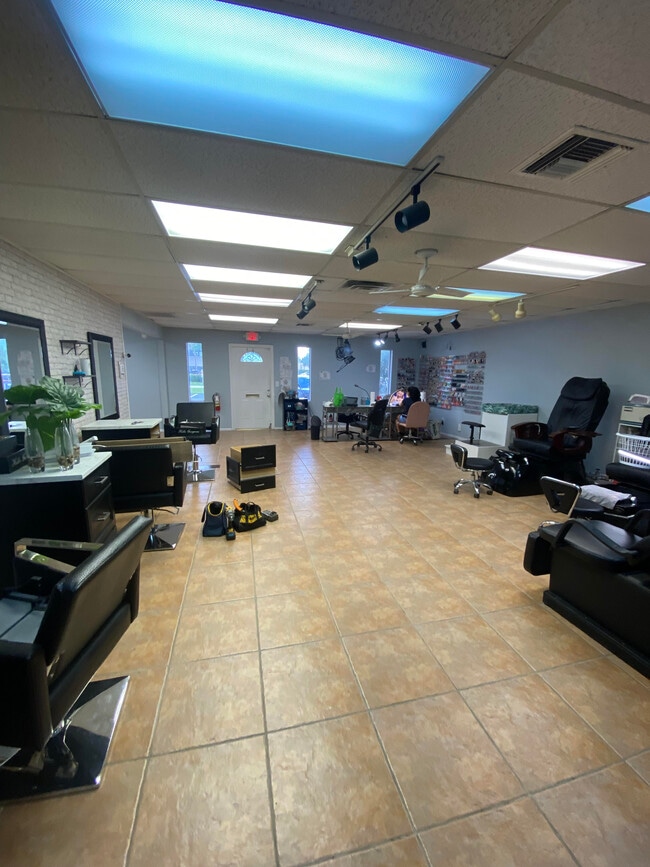
Officebuilding
Lee
AE
Florida
12071C0436H
12b
2024
1.21 AC
2025
S Ft Myers/San Carlos
001708
Southwest Florida
10,934 SF
DEMOGRAPHICS near 12820 Kenwood Ln
1 Mile
3 Mile
5 Mile
2024 Total Population
10,216
69,365
153,540
2029 Population
11,991
81,956
182,172
Pop Growth 2024-2029
+ 17.37%
+ 18.15%
+ 18.65%
Average Age
49
48
48
2024 Total Households
5,279
32,876
70,988
HH Growth 2024-2029
+ 17.16%
+ 17.78%
+ 18.31%
Median Household Inc
$52,695
$58,640
$62,882
Avg Household Size
1.80
2.00
2.10
2024 Avg HH Vehicles
1.00
2.00
2.00
Median Home Value
$205,324
$250,045
$289,113
Median Year Built
1983
1985
1990
Nearby Places
- Restaurants
- Banks
- Shops
- Fitness
- Groceries
PUBLIC TRANSPORTATION
AIRPORT
Southwest Florida International
DRIVE
WALK
Distance
Southwest Florida International
17 min
8.8 mi
Punta Gorda
DRIVE
WALK
Distance
Punta Gorda
45 min
34.5 mi
Freight Ports
Port Manatee
DRIVE
WALK
Distance
Port Manatee
125 min
106.1 mi
Nearby Properties
Address
Land Use
TOTAL SIZE
Lot Size
Zoning
Address
Land Use
TOTAL SIZE
Lot Size
Zoning
741,488 SF
23.22 AC
CPD
Address
Land Use
TOTAL SIZE
Lot Size
Zoning
1,001,577 SF
140.54 AC
AG-2
Address
Land Use
TOTAL SIZE
Lot Size
Zoning
990,859 SF
38 AC
CI
Address
Land Use
TOTAL SIZE
Lot Size
Zoning
541,926 SF
54.06 AC
RM2
Address
Land Use
TOTAL SIZE
Lot Size
Zoning
689,351 SF
42.34 AC
RM-16/
Address
Land Use
TOTAL SIZE
Lot Size
Zoning
425,522 SF
380.73 AC
IL
Address
Land Use
TOTAL SIZE
Lot Size
Zoning
539,207 SF
61.09 AC
AG-2
Address
Land Use
TOTAL SIZE
Lot Size
Zoning
576,858 SF
77.73 AC
CF-2
Address
Land Use
TOTAL SIZE
Lot Size
Zoning
562,104 SF
18.98 AC
RPD
Address
Land Use
TOTAL SIZE
Lot Size
Zoning
15.08 AC
Address
Land Use
TOTAL SIZE
Lot Size
Zoning
331,738 SF
39.51 AC
RM-10
Address
Land Use
TOTAL SIZE
Lot Size
Zoning
445,073 SF
44.82 AC
C-1
Address
Land Use
TOTAL SIZE
Lot Size
Zoning
346,817 SF
26.28 AC
MPD
Address
Land Use
TOTAL SIZE
Lot Size
Zoning
423,044 SF
37.11 AC
C-1
Address
Land Use
TOTAL SIZE
Lot Size
Zoning
427,764 SF
12.73 AC
C1
Address
Land Use
TOTAL SIZE
Lot Size
Zoning
25.16 AC
RPD
Address
Land Use
TOTAL SIZE
Lot Size
Zoning
441,655 SF
33.09 AC
RM-2
Address
Land Use
TOTAL SIZE
Lot Size
Zoning
347,746 SF
29.74 AC
RM-10
Address
Land Use
TOTAL SIZE
Lot Size
Zoning
444,774 SF
36.07 AC
MPD
Address
Land Use
TOTAL SIZE
Lot Size
Zoning
349,074 SF
39.54 AC
MPD
Address
Land Use
TOTAL SIZE
Lot Size
Zoning
381,135 SF
15.07 AC
MPD
Address
Land Use
TOTAL SIZE
Lot Size
Zoning
313,327 SF
29.72 AC
C-1
Address
Land Use
TOTAL SIZE
Lot Size
Zoning
1,446 SF
9.81 AC
RS-6
Address
Land Use
TOTAL SIZE
Lot Size
Zoning
59,832 SF
4.23 AC
CPD
Address
Land Use
TOTAL SIZE
Lot Size
Zoning
261,136 SF
11.68 AC
AG-2
Address
Land Use
TOTAL SIZE
Lot Size
Zoning
173,069 SF
34.58 AC
RS-6
Address
Land Use
TOTAL SIZE
Lot Size
Zoning
9,670 SF
9.12 AC
AG-2
Address
Land Use
TOTAL SIZE
Lot Size
Zoning
206,290 SF
31.37 AC
CFPD
Address
Land Use
TOTAL SIZE
Lot Size
Zoning
170,495 SF
7.80 AC
CPD
Address
Land Use
TOTAL SIZE
Lot Size
Zoning
17,361 SF
19.88 AC
REC
The World's #1 Commercial Real Estate Marketplace
Connect with us
© 2025 CoStar Group
The information above has been obtained from sources believed reliable. While we do not doubt its accuracy we have not verified it and make no guarantee, warranty or representation about it. It is your responsibility to independently confirm its accuracy and completeness. Any projections, opinions, assumptions, or estimates used are for example only and do not represent the current or future performance of the property. The value of this transaction to you depends on tax and other factors which should be evaluated by your tax, financial, and legal advisors. You and your advisors should conduct a careful, independent investigation of the property to determine to your satisfaction the suitability of the property for your needs.