Property Record
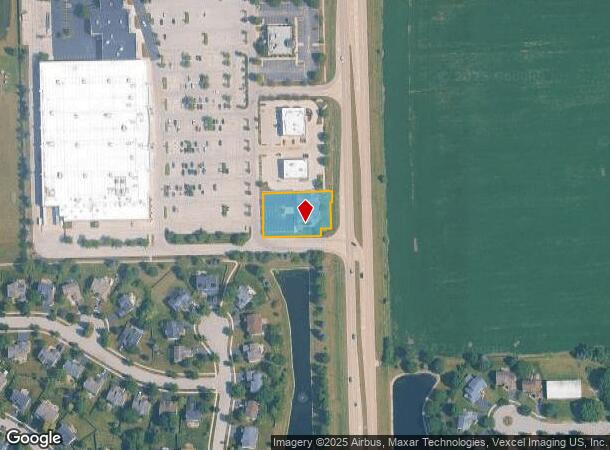
12820 S Route 59, Plainfield, IL 60585


NEARBY LISTINGS FOR SALE OR LEASE
Property Detail
12820 S Route 59
Chicago-Naperville-Elgin, IL-IN-WI
Commercial
07-01-33-208-007
LOT 5 IN KENSINGTON CENTER, A SUB OF PRT OF THE NE1/4 OF SEC 33, T37N-R9E.
Storebuilding
Will
X
Illinois
17197C0039G
5
2024
0.57 AC
2024
Joliet/Central Will
880320
Chicago
25,003 SF
DEMOGRAPHICS near 12820 S Route 59
1 Mile
3 Mile
5 Mile
2024 Total Population
6,295
51,732
150,894
2029 Population
6,324
52,019
151,402
Pop Growth 2024-2029
+ 0.46%
+ 0.55%
+ 0.34%
Average Age
37
37
38
2024 Total Households
1,973
15,669
48,156
HH Growth 2024-2029
+ 0.56%
+ 0.57%
+ 0.34%
Median Household Inc
$128,044
$142,120
$124,199
Avg Household Size
3.20
3.20
3.10
2024 Avg HH Vehicles
2.00
2.00
2.00
Median Home Value
$366,407
$384,389
$339,614
Median Year Built
2002
2001
2000
Nearby Places
Map Layers
Map Styles
 Street
 Aerial
- Restaurants
- Banks
- Shops
- Fitness
- Groceries
PUBLIC TRANSPORTATION
COMMUTER RAIL
Route 59 Station (Burlington Northern-Santa Fe Railway Line - Northeast Illinois Regional Commuter Railroad (Metra))
DRIVE
WALK
Distance
Route 59 Station (Burlington Northern-Santa Fe Railway Line - Northeast Illinois Regional Commuter Railroad (Metra))
20 min
9.8 mi
AIRPORT
Chicago Midway International
DRIVE
WALK
Distance
Chicago Midway International
43 min
28.6 mi
Chicago O'Hare International
DRIVE
WALK
Distance
Chicago O'Hare International
59 min
40.0 mi
SALE & LEASE HISTORY
LISTING DATE
SALE/LEASE

Sep 21, 2017
For Sale
May 17, 2021
For Sale
May 17, 2021
For Lease
May 02, 2017
For Lease
Jan 10, 2018
For Sale
Nearby Properties
Address
Land Use
TOTAL SIZE
Lot Size
Zoning
Address
Land Use
TOTAL SIZE
Lot Size
Zoning
135.28 AC
Address
Land Use
TOTAL SIZE
Lot Size
Zoning
952,135 SF
21.86 AC
Address
Land Use
TOTAL SIZE
Lot Size
Zoning
20.75 AC
Address
Land Use
TOTAL SIZE
Lot Size
Zoning
14.67 AC
Address
Land Use
TOTAL SIZE
Lot Size
Zoning
12.47 AC
Address
Land Use
TOTAL SIZE
Lot Size
Zoning
965,899 SF
22.17 AC
Address
Land Use
TOTAL SIZE
Lot Size
Zoning
14.59 AC
Address
Land Use
TOTAL SIZE
Lot Size
Zoning
33.04 AC
Address
Land Use
TOTAL SIZE
Lot Size
Zoning
448,352 SF
15.67 AC
Address
Land Use
TOTAL SIZE
Lot Size
Zoning
30.80 AC
Address
Land Use
TOTAL SIZE
Lot Size
Zoning
23.79 AC
Address
Land Use
TOTAL SIZE
Lot Size
Zoning
24.91 AC
Address
Land Use
TOTAL SIZE
Lot Size
Zoning
29.03 AC
Address
Land Use
TOTAL SIZE
Lot Size
Zoning
232,964 SF
28.66 AC
Address
Land Use
TOTAL SIZE
Lot Size
Zoning
36.79 AC
Address
Land Use
TOTAL SIZE
Lot Size
Zoning
160,039 SF
3.67 AC
Address
Land Use
TOTAL SIZE
Lot Size
Zoning
643,468 SF
14.77 AC
Address
Land Use
TOTAL SIZE
Lot Size
Zoning
409,695 SF
9.41 AC
Address
Land Use
TOTAL SIZE
Lot Size
Zoning
577,610 SF
13.05 AC
Address
Land Use
TOTAL SIZE
Lot Size
Zoning
521,457 SF
11.97 AC
Address
Land Use
TOTAL SIZE
Lot Size
Zoning
42.16 AC
Address
Land Use
TOTAL SIZE
Lot Size
Zoning
Address
Land Use
TOTAL SIZE
Lot Size
Zoning
8.10 AC
Address
Land Use
TOTAL SIZE
Lot Size
Zoning
406,938 SF
9.34 AC
Address
Land Use
TOTAL SIZE
Lot Size
Zoning
326,156 SF
7.49 AC
Address
Land Use
TOTAL SIZE
Lot Size
Zoning
345,727 SF
7.94 AC
Address
Land Use
TOTAL SIZE
Lot Size
Zoning
7.08 AC
Address
Land Use
TOTAL SIZE
Lot Size
Zoning
7.23 AC
Address
Land Use
TOTAL SIZE
Lot Size
Zoning
4.89 AC
Address
Land Use
TOTAL SIZE
Lot Size
Zoning
324,086 SF
7.44 AC
The World's #1 Commercial Real Estate Marketplace
Connect with us
© 2025 CoStar Group
The information above has been obtained from sources believed reliable. While we do not doubt its accuracy we have not verified it and make no guarantee, warranty or representation about it. It is your responsibility to independently confirm its accuracy and completeness. Any projections, opinions, assumptions, or estimates used are for example only and do not represent the current or future performance of the property. The value of this transaction to you depends on tax and other factors which should be evaluated by your tax, financial, and legal advisors. You and your advisors should conduct a careful, independent investigation of the property to determine to your satisfaction the suitability of the property for your needs.