Property Record
12822 Stark Rd, Livonia, MI 48150


NEARBY LISTINGS FOR SALE OR LEASE
Property Detail
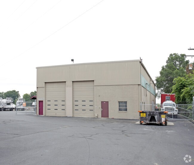
12822 Stark Rd
Detroit-Warren-Dearborn, MI
Newman Schoolcraft Farms
46-109-02-0019-001
28D19 20 21 22 NEWMAN SCHOOLCRAFT FARMS T1S R9E L69 P90 WCR LOTS 19 THRU 22 12900 STARK ADDN'L ADDRESS PER ENGINEERING
Industrialgeneral
Wayne
X
Michigan
26163C0044E
19-22
2025
7.09 AC
2025
Livonia
558301
Detroit
41,929 SF
DEMOGRAPHICS near 12822 Stark Rd
1 Mile
3 Mile
5 Mile
2024 Total Population
3,623
75,974
223,635
2029 Population
3,490
72,810
214,583
Pop Growth 2024-2029
(3.67%)
(4.16%)
(4.05%)
Average Age
46
43
43
2024 Total Households
1,529
31,998
96,120
HH Growth 2024-2029
(3.66%)
(4.15%)
(4.03%)
Median Household Inc
$96,806
$84,711
$74,569
Avg Household Size
2.30
2.30
2.30
2024 Avg HH Vehicles
2.00
2.00
2.00
Median Home Value
$254,017
$230,868
$200,642
Median Year Built
1966
1964
1963
Nearby Places
Map Layers
Map Styles
 Street
 Aerial
- Restaurants
- Banks
- Shops
- Fitness
- Groceries
PUBLIC TRANSPORTATION
AIRPORT
Detroit Metro Wayne County
DRIVE
WALK
Distance
Detroit Metro Wayne County
27 min
20.1 mi
Windsor International
DRIVE
WALK
Distance
Windsor International
46 min
29.6 mi
Freight Ports
Port of Toledo
DRIVE
WALK
Distance
Port of Toledo
77 min
61.8 mi
Nearby Properties
Address
Land Use
TOTAL SIZE
Lot Size
Zoning
Address
Land Use
TOTAL SIZE
Lot Size
Zoning
3,733,882 SF
183.17 AC
M-2
Address
Land Use
TOTAL SIZE
Lot Size
Zoning
1,005,040 SF
Address
Land Use
TOTAL SIZE
Lot Size
Zoning
517,265 SF
116.72 AC
Address
Land Use
TOTAL SIZE
Lot Size
Zoning
1,316,911 SF
72.87 AC
M-1
Address
Land Use
TOTAL SIZE
Lot Size
Zoning
1,071,675 SF
59.61 AC
M-2
Address
Land Use
TOTAL SIZE
Lot Size
Zoning
909,159 SF
55.33 AC
M-2
Address
Land Use
TOTAL SIZE
Lot Size
Zoning
352,514 SF
26.40 AC
Address
Land Use
TOTAL SIZE
Lot Size
Zoning
480,910 SF
26.32 AC
Address
Land Use
TOTAL SIZE
Lot Size
Zoning
361,807 SF
18.77 AC
M-2
Address
Land Use
TOTAL SIZE
Lot Size
Zoning
199,485 SF
10.31 AC
R-9
Address
Land Use
TOTAL SIZE
Lot Size
Zoning
1,156,275 SF
75.88 AC
M-2
Address
Land Use
TOTAL SIZE
Lot Size
Zoning
249,795 SF
21.17 AC
Address
Land Use
TOTAL SIZE
Lot Size
Zoning
1,013,885 SF
36.48 AC
M-1
Address
Land Use
TOTAL SIZE
Lot Size
Zoning
Address
Land Use
TOTAL SIZE
Lot Size
Zoning
176,396 SF
11.76 AC
Address
Land Use
TOTAL SIZE
Lot Size
Zoning
286,188 SF
40.21 AC
Address
Land Use
TOTAL SIZE
Lot Size
Zoning
285,136 SF
15.28 AC
Address
Land Use
TOTAL SIZE
Lot Size
Zoning
172,094 SF
11.84 AC
M-2
Address
Land Use
TOTAL SIZE
Lot Size
Zoning
206,130 SF
14.12 AC
Address
Land Use
TOTAL SIZE
Lot Size
Zoning
399,770 SF
34.90 AC
M-2
Address
Land Use
TOTAL SIZE
Lot Size
Zoning
243,371 SF
16.04 AC
Address
Land Use
TOTAL SIZE
Lot Size
Zoning
121,420 SF
16.01 AC
C-2
Address
Land Use
TOTAL SIZE
Lot Size
Zoning
177,268 SF
17.11 AC
Address
Land Use
TOTAL SIZE
Lot Size
Zoning
127,811 SF
6.95 AC
M-2
Address
Land Use
TOTAL SIZE
Lot Size
Zoning
145,232 SF
7.16 AC
M-2
Address
Land Use
TOTAL SIZE
Lot Size
Zoning
170,275 SF
16.53 AC
Address
Land Use
TOTAL SIZE
Lot Size
Zoning
137,490 SF
12.16 AC
C-2
Address
Land Use
TOTAL SIZE
Lot Size
Zoning
1,529,287 SF
76.96 AC
M-1
Address
Land Use
TOTAL SIZE
Lot Size
Zoning
137,400 SF
11.27 AC
Address
Land Use
TOTAL SIZE
Lot Size
Zoning
151,806 SF
15.61 AC
C-2
The World's #1 Commercial Real Estate Marketplace
Connect with us
© 2026 CoStar Group
The information above has been obtained from sources believed reliable. While we do not doubt its accuracy we have not verified it and make no guarantee, warranty or representation about it. It is your responsibility to independently confirm its accuracy and completeness. Any projections, opinions, assumptions, or estimates used are for example only and do not represent the current or future performance of the property. The value of this transaction to you depends on tax and other factors which should be evaluated by your tax, financial, and legal advisors. You and your advisors should conduct a careful, independent investigation of the property to determine to your satisfaction the suitability of the property for your needs.