Property Record
12829 Ne H K Dodgen Loop, Temple, TX 76501

Property Detail
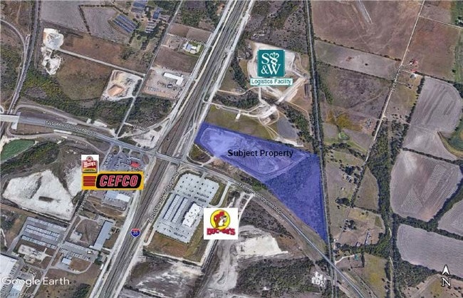
12829 Ne H K Dodgen Loop
Killeen-Temple, TX
BELLAIRE COMMERCIAL SUBDIVISION, BLOCK 001, LOT 0009, ACRES 9.669
480218
BELL
Commercialnec
Texas
B and X Area of moderate flood hazard, usually the area between the limits of the 100-year and 500-year floods.
9
2025
9.67 AC
2025
Temple
020500
Killeen/Temple/Fort Hood
2,084 SF
NEARBY LISTINGS FOR SALE OR LEASE
DEMOGRAPHICS near 12829 Ne H K Dodgen Loop
1 mile
3 mile
5 mile
2025 Total Population
118
13,343
47,003
2030 Population
127
14,239
50,229
Pop Growth 2025-2030
+ 7.63%
+ 6.72%
+ 6.86%
Average Age
40
39
38
2025 Total Households
45
5,315
19,364
HH Growth 2025-2030
+ 6.67%
+ 6.74%
+ 6.90%
Median Household Inc
$66,250
$60,263
$58,269
Avg Household Size
2.50
2.40
2.30
2025 Avg HH Vehicles
2.00
2.00
2.00
Median Home Value
$266,666
$186,551
$204,667
Median Year Built
1989
1972
1981
Nearby Places
Map Layers
Map Styles
 Street
 Aerial
Transit
 Traffic
 Biking
Places
Listings with unknown addresses are not visible on the map
- Restaurants
- Banks
- Shops
- Fitness
- Groceries
PUBLIC TRANSPORTATION
COMMUTER RAIL
Temple (Texas Eagle - Amtrak)
Drive
Walk
Distance
Temple (Texas Eagle - Amtrak)
8 min
3.8 mi
AIRPORT
Killeen Municipal
Drive
Walk
Distance
Killeen Municipal
31 min
25.8 mi
Freight Ports
Port of Houston
Drive
Walk
Distance
Port of Houston
229 min
176.2 mi
SALE & LEASE HISTORY
LISTING DATE
SALE/LEASE

May 03, 2019
For Sale
Nearby Properties
Address
Land Use
TOTAL SIZE
Lot Size
Zoning
Address
Land Use
TOTAL SIZE
Lot Size
Zoning
274,710 SF
38.05 AC
C
Address
Land Use
TOTAL SIZE
Lot Size
Zoning
Address
Land Use
TOTAL SIZE
Lot Size
Zoning
71,378 SF
13.75 AC
Address
Land Use
TOTAL SIZE
Lot Size
Zoning
71,378 SF
14.37 AC
A
Address
Land Use
TOTAL SIZE
Lot Size
Zoning
Address
Land Use
TOTAL SIZE
Lot Size
Zoning
612,900 SF
38.68 AC
Address
Land Use
TOTAL SIZE
Lot Size
Zoning
1,088 SF
Address
Land Use
TOTAL SIZE
Lot Size
Zoning
71,382 SF
59.32 AC
Address
Land Use
TOTAL SIZE
Lot Size
Zoning
117,017 SF
64.64 AC
Address
Land Use
TOTAL SIZE
Lot Size
Zoning
1,088 SF
Address
Land Use
TOTAL SIZE
Lot Size
Zoning
154,068 SF
11.33 AC
Address
Land Use
TOTAL SIZE
Lot Size
Zoning
Address
Land Use
TOTAL SIZE
Lot Size
Zoning
Address
Land Use
TOTAL SIZE
Lot Size
Zoning
246,008 SF
21.53 AC
Address
Land Use
TOTAL SIZE
Lot Size
Zoning
224,088 SF
21.98 AC
Address
Land Use
TOTAL SIZE
Lot Size
Zoning
Address
Land Use
TOTAL SIZE
Lot Size
Zoning
105,950 SF
14.26 AC
Address
Land Use
TOTAL SIZE
Lot Size
Zoning
88,655 SF
2.10 AC
Address
Land Use
TOTAL SIZE
Lot Size
Zoning
76,545 SF
5.29 AC
Address
Land Use
TOTAL SIZE
Lot Size
Zoning
1,088 SF
Address
Land Use
TOTAL SIZE
Lot Size
Zoning
Address
Land Use
TOTAL SIZE
Lot Size
Zoning
53,932 SF
3.10 AC
LI SPPC
Address
Land Use
TOTAL SIZE
Lot Size
Zoning
74,320 SF
1.89 AC
CA
Address
Land Use
TOTAL SIZE
Lot Size
Zoning
Address
Land Use
TOTAL SIZE
Lot Size
Zoning
Address
Land Use
TOTAL SIZE
Lot Size
Zoning
1,375 SF
27.22 AC
COMB
Address
Land Use
TOTAL SIZE
Lot Size
Zoning
60,792 SF
12.39 AC
Address
Land Use
TOTAL SIZE
Lot Size
Zoning
69,546 SF
20.60 AC
Address
Land Use
TOTAL SIZE
Lot Size
Zoning
86,653 SF
5.41 AC
PD
Address
Land Use
TOTAL SIZE
Lot Size
Zoning
66,036 SF
1.91 AC
The World's #1 Commercial Real Estate Marketplace
Connect with us
© 2026 CoStar Group
The information above has been obtained from sources believed reliable. While we do not doubt its accuracy we have not verified it and make no guarantee, warranty or representation about it. It is your responsibility to independently confirm its accuracy and completeness. Any projections, opinions, assumptions, or estimates used are for example only and do not represent the current or future performance of the property. The value of this transaction to you depends on tax and other factors which should be evaluated by your tax, financial, and legal advisors. You and your advisors should conduct a careful, independent investigation of the property to determine to your satisfaction the suitability of the property for your needs.