Property Record
12832 W Jomax Rd, Peoria, AZ 85383

NEARBY LISTINGS FOR SALE OR LEASE
Property Detail
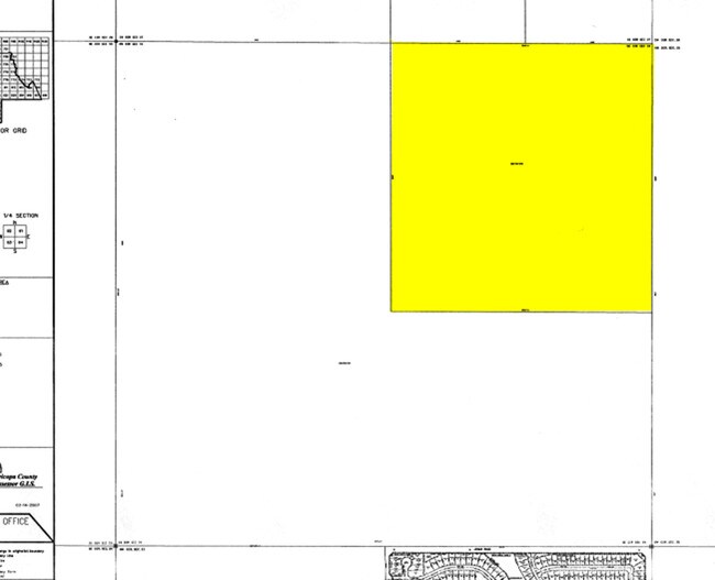
12832 W Jomax Rd
503-52-040
NE4 160 AC
Poultryranch
Maricopa
X
Arizona
04013C1230L
160 AC
2025
Loop 303/Surprise
2025
Phoenix
610902
Phoenix-Mesa-Scottsdale, AZ
DEMOGRAPHICS near 12832 W Jomax Rd
1 Mile
3 Mile
5 Mile
2024 Total Population
4,772
30,381
73,714
2029 Population
5,343
33,773
81,167
Pop Growth 2024-2029
+ 11.97%
+ 11.16%
+ 10.11%
Average Age
57
45
49
2024 Total Households
2,178
11,494
30,092
HH Growth 2024-2029
+ 11.94%
+ 11.38%
+ 10.21%
Median Household Inc
$99,220
$105,507
$95,139
Avg Household Size
2.20
2.60
2.40
2024 Avg HH Vehicles
2.00
2.00
2.00
Median Home Value
$518,207
$488,871
$428,157
Median Year Built
2010
2010
2005
Nearby Places
Map Layers
Map Styles
 Street
 Aerial
- Restaurants
- Banks
- Shops
- Fitness
- Groceries
PUBLIC TRANSPORTATION
AIRPORT
Phoenix Sky Harbor International
DRIVE
WALK
Distance
Phoenix Sky Harbor International
60 min
45.0 mi
Freight Ports
Port of San Diego
DRIVE
WALK
Distance
Port of San Diego
403 min
360.0 mi
Nearby Properties
Address
Land Use
TOTAL SIZE
Lot Size
Zoning
Address
Land Use
TOTAL SIZE
Lot Size
Zoning
Address
Land Use
TOTAL SIZE
Lot Size
Zoning
110,752 SF
16.07 AC
PAD
Address
Land Use
TOTAL SIZE
Lot Size
Zoning
120,691 SF
16.33 AC
PAD
Address
Land Use
TOTAL SIZE
Lot Size
Zoning
252,143 SF
13.24 AC
Address
Land Use
TOTAL SIZE
Lot Size
Zoning
192,849 SF
19.09 AC
R3
Address
Land Use
TOTAL SIZE
Lot Size
Zoning
118,893 SF
5.07 AC
C3
Address
Land Use
TOTAL SIZE
Lot Size
Zoning
28,034 SF
18.35 AC
PCD
Address
Land Use
TOTAL SIZE
Lot Size
Zoning
1,522 SF
20.43 AC
C2
Address
Land Use
TOTAL SIZE
Lot Size
Zoning
57,888 SF
4.65 AC
PAD
Address
Land Use
TOTAL SIZE
Lot Size
Zoning
Address
Land Use
TOTAL SIZE
Lot Size
Zoning
22,755 SF
2.63 AC
PCD
Address
Land Use
TOTAL SIZE
Lot Size
Zoning
21.72 AC
Address
Land Use
TOTAL SIZE
Lot Size
Zoning
16,454 SF
6.55 AC
C-C
Address
Land Use
TOTAL SIZE
Lot Size
Zoning
11,578 SF
19.90 AC
Address
Land Use
TOTAL SIZE
Lot Size
Zoning
18.96 AC
R-43
Address
Land Use
TOTAL SIZE
Lot Size
Zoning
10,001 SF
2.15 AC
PCD
Address
Land Use
TOTAL SIZE
Lot Size
Zoning
12,207 SF
47.06 AC
PAD
Address
Land Use
TOTAL SIZE
Lot Size
Zoning
14,722 SF
1.51 AC
PAD
Address
Land Use
TOTAL SIZE
Lot Size
Zoning
213.80 AC
Address
Land Use
TOTAL SIZE
Lot Size
Zoning
4,989 SF
0.97 AC
PAD
Address
Land Use
TOTAL SIZE
Lot Size
Zoning
6,840 SF
1.33 AC
PCD
Address
Land Use
TOTAL SIZE
Lot Size
Zoning
6,642 SF
0.89 AC
PAD
Address
Land Use
TOTAL SIZE
Lot Size
Zoning
6,533 SF
0.70 AC
PAD
Address
Land Use
TOTAL SIZE
Lot Size
Zoning
Address
Land Use
TOTAL SIZE
Lot Size
Zoning
6,220 SF
0.74 AC
PAD
Address
Land Use
TOTAL SIZE
Lot Size
Zoning
6,220 SF
0.74 AC
PAD
The World's #1 Commercial Real Estate Marketplace
Connect with us
© 2025 CoStar Group
The information above has been obtained from sources believed reliable. While we do not doubt its accuracy we have not verified it and make no guarantee, warranty or representation about it. It is your responsibility to independently confirm its accuracy and completeness. Any projections, opinions, assumptions, or estimates used are for example only and do not represent the current or future performance of the property. The value of this transaction to you depends on tax and other factors which should be evaluated by your tax, financial, and legal advisors. You and your advisors should conduct a careful, independent investigation of the property to determine to your satisfaction the suitability of the property for your needs.