Property Record
12845 Ne Jacksonville Rd, Anthony, FL 32617


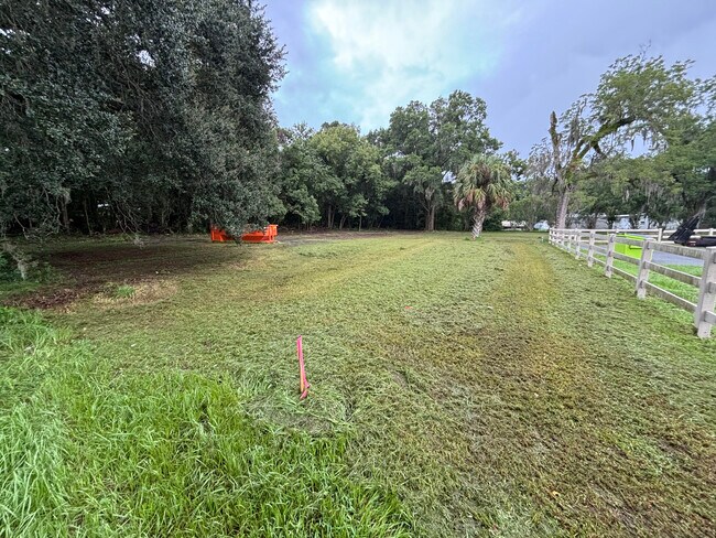
This Property Is For Sale
NEARBY LISTINGS FOR SALE OR LEASE
-
-
View all Anthony listings for sale on LoopNet.com
Property Detail
12845 Ne Jacksonville Rd
Ocala, FL
Town Of Sparr
08430-004-00
SEC 28 TWP 13 RGE 22 PLAT BOOK E PAGE 052 TOWN OF SPARR COM 368 FT N OF SW COR LOT 2 BLK 20 N 200 FT ALONG E ROW HWY #301 E 352 FT MOL TO RR ROW LN SWLY 200 FT MOL TO PT E OF POB W TO POB EXCEPT: COM 478 FT N OF SW COR OF LOT 2 BLK 20 FOR POB N ALONG
Residentialacreage
Marion
X
Florida
12083C0330D
2
2024
1.12 AC
2024
Outlying Marion County
000303
Ocala
1,214 SF
DEMOGRAPHICS near 12845 Ne Jacksonville Rd
1 Mile
3 Mile
5 Mile
2024 Total Population
576
3,927
13,191
2029 Population
644
4,399
14,823
Pop Growth 2024-2029
+ 11.81%
+ 12.02%
+ 12.37%
Average Age
43
44
43
2024 Total Households
233
1,497
4,784
HH Growth 2024-2029
+ 11.59%
+ 12.16%
+ 12.73%
Median Household Inc
$65,000
$59,296
$52,246
Avg Household Size
2.40
2.40
2.50
2024 Avg HH Vehicles
2.00
2.00
2.00
Median Home Value
$257,142
$242,016
$211,866
Median Year Built
1988
1987
1986
Nearby Places
Map Layers
Map Styles
 Street
 Aerial
- Restaurants
- Banks
- Shops
- Fitness
- Groceries
PUBLIC TRANSPORTATION
AIRPORT
Gainesville Regional
DRIVE
WALK
Distance
Gainesville Regional
51 min
33.9 mi
Freight Ports
Jacksonville Port
DRIVE
WALK
Distance
Jacksonville Port
121 min
94.0 mi
Nearby Properties
Address
Land Use
TOTAL SIZE
Lot Size
Zoning
Address
Land Use
TOTAL SIZE
Lot Size
Zoning
175,004 SF
30 AC
A1
Address
Land Use
TOTAL SIZE
Lot Size
Zoning
86,722 SF
30.19 AC
A1
Address
Land Use
TOTAL SIZE
Lot Size
Zoning
50,947 SF
23 AC
GU
Address
Land Use
TOTAL SIZE
Lot Size
Zoning
25,250 SF
14.96 AC
A1
Address
Land Use
TOTAL SIZE
Lot Size
Zoning
5,358 SF
61.73 AC
GU
Address
Land Use
TOTAL SIZE
Lot Size
Zoning
13,973 SF
163.67 AC
A1
Address
Land Use
TOTAL SIZE
Lot Size
Zoning
7,077 SF
60 AC
A1
Address
Land Use
TOTAL SIZE
Lot Size
Zoning
7,091 SF
137.15 AC
A1
Address
Land Use
TOTAL SIZE
Lot Size
Zoning
8,479 SF
52.72 AC
A1
Address
Land Use
TOTAL SIZE
Lot Size
Zoning
12,774 SF
12.05 AC
R4
Address
Land Use
TOTAL SIZE
Lot Size
Zoning
54,889 SF
10.45 AC
B5
Address
Land Use
TOTAL SIZE
Lot Size
Zoning
12,910 SF
16.21 AC
A1
Address
Land Use
TOTAL SIZE
Lot Size
Zoning
5,841 SF
91 AC
A1
Address
Land Use
TOTAL SIZE
Lot Size
Zoning
1,720 SF
19.98 AC
A3
Address
Land Use
TOTAL SIZE
Lot Size
Zoning
6,797 SF
69.56 AC
A1
Address
Land Use
TOTAL SIZE
Lot Size
Zoning
9,098 SF
1.30 AC
B4
Address
Land Use
TOTAL SIZE
Lot Size
Zoning
19.01 AC
A1
Address
Land Use
TOTAL SIZE
Lot Size
Zoning
4,602 SF
10 AC
A1
Address
Land Use
TOTAL SIZE
Lot Size
Zoning
7,131 SF
294 AC
A1
Address
Land Use
TOTAL SIZE
Lot Size
Zoning
7,305 SF
56.85 AC
A1
Address
Land Use
TOTAL SIZE
Lot Size
Zoning
4,753 SF
4.82 AC
B4
Address
Land Use
TOTAL SIZE
Lot Size
Zoning
5,551 SF
103 AC
A1
Address
Land Use
TOTAL SIZE
Lot Size
Zoning
10 AC
A1
Address
Land Use
TOTAL SIZE
Lot Size
Zoning
2,640 SF
3 AC
B4
Address
Land Use
TOTAL SIZE
Lot Size
Zoning
3,122 SF
27.62 AC
A1
Address
Land Use
TOTAL SIZE
Lot Size
Zoning
4,418 SF
1.24 AC
B4
Address
Land Use
TOTAL SIZE
Lot Size
Zoning
10,040 SF
3.42 AC
R4
Address
Land Use
TOTAL SIZE
Lot Size
Zoning
5,805 SF
3 AC
GU
Address
Land Use
TOTAL SIZE
Lot Size
Zoning
4,866 SF
40.76 AC
A1
Address
Land Use
TOTAL SIZE
Lot Size
Zoning
4,290 SF
1.71 AC
A1
The World's #1 Commercial Real Estate Marketplace
Connect with us
© 2025 CoStar Group
The information above has been obtained from sources believed reliable. While we do not doubt its accuracy we have not verified it and make no guarantee, warranty or representation about it. It is your responsibility to independently confirm its accuracy and completeness. Any projections, opinions, assumptions, or estimates used are for example only and do not represent the current or future performance of the property. The value of this transaction to you depends on tax and other factors which should be evaluated by your tax, financial, and legal advisors. You and your advisors should conduct a careful, independent investigation of the property to determine to your satisfaction the suitability of the property for your needs.