Property Record
1285 Healing Stone Ct, Normal, IL 61761
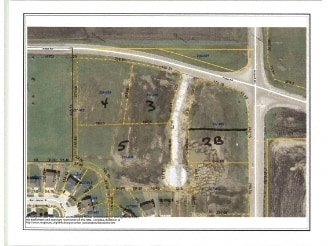

Property Detail
1285 Healing Stone Ct
14-24-227-091
SEC 24-24-2E RESUB LOTS 3 & 4 1ST ADD EAGLES LANDINGS COMMERCIAL SUB LOTS 5 & 9
Commercialacreage
McLean
B1
Illinois
B and X Area of moderate flood hazard, usually the area between the limits of the 100-year and 500-year floods.
3,4
2024
2.06 AC
2025
Bloomington/Normal
000507
Other Market Areas
46,886 SF
Bloomington, IL
NEARBY LISTINGS FOR SALE OR LEASE
DEMOGRAPHICS near 1285 Healing Stone Ct
1 mile
3 mile
5 mile
2025 Total Population
3,951
40,424
100,977
2030 Population
4,020
40,290
101,079
Pop Growth 2025-2030
+ 1.75%
(0.33%)
+ 0.10%
Average Age
36
39
37
2025 Total Households
1,336
15,972
40,230
HH Growth 2025-2030
+ 1.87%
(0.30%)
+ 0.10%
Median Household Inc
$159,524
$108,421
$77,776
Avg Household Size
3.00
2.50
2.30
2025 Avg HH Vehicles
2.00
2.00
2.00
Median Home Value
$315,341
$269,991
$235,714
Median Year Built
2006
1994
1982
Nearby Places
Map Layers
Map Styles
 Street
 Aerial
Layers
 Traffic
 Biking
Places
Listings with unknown addresses are not visible on the map
- Restaurants
- Banks
- Shops
- Fitness
- Groceries
PUBLIC TRANSPORTATION
COMMUTER RAIL
Bloomington-Normal (Lincoln Service - Amtrak, Lincoln Service Missouri River Runner - Amtrak, Texas Eagle - Amtrak)
Drive
Walk
Distance
Bloomington-Normal (Lincoln Service - Amtrak, Lincoln Service Missouri River Runner - Amtrak, Texas Eagle - Amtrak)
10 min
4.6 mi
AIRPORT
Central Il Regional/Bloomington-Normal
Drive
Walk
Distance
Central Il Regional/Bloomington-Normal
11 min
4.2 mi
Freight Ports
Port Milwaukee
Drive
Walk
Distance
Port Milwaukee
236 min
201.6 mi
Nearby Properties
Address
Land Use
TOTAL SIZE
Lot Size
Zoning
Address
Land Use
TOTAL SIZE
Lot Size
Zoning
562,852 SF
48.94 AC
Address
Land Use
TOTAL SIZE
Lot Size
Zoning
426,806 SF
20.93 AC
Address
Land Use
TOTAL SIZE
Lot Size
Zoning
414,270 SF
13.50 AC
Address
Land Use
TOTAL SIZE
Lot Size
Zoning
177,365 SF
11.75 AC
Address
Land Use
TOTAL SIZE
Lot Size
Zoning
123,016 SF
18.52 AC
C-2
Address
Land Use
TOTAL SIZE
Lot Size
Zoning
136,382 SF
9.53 AC
Address
Land Use
TOTAL SIZE
Lot Size
Zoning
16.79 AC
Address
Land Use
TOTAL SIZE
Lot Size
Zoning
423,526 SF
25.35 AC
B-1
Address
Land Use
TOTAL SIZE
Lot Size
Zoning
208,876 SF
20.87 AC
B-1
Address
Land Use
TOTAL SIZE
Lot Size
Zoning
180,144 SF
8.95 AC
Address
Land Use
TOTAL SIZE
Lot Size
Zoning
122,112 SF
7.16 AC
Address
Land Use
TOTAL SIZE
Lot Size
Zoning
28,953 SF
1 AC
Address
Land Use
TOTAL SIZE
Lot Size
Zoning
231,077 SF
15.49 AC
Address
Land Use
TOTAL SIZE
Lot Size
Zoning
197,766 SF
13.86 AC
Address
Land Use
TOTAL SIZE
Lot Size
Zoning
83.87 AC
Address
Land Use
TOTAL SIZE
Lot Size
Zoning
141,694 SF
5.75 AC
Address
Land Use
TOTAL SIZE
Lot Size
Zoning
139,324 SF
15.78 AC
B-1
Address
Land Use
TOTAL SIZE
Lot Size
Zoning
223,726 SF
10.15 AC
Address
Land Use
TOTAL SIZE
Lot Size
Zoning
105,746 SF
8.17 AC
B-1
Address
Land Use
TOTAL SIZE
Lot Size
Zoning
328,400 SF
32.14 AC
Address
Land Use
TOTAL SIZE
Lot Size
Zoning
16.92 AC
Address
Land Use
TOTAL SIZE
Lot Size
Zoning
166,922 SF
7.42 AC
Address
Land Use
TOTAL SIZE
Lot Size
Zoning
104,805 SF
3.77 AC
Address
Land Use
TOTAL SIZE
Lot Size
Zoning
134,416 SF
4.26 AC
Address
Land Use
TOTAL SIZE
Lot Size
Zoning
100,382 SF
3.73 AC
R-3A
Address
Land Use
TOTAL SIZE
Lot Size
Zoning
75,574 SF
5.95 AC
B-1
Address
Land Use
TOTAL SIZE
Lot Size
Zoning
59,808 SF
3.07 AC
B-1
Address
Land Use
TOTAL SIZE
Lot Size
Zoning
75,387 SF
2.94 AC
C-2
Address
Land Use
TOTAL SIZE
Lot Size
Zoning
289,630 SF
10.20 AC
R-1B
The World's #1 Commercial Real Estate Marketplace
Connect with us
© 2026 CoStar Group
The information above has been obtained from sources believed reliable. While we do not doubt its accuracy we have not verified it and make no guarantee, warranty or representation about it. It is your responsibility to independently confirm its accuracy and completeness. Any projections, opinions, assumptions, or estimates used are for example only and do not represent the current or future performance of the property. The value of this transaction to you depends on tax and other factors which should be evaluated by your tax, financial, and legal advisors. You and your advisors should conduct a careful, independent investigation of the property to determine to your satisfaction the suitability of the property for your needs.