Property Record
1285 Highway 55 E, Clover, SC 29710


Property Detail
1285 Highway 55 E
Charlotte-Concord-Gastonia, NC-SC
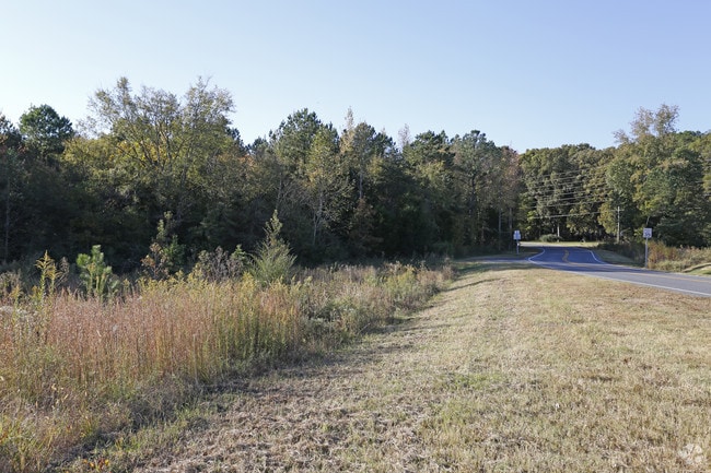
HWY 55(TRACT A)(6.829 LESS .96 SOLD TO SCDOT)
0100601104
YORK
Commercialacreage
South Carolina
B and X Area of moderate flood hazard, usually the area between the limits of the 100-year and 500-year floods.
5.87 AC
2025
York County
2025
Charlotte
061705
NEARBY LISTINGS FOR SALE OR LEASE
-
-
View all Clover listings for sale on LoopNet.com
DEMOGRAPHICS near 1285 Highway 55 E
1 mile
3 mile
5 mile
2025 Total Population
1,464
13,185
25,206
2030 Population
1,560
14,072
26,839
Pop Growth 2025-2030
+ 6.56%
+ 6.73%
+ 6.48%
Average Age
40
40
41
2025 Total Households
519
4,850
9,374
HH Growth 2025-2030
+ 6.55%
+ 6.70%
+ 6.49%
Median Household Inc
$89,020
$78,959
$74,687
Avg Household Size
2.80
2.70
2.60
2025 Avg HH Vehicles
2.00
2.00
2.00
Median Home Value
$376,851
$339,931
$335,880
Median Year Built
2000
1997
1997
Nearby Places
Map Layers
Map Styles
 Street
 Aerial
Transit
 Traffic
 Biking
Places
Listings with unknown addresses are not visible on the map
- Restaurants
- Banks
- Shops
- Fitness
- Groceries
PUBLIC TRANSPORTATION
AIRPORT
Charlotte/Douglas International
Drive
Walk
Distance
Charlotte/Douglas International
39 min
23.2 mi
Freight Ports
North Charleston Terminal
Drive
Walk
Distance
North Charleston Terminal
227 min
194.8 mi
SALE & LEASE HISTORY
LISTING DATE
SALE/LEASE

Mar 31, 2017
For Sale
Nearby Properties
Address
Land Use
TOTAL SIZE
Lot Size
Zoning
Address
Land Use
TOTAL SIZE
Lot Size
Zoning
5.46 AC
Address
Land Use
TOTAL SIZE
Lot Size
Zoning
30,000 SF
7.40 AC
LI
Address
Land Use
TOTAL SIZE
Lot Size
Zoning
2,070 SF
174.74 AC
RCI
Address
Land Use
TOTAL SIZE
Lot Size
Zoning
7,840 SF
4.28 AC
Address
Land Use
TOTAL SIZE
Lot Size
Zoning
3,419 SF
2.33 AC
PD
Address
Land Use
TOTAL SIZE
Lot Size
Zoning
6.13 AC
Address
Land Use
TOTAL SIZE
Lot Size
Zoning
16,250 SF
0.91 AC
Address
Land Use
TOTAL SIZE
Lot Size
Zoning
5,000 SF
1 AC
Address
Land Use
TOTAL SIZE
Lot Size
Zoning
2,160 SF
3.37 AC
RCI
Address
Land Use
TOTAL SIZE
Lot Size
Zoning
4,026 SF
0.91 AC
Address
Land Use
TOTAL SIZE
Lot Size
Zoning
2,780 SF
1 AC
Address
Land Use
TOTAL SIZE
Lot Size
Zoning
4.04 AC
BDIII
Address
Land Use
TOTAL SIZE
Lot Size
Zoning
2,783 SF
1 AC
RCI
Address
Land Use
TOTAL SIZE
Lot Size
Zoning
4,797 SF
1 AC
Address
Land Use
TOTAL SIZE
Lot Size
Zoning
3,884 SF
1 AC
Address
Land Use
TOTAL SIZE
Lot Size
Zoning
3,202 SF
174 SF
RUD
Address
Land Use
TOTAL SIZE
Lot Size
Zoning
3,431 SF
1 AC
Address
Land Use
TOTAL SIZE
Lot Size
Zoning
2,113 SF
1 AC
RCI
Address
Land Use
TOTAL SIZE
Lot Size
Zoning
3,358 SF
1 AC
Address
Land Use
TOTAL SIZE
Lot Size
Zoning
3,480 SF
0.29 AC
Address
Land Use
TOTAL SIZE
Lot Size
Zoning
3,592 SF
1 AC
RDI
Address
Land Use
TOTAL SIZE
Lot Size
Zoning
3,300 SF
1 AC
Address
Land Use
TOTAL SIZE
Lot Size
Zoning
3,612 SF
0.27 AC
RDI
Address
Land Use
TOTAL SIZE
Lot Size
Zoning
2,944 SF
1 AC
Address
Land Use
TOTAL SIZE
Lot Size
Zoning
31.94 AC
Address
Land Use
TOTAL SIZE
Lot Size
Zoning
1,736 SF
RUD
Address
Land Use
TOTAL SIZE
Lot Size
Zoning
2,820 SF
1 AC
Address
Land Use
TOTAL SIZE
Lot Size
Zoning
2,824 SF
1 AC
The World's #1 Commercial Real Estate Marketplace
Connect with us
© 2026 CoStar Group
The information above has been obtained from sources believed reliable. While we do not doubt its accuracy we have not verified it and make no guarantee, warranty or representation about it. It is your responsibility to independently confirm its accuracy and completeness. Any projections, opinions, assumptions, or estimates used are for example only and do not represent the current or future performance of the property. The value of this transaction to you depends on tax and other factors which should be evaluated by your tax, financial, and legal advisors. You and your advisors should conduct a careful, independent investigation of the property to determine to your satisfaction the suitability of the property for your needs.