Property Record
1285 Lansing Rd, Charlotte, MI 48813

NEARBY LISTINGS FOR SALE OR LEASE
-
-
View all Charlotte listings for sale on LoopNet.com
Property Detail
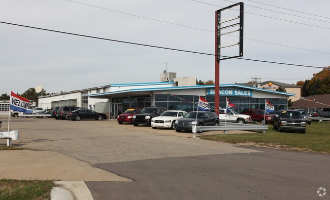
1285 Lansing Rd
110-008-100-095-00
COM. ON NWLY LINE OF US-27 HWY. 1848.5 FEET NELY FROM W LINE OF SEC. 8, N 40DEG W 235 FEET,S 50DEG W 50 FEET, N 40DEG W 200 FEET, N 50DEG E 250 FEET, S 40DEG E 200 FEET, N 50DEG E 157.6 FEET, S 15DEG E PARALLEL WITH CATHOLIC CEMETERY 259.6 FEET TO NW
Vehiclerentalsvehiclesales
Eaton
X
Michigan
26045C0325E
2.78 AC
2024
Outlying Eaton County
2025
West Michigan
020901
Lansing-East Lansing, MI
33,320 SF
DEMOGRAPHICS near 1285 Lansing Rd
1 Mile
3 Mile
5 Mile
2024 Total Population
1,532
12,591
18,747
2029 Population
1,532
12,571
18,701
Pop Growth 2024-2029
0.00%
(0.16%)
(0.25%)
Average Age
43
42
41
2024 Total Households
618
5,078
7,429
HH Growth 2024-2029
0.00%
(0.16%)
(0.23%)
Median Household Inc
$60,900
$63,118
$64,767
Avg Household Size
2.30
2.30
2.40
2024 Avg HH Vehicles
2.00
2.00
2.00
Median Home Value
$245,192
$158,154
$166,134
Median Year Built
1988
1969
1973
Nearby Places
Map Layers
Map Styles
 Street
 Aerial
- Restaurants
- Banks
- Shops
- Fitness
- Groceries
PUBLIC TRANSPORTATION
AIRPORT
Capital Region International
DRIVE
WALK
Distance
Capital Region International
29 min
22.0 mi
Freight Ports
Port of Toledo
DRIVE
WALK
Distance
Port of Toledo
160 min
114.1 mi
Nearby Properties
Address
Land Use
TOTAL SIZE
Lot Size
Zoning
Address
Land Use
TOTAL SIZE
Lot Size
Zoning
593,008 SF
101.57 AC
N/A
Address
Land Use
TOTAL SIZE
Lot Size
Zoning
38,722 SF
4.23 AC
N/A
Address
Land Use
TOTAL SIZE
Lot Size
Zoning
159,186 SF
28.10 AC
N/A
Address
Land Use
TOTAL SIZE
Lot Size
Zoning
126,110 SF
9.92 AC
N/A
Address
Land Use
TOTAL SIZE
Lot Size
Zoning
193,657 SF
18.37 AC
N/A
Address
Land Use
TOTAL SIZE
Lot Size
Zoning
86,060 SF
15.56 AC
N/A
Address
Land Use
TOTAL SIZE
Lot Size
Zoning
45,729 SF
6.46 AC
N/A
Address
Land Use
TOTAL SIZE
Lot Size
Zoning
81,764 SF
11.44 AC
N/A
Address
Land Use
TOTAL SIZE
Lot Size
Zoning
146,685 SF
10.86 AC
N/A
Address
Land Use
TOTAL SIZE
Lot Size
Zoning
110,000 SF
13.86 AC
N/A
Address
Land Use
TOTAL SIZE
Lot Size
Zoning
6,636 SF
22.48 AC
I
Address
Land Use
TOTAL SIZE
Lot Size
Zoning
60,513 SF
11 AC
N/A
Address
Land Use
TOTAL SIZE
Lot Size
Zoning
141,244 SF
10 AC
N/A
Address
Land Use
TOTAL SIZE
Lot Size
Zoning
38,646 SF
6.53 AC
N/A
Address
Land Use
TOTAL SIZE
Lot Size
Zoning
28,275 SF
3.27 AC
Address
Land Use
TOTAL SIZE
Lot Size
Zoning
84,552 SF
13.86 AC
N/A
Address
Land Use
TOTAL SIZE
Lot Size
Zoning
174,712 SF
9.50 AC
N/A
Address
Land Use
TOTAL SIZE
Lot Size
Zoning
48,384 SF
3.70 AC
N/A
Address
Land Use
TOTAL SIZE
Lot Size
Zoning
10,449 SF
3.15 AC
N/A
Address
Land Use
TOTAL SIZE
Lot Size
Zoning
4.33 AC
N/A
Address
Land Use
TOTAL SIZE
Lot Size
Zoning
65,731 SF
12.60 AC
N/A
Address
Land Use
TOTAL SIZE
Lot Size
Zoning
63,498 SF
7.34 AC
N/A
Address
Land Use
TOTAL SIZE
Lot Size
Zoning
54,550 SF
Address
Land Use
TOTAL SIZE
Lot Size
Zoning
97,600 SF
11.52 AC
N/A
Address
Land Use
TOTAL SIZE
Lot Size
Zoning
48,092 SF
5.16 AC
N/A
Address
Land Use
TOTAL SIZE
Lot Size
Zoning
40,484 SF
2.28 AC
N/A
Address
Land Use
TOTAL SIZE
Lot Size
Zoning
14,440 SF
0.94 AC
N/A
Address
Land Use
TOTAL SIZE
Lot Size
Zoning
4,608 SF
1.90 AC
N/A
Address
Land Use
TOTAL SIZE
Lot Size
Zoning
104,305 SF
7.36 AC
N/A
Address
Land Use
TOTAL SIZE
Lot Size
Zoning
41,605 SF
17 AC
N/A
The World's #1 Commercial Real Estate Marketplace
Connect with us
© 2025 CoStar Group
The information above has been obtained from sources believed reliable. While we do not doubt its accuracy we have not verified it and make no guarantee, warranty or representation about it. It is your responsibility to independently confirm its accuracy and completeness. Any projections, opinions, assumptions, or estimates used are for example only and do not represent the current or future performance of the property. The value of this transaction to you depends on tax and other factors which should be evaluated by your tax, financial, and legal advisors. You and your advisors should conduct a careful, independent investigation of the property to determine to your satisfaction the suitability of the property for your needs.