Property Record
1285 Mcgarity Rd, Mcdonough, GA 30252


NEARBY LISTINGS FOR SALE OR LEASE
-
-
View all Mcdonough listings for sale on LoopNet.com
Property Detail
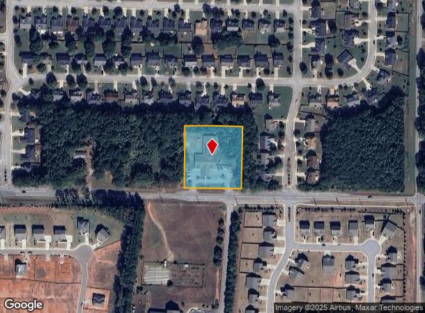
1285 Mcgarity Rd
Atlanta-Sandy Springs-Roswell, GA
Clearwater Pointe Ph 01
0122-02-055-000
LAND LOT: 119 /LAND DISTRICT: 7; COMMERCIAL
Daycare
Henry
X
Georgia
13151C0178D
119
2025
1.64 AC
2025
McDonough/Butts
070216
Atlanta
13,083 SF
DEMOGRAPHICS near 1285 Mcgarity Rd
1 Mile
3 Mile
5 Mile
2024 Total Population
4,092
27,735
69,238
2029 Population
4,499
30,296
75,663
Pop Growth 2024-2029
+ 9.95%
+ 9.23%
+ 9.28%
Average Age
38
39
37
2024 Total Households
1,345
9,579
24,007
HH Growth 2024-2029
+ 10.04%
+ 9.26%
+ 9.39%
Median Household Inc
$115,570
$87,894
$79,014
Avg Household Size
3.00
2.90
2.80
2024 Avg HH Vehicles
2.00
2.00
2.00
Median Home Value
$341,532
$267,649
$260,153
Median Year Built
2003
2002
2001
Nearby Places
Map Layers
Map Styles
 Street
 Aerial
- Restaurants
- Banks
- Shops
- Fitness
- Groceries
PUBLIC TRANSPORTATION
AIRPORT
Hartsfield - Jackson Atlanta International
DRIVE
WALK
Distance
Hartsfield - Jackson Atlanta International
40 min
26.8 mi
Freight Ports
Georgia Ports - Savannah
DRIVE
WALK
Distance
Georgia Ports - Savannah
252 min
223.9 mi
SALE & LEASE HISTORY
LISTING DATE
SALE/LEASE

Sep 23, 2016
For Sale
Sep 10, 2020
For Sale
Nov 21, 2016
For Sale
Nov 08, 2016
For Sale
Nov 06, 2024
For Sale
Nearby Properties
Address
Land Use
TOTAL SIZE
Lot Size
Zoning
Address
Land Use
TOTAL SIZE
Lot Size
Zoning
27,336 SF
27.95 AC
Address
Land Use
TOTAL SIZE
Lot Size
Zoning
40,500 SF
27.66 AC
RA
Address
Land Use
TOTAL SIZE
Lot Size
Zoning
25,622 SF
17.43 AC
RMH
Address
Land Use
TOTAL SIZE
Lot Size
Zoning
40,246 SF
13.73 AC
Address
Land Use
TOTAL SIZE
Lot Size
Zoning
63,279 SF
52.18 AC
C1
Address
Land Use
TOTAL SIZE
Lot Size
Zoning
124,652 SF
25 AC
Address
Land Use
TOTAL SIZE
Lot Size
Zoning
73,785 SF
12.40 AC
C2
Address
Land Use
TOTAL SIZE
Lot Size
Zoning
52,071 SF
0.62 AC
C1
Address
Land Use
TOTAL SIZE
Lot Size
Zoning
3,204 SF
7.26 AC
RM
Address
Land Use
TOTAL SIZE
Lot Size
Zoning
64,646 SF
5.13 AC
M1
Address
Land Use
TOTAL SIZE
Lot Size
Zoning
68,354 SF
8.03 AC
C1
Address
Land Use
TOTAL SIZE
Lot Size
Zoning
1,818 SF
163.82 AC
RA
Address
Land Use
TOTAL SIZE
Lot Size
Zoning
6,776 SF
7.90 AC
OI
Address
Land Use
TOTAL SIZE
Lot Size
Zoning
63,713 SF
16.65 AC
Address
Land Use
TOTAL SIZE
Lot Size
Zoning
168,254 SF
10.65 AC
C
Address
Land Use
TOTAL SIZE
Lot Size
Zoning
20,217 SF
41.18 AC
Address
Land Use
TOTAL SIZE
Lot Size
Zoning
41,852 SF
1.76 AC
C2
Address
Land Use
TOTAL SIZE
Lot Size
Zoning
118,832 SF
3.79 AC
Address
Land Use
TOTAL SIZE
Lot Size
Zoning
79,748 SF
4.47 AC
C2
Address
Land Use
TOTAL SIZE
Lot Size
Zoning
2,128 SF
102.46 AC
M1
Address
Land Use
TOTAL SIZE
Lot Size
Zoning
3,600 SF
15.60 AC
C1
Address
Land Use
TOTAL SIZE
Lot Size
Zoning
14,980 SF
1.90 AC
C2
Address
Land Use
TOTAL SIZE
Lot Size
Zoning
82,570 SF
1.28 AC
C1
Address
Land Use
TOTAL SIZE
Lot Size
Zoning
50,580 SF
13.06 AC
Address
Land Use
TOTAL SIZE
Lot Size
Zoning
413,336 SF
17.07 AC
M1
Address
Land Use
TOTAL SIZE
Lot Size
Zoning
23,904 SF
0.76 AC
C1
Address
Land Use
TOTAL SIZE
Lot Size
Zoning
23,204 SF
1.23 AC
C2
Address
Land Use
TOTAL SIZE
Lot Size
Zoning
16,017 SF
2.75 AC
C2
Address
Land Use
TOTAL SIZE
Lot Size
Zoning
263,412 SF
10.01 AC
RA
The World's #1 Commercial Real Estate Marketplace
Connect with us
© 2025 CoStar Group
The information above has been obtained from sources believed reliable. While we do not doubt its accuracy we have not verified it and make no guarantee, warranty or representation about it. It is your responsibility to independently confirm its accuracy and completeness. Any projections, opinions, assumptions, or estimates used are for example only and do not represent the current or future performance of the property. The value of this transaction to you depends on tax and other factors which should be evaluated by your tax, financial, and legal advisors. You and your advisors should conduct a careful, independent investigation of the property to determine to your satisfaction the suitability of the property for your needs.