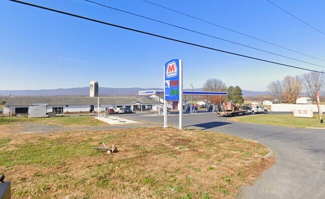
Property Record
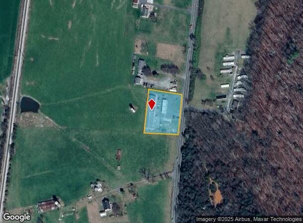
1285 N East Side Hwy, Elkton, VA 22827
NEARBY LISTINGS FOR SALE OR LEASE
-
-
View all Elkton listings for lease on LoopNet.com
Property Detail
1285 N East Side Hwy
115-2-L3F
Elkton
Storebuilding
ELKTON
X
Rockingham
51079C0025C
Virginia
2025
1.26 AC
2025
Staunton & Harrisonburg
010200
Other Market Areas
20,608 SF
Harrisonburg, VA
DEMOGRAPHICS near 1285 N East Side Hwy
1 Mile
3 Mile
5 Mile
2024 Total Population
1,555
6,098
11,950
2029 Population
1,602
6,293
12,210
Pop Growth 2024-2029
+ 3.02%
+ 3.20%
+ 2.18%
Average Age
42
43
43
2024 Total Households
678
2,568
4,927
HH Growth 2024-2029
+ 3.10%
+ 3.27%
+ 2.23%
Median Household Inc
$51,020
$61,930
$60,758
Avg Household Size
2.30
2.40
2.40
2024 Avg HH Vehicles
2.00
2.00
2.00
Median Home Value
$195,976
$201,629
$193,983
Median Year Built
1978
1978
1977
Nearby Places
Map Layers
Map Styles
 Street
 Aerial
- Restaurants
- Banks
- Shops
- Fitness
- Groceries
PUBLIC TRANSPORTATION
AIRPORT
Charlottesville-Albemarle
DRIVE
WALK
Distance
Charlottesville-Albemarle
45 min
31.1 mi
SALE & LEASE HISTORY
LISTING DATE
SALE/LEASE

Sep 24, 2016
For Sale
Jun 05, 2018
For Sale
Apr 27, 2023
For Lease
Nearby Properties
Address
Land Use
TOTAL SIZE
Lot Size
Zoning
Address
Land Use
TOTAL SIZE
Lot Size
Zoning
91,860 SF
55 AC
A2
Address
Land Use
TOTAL SIZE
Lot Size
Zoning
86,249 SF
22.95 AC
A2
Address
Land Use
TOTAL SIZE
Lot Size
Zoning
68,292 SF
2.41 AC
R3
Address
Land Use
TOTAL SIZE
Lot Size
Zoning
94,782 SF
10.35 AC
B2
Address
Land Use
TOTAL SIZE
Lot Size
Zoning
1,824 SF
2.58 AC
A2
Address
Land Use
TOTAL SIZE
Lot Size
Zoning
52,065 SF
8.08 AC
M1
Address
Land Use
TOTAL SIZE
Lot Size
Zoning
12,470 SF
9.99 AC
A1
Address
Land Use
TOTAL SIZE
Lot Size
Zoning
13,294 SF
1.36 AC
A2
Address
Land Use
TOTAL SIZE
Lot Size
Zoning
10,080 SF
8.11 AC
R3
Address
Land Use
TOTAL SIZE
Lot Size
Zoning
129,968 SF
8.71 AC
B2
Address
Land Use
TOTAL SIZE
Lot Size
Zoning
20,397 SF
5 AC
R2
Address
Land Use
TOTAL SIZE
Lot Size
Zoning
15,000 SF
20.52 AC
I1
Address
Land Use
TOTAL SIZE
Lot Size
Zoning
3 AC
R3
Address
Land Use
TOTAL SIZE
Lot Size
Zoning
376.65 AC
A1
Address
Land Use
TOTAL SIZE
Lot Size
Zoning
30,156 SF
0.06 AC
R3
Address
Land Use
TOTAL SIZE
Lot Size
Zoning
13,440 SF
2.68 AC
R2
Address
Land Use
TOTAL SIZE
Lot Size
Zoning
24,233 SF
8 AC
B1
Address
Land Use
TOTAL SIZE
Lot Size
Zoning
16,380 SF
0.61 AC
B1
Address
Land Use
TOTAL SIZE
Lot Size
Zoning
26,996 SF
21.72 AC
M2
Address
Land Use
TOTAL SIZE
Lot Size
Zoning
23,844 SF
6.43 AC
A1
Address
Land Use
TOTAL SIZE
Lot Size
Zoning
22,527 SF
1.65 AC
A2
Address
Land Use
TOTAL SIZE
Lot Size
Zoning
20,472 SF
1.17 AC
B1
Address
Land Use
TOTAL SIZE
Lot Size
Zoning
3,955 SF
3.82 AC
B2
Address
Land Use
TOTAL SIZE
Lot Size
Zoning
10,035 SF
0.30 AC
B1
Address
Land Use
TOTAL SIZE
Lot Size
Zoning
26,517 SF
5.79 AC
R3
Address
Land Use
TOTAL SIZE
Lot Size
Zoning
3,862 SF
1.38 AC
B1
Address
Land Use
TOTAL SIZE
Lot Size
Zoning
18,426 SF
4.40 AC
B1
Address
Land Use
TOTAL SIZE
Lot Size
Zoning
6,679 SF
2.91 AC
R2
Address
Land Use
TOTAL SIZE
Lot Size
Zoning
16,090 SF
2.47 AC
A2
Address
Land Use
TOTAL SIZE
Lot Size
Zoning
10,368 SF
2.07 AC
B1
The World's #1 Commercial Real Estate Marketplace
Connect with us
© 2026 CoStar Group
The information above has been obtained from sources believed reliable. While we do not doubt its accuracy we have not verified it and make no guarantee, warranty or representation about it. It is your responsibility to independently confirm its accuracy and completeness. Any projections, opinions, assumptions, or estimates used are for example only and do not represent the current or future performance of the property. The value of this transaction to you depends on tax and other factors which should be evaluated by your tax, financial, and legal advisors. You and your advisors should conduct a careful, independent investigation of the property to determine to your satisfaction the suitability of the property for your needs.