Property Record
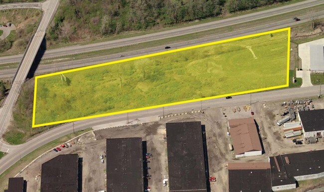
1285 N Ridge Rd, Painesville, OH 44077

NEARBY LISTINGS FOR SALE OR LEASE
Property Detail
1285 N Ridge Rd
11-B-029-0-00-032
LOT 6 TRACT 2
Publicstorage
Lake
X
Ohio
39085C0126F
6
0
7.76 AC
2025
Northeast
204800
Cleveland
50,746 SF
Cleveland-Elyria, OH
DEMOGRAPHICS near 1285 N Ridge Rd
1 Mile
3 Mile
5 Mile
2024 Total Population
1,831
35,178
61,252
2029 Population
1,841
35,123
61,207
Pop Growth 2024-2029
+ 0.55%
(0.16%)
(0.07%)
Average Age
41
40
41
2024 Total Households
711
13,927
24,531
HH Growth 2024-2029
+ 0.70%
(0.19%)
(0.11%)
Median Household Inc
$81,871
$61,031
$73,642
Avg Household Size
2.50
2.40
2.40
2024 Avg HH Vehicles
2.00
2.00
2.00
Median Home Value
$159,478
$154,323
$178,348
Median Year Built
1981
1969
1974
Nearby Places
Map Layers
Map Styles
 Street
 Aerial
- Restaurants
- Banks
- Shops
- Fitness
- Groceries
Nearby Properties
Address
Land Use
TOTAL SIZE
Lot Size
Zoning
Address
Land Use
TOTAL SIZE
Lot Size
Zoning
160,976 SF
3.31 AC
B-4
Address
Land Use
TOTAL SIZE
Lot Size
Zoning
165,749 SF
8 AC
R-1
Address
Land Use
TOTAL SIZE
Lot Size
Zoning
243,207 SF
43.47 AC
R-3
Address
Land Use
TOTAL SIZE
Lot Size
Zoning
78,850 SF
Address
Land Use
TOTAL SIZE
Lot Size
Zoning
172,688 SF
26.82 AC
R-1
Address
Land Use
TOTAL SIZE
Lot Size
Zoning
113,375 SF
2.73 AC
B-3
Address
Land Use
TOTAL SIZE
Lot Size
Zoning
82,044 SF
8.79 AC
Address
Land Use
TOTAL SIZE
Lot Size
Zoning
144,410 SF
9.84 AC
Address
Land Use
TOTAL SIZE
Lot Size
Zoning
137,183 SF
12.35 AC
Address
Land Use
TOTAL SIZE
Lot Size
Zoning
402,462 SF
26.37 AC
I-2
Address
Land Use
TOTAL SIZE
Lot Size
Zoning
51,672 SF
Address
Land Use
TOTAL SIZE
Lot Size
Zoning
47,436 SF
16.83 AC
R1
Address
Land Use
TOTAL SIZE
Lot Size
Zoning
153,534 SF
36.47 AC
I2
Address
Land Use
TOTAL SIZE
Lot Size
Zoning
78,810 SF
8.15 AC
R-1
Address
Land Use
TOTAL SIZE
Lot Size
Zoning
Address
Land Use
TOTAL SIZE
Lot Size
Zoning
74,502 SF
11.47 AC
R-1
Address
Land Use
TOTAL SIZE
Lot Size
Zoning
50,644 SF
250.64 AC
I-2
Address
Land Use
TOTAL SIZE
Lot Size
Zoning
8,556 SF
74.61 AC
R-1
Address
Land Use
TOTAL SIZE
Lot Size
Zoning
74,502 SF
6.35 AC
R-1
Address
Land Use
TOTAL SIZE
Lot Size
Zoning
47,934 SF
0.73 AC
B-4
Address
Land Use
TOTAL SIZE
Lot Size
Zoning
142,593 SF
11.81 AC
Address
Land Use
TOTAL SIZE
Lot Size
Zoning
14,400 SF
173.24 AC
I1
Address
Land Use
TOTAL SIZE
Lot Size
Zoning
1,099,977 SF
142.16 AC
I-2
Address
Land Use
TOTAL SIZE
Lot Size
Zoning
75,593 SF
2.49 AC
B-3
Address
Land Use
TOTAL SIZE
Lot Size
Zoning
116,755 SF
11.12 AC
Address
Land Use
TOTAL SIZE
Lot Size
Zoning
95,628 SF
8.95 AC
R-3
Address
Land Use
TOTAL SIZE
Lot Size
Zoning
50,908 SF
71.84 AC
I-2
Address
Land Use
TOTAL SIZE
Lot Size
Zoning
100,142 SF
25.07 AC
Address
Land Use
TOTAL SIZE
Lot Size
Zoning
62,554 SF
3.26 AC
R-1
Address
Land Use
TOTAL SIZE
Lot Size
Zoning
79,825 SF
9.28 AC
R-1
The World's #1 Commercial Real Estate Marketplace
Connect with us
© 2026 CoStar Group
The information above has been obtained from sources believed reliable. While we do not doubt its accuracy we have not verified it and make no guarantee, warranty or representation about it. It is your responsibility to independently confirm its accuracy and completeness. Any projections, opinions, assumptions, or estimates used are for example only and do not represent the current or future performance of the property. The value of this transaction to you depends on tax and other factors which should be evaluated by your tax, financial, and legal advisors. You and your advisors should conduct a careful, independent investigation of the property to determine to your satisfaction the suitability of the property for your needs.