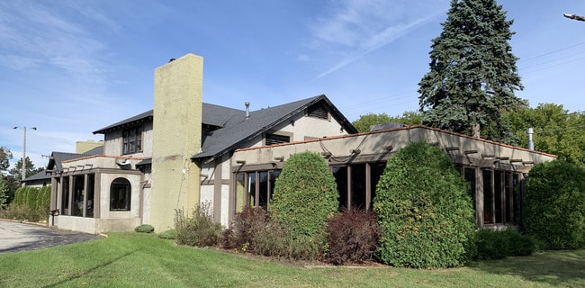
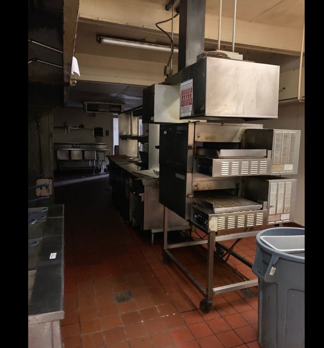
Property Record
1285 N Us Highway 31, Petoskey, MI 49770


NEARBY LISTINGS FOR SALE OR LEASE
Property Detail
1285 N Us Highway 31
01-16-34-100-019
PT OF NW ? OF NW ? OF SECTION 34, COM 750.70 FT S & 33 FT E OF NW COR OF SD SEC TH S83?57?E 499.50 FT ALG N R/O/W LN OF HWY
Commercialnec
Emmet
2024
Michigan
2025
0.75 AC
970400
Michigan North Central Area
8,019 SF
Other Market Areas
DEMOGRAPHICS near 1285 N Us Highway 31
1 Mile
3 Mile
5 Mile
2024 Total Population
752
8,140
15,907
2029 Population
751
8,153
15,969
Pop Growth 2024-2029
(0.13%)
+ 0.16%
+ 0.39%
Average Age
43
43
44
2024 Total Households
317
3,574
7,128
HH Growth 2024-2029
+ 0.32%
+ 0.20%
+ 0.39%
Median Household Inc
$66,562
$68,479
$65,347
Avg Household Size
2.30
2.20
2.10
2024 Avg HH Vehicles
2.00
2.00
2.00
Median Home Value
$301,163
$258,854
$262,235
Median Year Built
1979
1973
1979
Nearby Places
Map Layers
Map Styles
 Street
 Aerial
- Restaurants
- Banks
- Shops
- Fitness
- Groceries
SALE & LEASE HISTORY
LISTING DATE
SALE/LEASE

Oct 30, 2020
For Sale
Nov 06, 2019
For Sale
Dec 21, 2020
For Lease
Dec 21, 2020
For Sale
Nearby Properties
Address
Land Use
TOTAL SIZE
Lot Size
Zoning
Address
Land Use
TOTAL SIZE
Lot Size
Zoning
0.01 AC
EC RR
Address
Land Use
TOTAL SIZE
Lot Size
Zoning
1.43 AC
COP B-2
Address
Land Use
TOTAL SIZE
Lot Size
Zoning
137,452 SF
14.69 AC
EC B-2
Address
Land Use
TOTAL SIZE
Lot Size
Zoning
2.71 AC
COP B-3
Address
Land Use
TOTAL SIZE
Lot Size
Zoning
1.10 AC
LTT RR
Address
Land Use
TOTAL SIZE
Lot Size
Zoning
0.45 AC
EC R-2
Address
Land Use
TOTAL SIZE
Lot Size
Zoning
1.54 AC
EC FF-1
Address
Land Use
TOTAL SIZE
Lot Size
Zoning
0.18 AC
COP B-2
Address
Land Use
TOTAL SIZE
Lot Size
Zoning
1.80 AC
EC FF-1
Address
Land Use
TOTAL SIZE
Lot Size
Zoning
27,900 SF
6.43 AC
EC B-2
Address
Land Use
TOTAL SIZE
Lot Size
Zoning
2,412 SF
4.13 AC
LTT I-1
Address
Land Use
TOTAL SIZE
Lot Size
Zoning
15.46 AC
EC B-2
Address
Land Use
TOTAL SIZE
Lot Size
Zoning
6.72 AC
LTT I-1
Address
Land Use
TOTAL SIZE
Lot Size
Zoning
6.73 AC
COP RM-1
Address
Land Use
TOTAL SIZE
Lot Size
Zoning
15,710 SF
0.40 AC
COP B-2
Address
Land Use
TOTAL SIZE
Lot Size
Zoning
662 SF
27.77 AC
EC FF-1
Address
Land Use
TOTAL SIZE
Lot Size
Zoning
0.13 AC
COP B-2
Address
Land Use
TOTAL SIZE
Lot Size
Zoning
12.98 AC
LTT B-2
Address
Land Use
TOTAL SIZE
Lot Size
Zoning
0.86 AC
COP B-3
Address
Land Use
TOTAL SIZE
Lot Size
Zoning
133,941 SF
11.49 AC
LTT I-2
Address
Land Use
TOTAL SIZE
Lot Size
Zoning
17.69 AC
EC R-2
Address
Land Use
TOTAL SIZE
Lot Size
Zoning
1,728 SF
8.20 AC
EC R-2
Address
Land Use
TOTAL SIZE
Lot Size
Zoning
32,573 SF
3.62 AC
EC R-2
Address
Land Use
TOTAL SIZE
Lot Size
Zoning
72,136 SF
8.56 AC
LTT I-2
Address
Land Use
TOTAL SIZE
Lot Size
Zoning
0.29 AC
COP B-2
Address
Land Use
TOTAL SIZE
Lot Size
Zoning
44.14 AC
EC I-1
Address
Land Use
TOTAL SIZE
Lot Size
Zoning
30,340 SF
6 AC
LTT B-2
Address
Land Use
TOTAL SIZE
Lot Size
Zoning
8.10 AC
EC R-2
Address
Land Use
TOTAL SIZE
Lot Size
Zoning
Address
Land Use
TOTAL SIZE
Lot Size
Zoning
0.70 AC
COP B-2B
The World's #1 Commercial Real Estate Marketplace
Connect with us
© 2025 CoStar Group
The information above has been obtained from sources believed reliable. While we do not doubt its accuracy we have not verified it and make no guarantee, warranty or representation about it. It is your responsibility to independently confirm its accuracy and completeness. Any projections, opinions, assumptions, or estimates used are for example only and do not represent the current or future performance of the property. The value of this transaction to you depends on tax and other factors which should be evaluated by your tax, financial, and legal advisors. You and your advisors should conduct a careful, independent investigation of the property to determine to your satisfaction the suitability of the property for your needs.