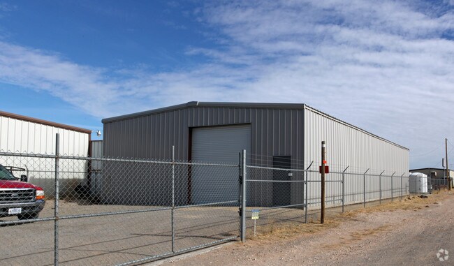
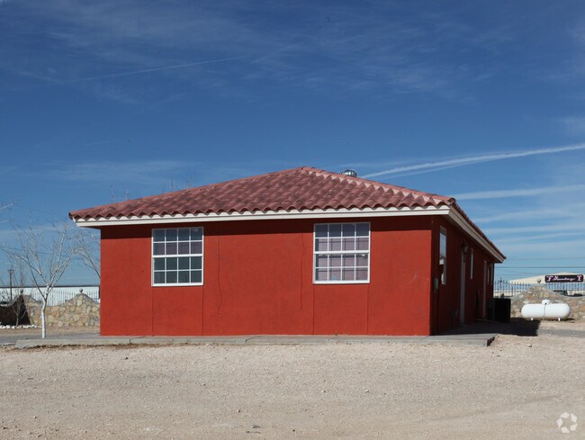
Property Record
12900 Montana Ave, El Paso, TX 79938

NEARBY LISTINGS FOR SALE OR LEASE
-
-
View all El Paso listings for sale on LoopNet.com
Property Detail
12900 Montana Ave
El Paso, TX
Tsp 1 Sec 1 T & P Abst 2098
X579-000-2340-0099
79 TSP 2 SEC 34 T & P ABST 7876 TR 7-A (3.24 AC)
Commercialnec
El Paso
2024
Texas
2025
3.24 AC
010354
East
16,056 SF
El Paso
DEMOGRAPHICS near 12900 Montana Ave
1 Mile
3 Mile
5 Mile
2024 Total Population
16,371
90,062
162,011
2029 Population
16,787
91,105
163,668
Pop Growth 2024-2029
+ 2.54%
+ 1.16%
+ 1.02%
Average Age
31
31
34
2024 Total Households
4,467
26,332
50,313
HH Growth 2024-2029
+ 2.75%
+ 1.17%
+ 1.01%
Median Household Inc
$60,271
$64,003
$61,190
Avg Household Size
3.20
3.30
3.10
2024 Avg HH Vehicles
2.00
2.00
2.00
Median Home Value
$170,010
$163,522
$161,363
Median Year Built
2009
2008
2002
Nearby Places
Map Layers
Map Styles
 Street
 Aerial
- Restaurants
- Banks
- Shops
- Fitness
- Groceries
PUBLIC TRANSPORTATION
AIRPORT
El Paso International
DRIVE
WALK
Distance
El Paso International
21 min
11.1 mi
Freight Ports
Port of Corpus Christi
DRIVE
WALK
Distance
Port of Corpus Christi
676 min
690.0 mi
Nearby Properties
Address
Land Use
TOTAL SIZE
Lot Size
Zoning
Address
Land Use
TOTAL SIZE
Lot Size
Zoning
Address
Land Use
TOTAL SIZE
Lot Size
Zoning
440,943 SF
41.37 AC
C4
Address
Land Use
TOTAL SIZE
Lot Size
Zoning
417,251 SF
22.96 AC
A2
Address
Land Use
TOTAL SIZE
Lot Size
Zoning
349,689 SF
70 AC
R5
Address
Land Use
TOTAL SIZE
Lot Size
Zoning
300,851 SF
31.50 AC
SP
Address
Land Use
TOTAL SIZE
Lot Size
Zoning
192,676 SF
20.58 AC
C4C
Address
Land Use
TOTAL SIZE
Lot Size
Zoning
159,046 SF
175.80 AC
Address
Land Use
TOTAL SIZE
Lot Size
Zoning
148.75 AC
Address
Land Use
TOTAL SIZE
Lot Size
Zoning
234,094 SF
12.28 AC
A2
Address
Land Use
TOTAL SIZE
Lot Size
Zoning
193,556 SF
5.28 AC
C3
Address
Land Use
TOTAL SIZE
Lot Size
Zoning
90,150 SF
21.85 AC
Address
Land Use
TOTAL SIZE
Lot Size
Zoning
140,126 SF
13.98 AC
C4
Address
Land Use
TOTAL SIZE
Lot Size
Zoning
71,862 SF
4.54 AC
A3
Address
Land Use
TOTAL SIZE
Lot Size
Zoning
53,145 SF
3.75 AC
C4C
Address
Land Use
TOTAL SIZE
Lot Size
Zoning
54,678 SF
5.32 AC
C2
Address
Land Use
TOTAL SIZE
Lot Size
Zoning
64,090 SF
Address
Land Use
TOTAL SIZE
Lot Size
Zoning
37,187 SF
5.52 AC
Address
Land Use
TOTAL SIZE
Lot Size
Zoning
46,200 SF
11.39 AC
R5
Address
Land Use
TOTAL SIZE
Lot Size
Zoning
58,448 SF
10.89 AC
C4C
Address
Land Use
TOTAL SIZE
Lot Size
Zoning
64,510 SF
7.16 AC
Address
Land Use
TOTAL SIZE
Lot Size
Zoning
161,414 SF
11.54 AC
AO
Address
Land Use
TOTAL SIZE
Lot Size
Zoning
18.69 AC
R3
Address
Land Use
TOTAL SIZE
Lot Size
Zoning
40,820 SF
10.15 AC
Address
Land Use
TOTAL SIZE
Lot Size
Zoning
100,440 SF
9.86 AC
RF
Address
Land Use
TOTAL SIZE
Lot Size
Zoning
145,244 SF
8 AC
C3S
Address
Land Use
TOTAL SIZE
Lot Size
Zoning
41,209 SF
1.96 AC
C4C
Address
Land Use
TOTAL SIZE
Lot Size
Zoning
43,528 SF
10.75 AC
C4
Address
Land Use
TOTAL SIZE
Lot Size
Zoning
45,740 SF
2.23 AC
C4C
Address
Land Use
TOTAL SIZE
Lot Size
Zoning
100,396 SF
22.05 AC
C4
Address
Land Use
TOTAL SIZE
Lot Size
Zoning
256,946 SF
9.02 AC
C4C
The World's #1 Commercial Real Estate Marketplace
Connect with us
© 2026 CoStar Group
The information above has been obtained from sources believed reliable. While we do not doubt its accuracy we have not verified it and make no guarantee, warranty or representation about it. It is your responsibility to independently confirm its accuracy and completeness. Any projections, opinions, assumptions, or estimates used are for example only and do not represent the current or future performance of the property. The value of this transaction to you depends on tax and other factors which should be evaluated by your tax, financial, and legal advisors. You and your advisors should conduct a careful, independent investigation of the property to determine to your satisfaction the suitability of the property for your needs.