Property Record
12470 W Granada Rd, Avondale, AZ 85392

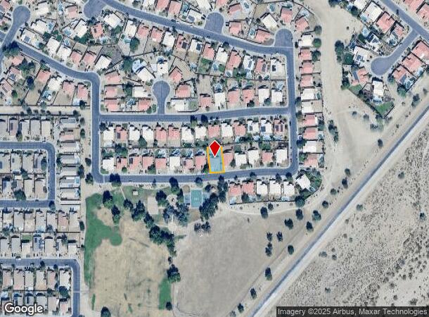
This Property Is For Sale
NEARBY LISTINGS FOR SALE OR LEASE
-
-
-
-
-
-
-
-
-
-
No Photo
-
View all Avondale listings for sale on LoopNet.com
Property Detail
12470 W Granada Rd
Phoenix-Mesa-Scottsdale, AZ
Vistas 2 At Rancho Santa Fe
501-90-045
Maricopa
Sfr
Arizona
X
0.16 AC
04013C2155M
Loop 303/Surprise
1,578 SF
Phoenix
DEMOGRAPHICS near 12470 W Granada Rd
1 Mile
3 Mile
5 Mile
2024 Total Population
16,303
106,502
237,863
2029 Population
17,657
115,698
258,466
Pop Growth 2024-2029
+ 8.31%
+ 8.63%
+ 8.66%
Average Age
37
44
50
2024 Total Households
5,192
41,075
102,339
HH Growth 2024-2029
+ 8.24%
+ 8.92%
+ 8.94%
Median Household Inc
$59,693
$63,655
$65,401
Avg Household Size
3.00
2.50
2.30
2024 Avg HH Vehicles
2.00
2.00
2.00
Median Home Value
$260,920
$287,395
$310,840
Median Year Built
2000
1998
1994
Nearby Places
- Restaurants
- Banks
- Shops
- Fitness
- Groceries
PUBLIC TRANSPORTATION
AIRPORT
Phoenix Sky Harbor International
DRIVE
WALK
Distance
Phoenix Sky Harbor International
32 min
23.1 mi
Freight Ports
Port of San Diego
DRIVE
WALK
Distance
Port of San Diego
379 min
340.6 mi
Nearby Properties
Address
Land Use
TOTAL SIZE
Lot Size
Zoning
Address
Land Use
TOTAL SIZE
Lot Size
Zoning
76,301 SF
15.91 AC
Address
Land Use
TOTAL SIZE
Lot Size
Zoning
12.04 AC
Address
Land Use
TOTAL SIZE
Lot Size
Zoning
12.80 AC
Address
Land Use
TOTAL SIZE
Lot Size
Zoning
49,475 SF
5.70 AC
PAD
Address
Land Use
TOTAL SIZE
Lot Size
Zoning
370,726 SF
23.41 AC
PAD
Address
Land Use
TOTAL SIZE
Lot Size
Zoning
Address
Land Use
TOTAL SIZE
Lot Size
Zoning
Address
Land Use
TOTAL SIZE
Lot Size
Zoning
324,374 SF
18.26 AC
PAD
Address
Land Use
TOTAL SIZE
Lot Size
Zoning
90,008 SF
20.42 AC
M-H
Address
Land Use
TOTAL SIZE
Lot Size
Zoning
563,328 SF
24.43 AC
C2
Address
Land Use
TOTAL SIZE
Lot Size
Zoning
177,052 SF
2.69 AC
THEBLVDD
Address
Land Use
TOTAL SIZE
Lot Size
Zoning
401,714 SF
100.01 AC
PAD
Address
Land Use
TOTAL SIZE
Lot Size
Zoning
1,126,656 SF
35.76 AC
I1
Address
Land Use
TOTAL SIZE
Lot Size
Zoning
901,699 SF
49.92 AC
I1
Address
Land Use
TOTAL SIZE
Lot Size
Zoning
287,294 SF
67.46 AC
PAD
Address
Land Use
TOTAL SIZE
Lot Size
Zoning
802,671 SF
48.81 AC
I1
Address
Land Use
TOTAL SIZE
Lot Size
Zoning
296,791 SF
35 AC
PAD
Address
Land Use
TOTAL SIZE
Lot Size
Zoning
369,413 SF
16.39 AC
THEBLVDD
Address
Land Use
TOTAL SIZE
Lot Size
Zoning
790,980 SF
42.95 AC
I1
Address
Land Use
TOTAL SIZE
Lot Size
Zoning
432,022 SF
19.33 AC
PAD
Address
Land Use
TOTAL SIZE
Lot Size
Zoning
797,310 SF
36.82 AC
I-1
Address
Land Use
TOTAL SIZE
Lot Size
Zoning
397,132 SF
27.52 AC
I1
Address
Land Use
TOTAL SIZE
Lot Size
Zoning
353,155 SF
16.80 AC
M-H
Address
Land Use
TOTAL SIZE
Lot Size
Zoning
340,061 SF
15.50 AC
M-H
Address
Land Use
TOTAL SIZE
Lot Size
Zoning
328,244 SF
18.44 AC
PAD
Address
Land Use
TOTAL SIZE
Lot Size
Zoning
332,075 SF
19.15 AC
C2
Address
Land Use
TOTAL SIZE
Lot Size
Zoning
229,266 SF
10.25 AC
PAD
Address
Land Use
TOTAL SIZE
Lot Size
Zoning
274,700 SF
23.23 AC
PAD
Address
Land Use
TOTAL SIZE
Lot Size
Zoning
191,303 SF
37.42 AC
R-6
Address
Land Use
TOTAL SIZE
Lot Size
Zoning
106,351 SF
20 AC
PAD
The World's #1 Commercial Real Estate Marketplace
Connect with us
© 2025 CoStar Group
The information above has been obtained from sources believed reliable. While we do not doubt its accuracy we have not verified it and make no guarantee, warranty or representation about it. It is your responsibility to independently confirm its accuracy and completeness. Any projections, opinions, assumptions, or estimates used are for example only and do not represent the current or future performance of the property. The value of this transaction to you depends on tax and other factors which should be evaluated by your tax, financial, and legal advisors. You and your advisors should conduct a careful, independent investigation of the property to determine to your satisfaction the suitability of the property for your needs.