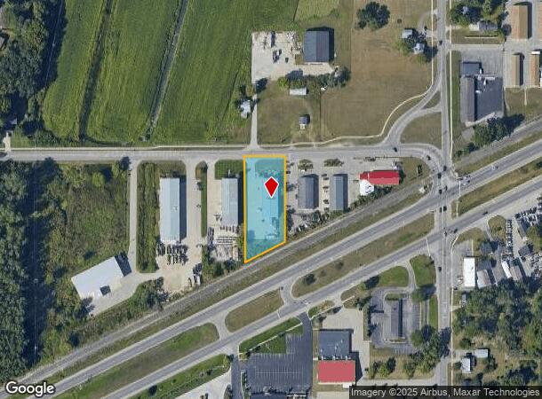
Property Record
1288 Rosewood St, Jenison, MI 49428


NEARBY LISTINGS FOR SALE OR LEASE
Property Detail
1288 Rosewood St
70-14-23-100-069
PART OF SE 1/4 OF NW 1/4 COM N 1/4 COR, TH S 0D 04M 20S W 131459 FT & N 89D 49M 52S W 5115 FT ALG CEN LI ROSEWOOD ST TO BEG,
Publicstorage
Ottawa
X
Michigan
26081C0400D
1.22 AC
2024
E Ottawa Cnty/Hudsonville
2025
West Michigan
021604
Grand Rapids-Wyoming, MI
6,250 SF
DEMOGRAPHICS near 1288 Rosewood St
1 Mile
3 Mile
5 Mile
2024 Total Population
8,537
51,000
111,375
2029 Population
8,964
53,010
115,420
Pop Growth 2024-2029
+ 5.00%
+ 3.94%
+ 3.63%
Average Age
41
39
38
2024 Total Households
3,323
18,905
40,914
HH Growth 2024-2029
+ 5.12%
+ 4.04%
+ 3.60%
Median Household Inc
$69,844
$81,175
$82,795
Avg Household Size
2.50
2.60
2.70
2024 Avg HH Vehicles
2.00
2.00
2.00
Median Home Value
$223,882
$255,307
$259,470
Median Year Built
1973
1979
1984
Nearby Places
Map Layers
Map Styles
 Street
 Aerial
- Restaurants
- Banks
- Shops
- Fitness
- Groceries
PUBLIC TRANSPORTATION
COMMUTER RAIL
DRIVE
WALK
Distance
15 min
9.5 mi
AIRPORT
Gerald R Ford International
DRIVE
WALK
Distance
Gerald R Ford International
32 min
21.0 mi
Nearby Properties
Address
Land Use
TOTAL SIZE
Lot Size
Zoning
Address
Land Use
TOTAL SIZE
Lot Size
Zoning
268,440 SF
28.11 AC
HDR
Address
Land Use
TOTAL SIZE
Lot Size
Zoning
20.61 AC
HDR
Address
Land Use
TOTAL SIZE
Lot Size
Zoning
269,021 SF
22.89 AC
HDR
Address
Land Use
TOTAL SIZE
Lot Size
Zoning
173,288 SF
4.17 AC
PUD
Address
Land Use
TOTAL SIZE
Lot Size
Zoning
114,312 SF
22.23 AC
R-4
Address
Land Use
TOTAL SIZE
Lot Size
Zoning
211,138 SF
30.58 AC
C-5
Address
Land Use
TOTAL SIZE
Lot Size
Zoning
222,785 SF
26.69 AC
CS
Address
Land Use
TOTAL SIZE
Lot Size
Zoning
74.03 AC
MHP
Address
Land Use
TOTAL SIZE
Lot Size
Zoning
124,950 SF
18.30 AC
MHR
Address
Land Use
TOTAL SIZE
Lot Size
Zoning
66,766 SF
R-1-A
Address
Land Use
TOTAL SIZE
Lot Size
Zoning
14.69 AC
R3-B
Address
Land Use
TOTAL SIZE
Lot Size
Zoning
9.65 AC
R3-B
Address
Land Use
TOTAL SIZE
Lot Size
Zoning
139,774 SF
10.67 AC
HDR-B
Address
Land Use
TOTAL SIZE
Lot Size
Zoning
9 AC
R3-A
Address
Land Use
TOTAL SIZE
Lot Size
Zoning
60,523 SF
6.48 AC
C-1
Address
Land Use
TOTAL SIZE
Lot Size
Zoning
82,554 SF
5.56 AC
HDR
Address
Land Use
TOTAL SIZE
Lot Size
Zoning
136,766 SF
18.52 AC
B3
Address
Land Use
TOTAL SIZE
Lot Size
Zoning
164,700 SF
19.18 AC
C-5
Address
Land Use
TOTAL SIZE
Lot Size
Zoning
60,980 SF
2.51 AC
PUD
Address
Land Use
TOTAL SIZE
Lot Size
Zoning
135,752 SF
13.86 AC
C-5
Address
Land Use
TOTAL SIZE
Lot Size
Zoning
62,080 SF
2.54 AC
PUD
Address
Land Use
TOTAL SIZE
Lot Size
Zoning
6.77 AC
R3-B
Address
Land Use
TOTAL SIZE
Lot Size
Zoning
71,102 SF
8.65 AC
MHR
Address
Land Use
TOTAL SIZE
Lot Size
Zoning
45,636 SF
14.11 AC
C-5
Address
Land Use
TOTAL SIZE
Lot Size
Zoning
106,193 SF
10.68 AC
CS
Address
Land Use
TOTAL SIZE
Lot Size
Zoning
45,034 SF
5.79 AC
PUD
Address
Land Use
TOTAL SIZE
Lot Size
Zoning
8,448 SF
2.68 AC
R-4
Address
Land Use
TOTAL SIZE
Lot Size
Zoning
61,464 SF
5.91 AC
C-1
Address
Land Use
TOTAL SIZE
Lot Size
Zoning
59,018 SF
10.60 AC
HDR
Address
Land Use
TOTAL SIZE
Lot Size
Zoning
66,980 SF
LDR
The World's #1 Commercial Real Estate Marketplace
Connect with us
© 2025 CoStar Group
The information above has been obtained from sources believed reliable. While we do not doubt its accuracy we have not verified it and make no guarantee, warranty or representation about it. It is your responsibility to independently confirm its accuracy and completeness. Any projections, opinions, assumptions, or estimates used are for example only and do not represent the current or future performance of the property. The value of this transaction to you depends on tax and other factors which should be evaluated by your tax, financial, and legal advisors. You and your advisors should conduct a careful, independent investigation of the property to determine to your satisfaction the suitability of the property for your needs.