Property Record
129 Bloomfield Ave, Bloomfield, NJ 07003
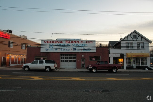

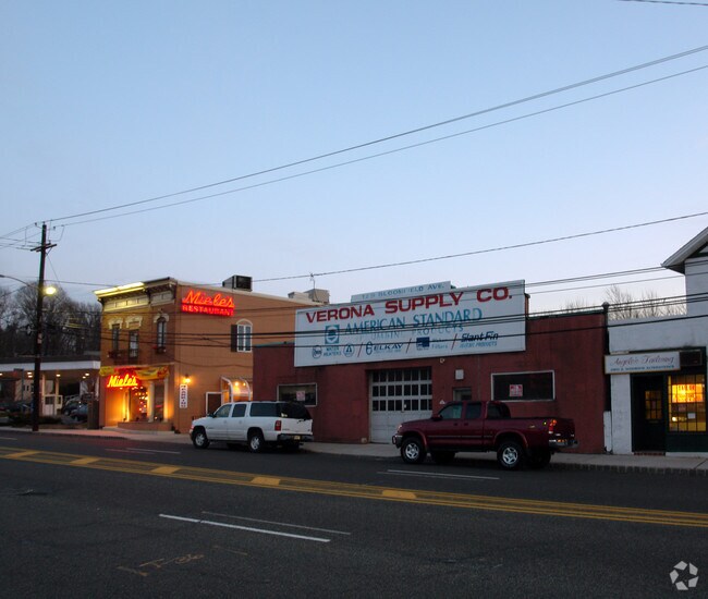
Property Detail
129 Bloomfield Ave
20-00201-0000-00020
58X167+68X72IRR
Warehouse
Essex
C1
New Jersey
B and X Area of moderate flood hazard, usually the area between the limits of the 100-year and 500-year floods.
20
2024
0.22 AC
2025
Suburban Essex/Rt 280
021200
Northern New Jersey
7,305 SF
Newark, NJ
NEARBY LISTINGS FOR SALE OR LEASE
DEMOGRAPHICS near 129 Bloomfield Ave
1 mile
3 mile
5 mile
2025 Total Population
17,104
157,364
509,447
2030 Population
18,035
164,970
532,148
Pop Growth 2025-2030
+ 5.44%
+ 4.83%
+ 4.46%
Average Age
43
41
41
2025 Total Households
7,222
59,460
192,284
HH Growth 2025-2030
+ 5.58%
+ 5.03%
+ 4.63%
Median Household Inc
$159,521
$143,999
$103,041
Avg Household Size
2.30
2.50
2.60
2025 Avg HH Vehicles
2.00
2.00
2.00
Median Home Value
$643,892
$663,427
$536,609
Median Year Built
1953
1952
1956
Nearby Places
Map Layers
Map Styles
 Street
 Aerial
Transit
 Traffic
 Biking
Places
Listings with unknown addresses are not visible on the map
- Restaurants
- Banks
- Shops
- Fitness
- Groceries
PUBLIC TRANSPORTATION
TRANSIT/SUBWAY
Grove Street (Grove Street - Newark Penn Station - Newark Light Rail (Newark Light Rail))
Drive
Walk
Distance
Grove Street (Grove Street - Newark Penn Station - Newark Light Rail (Newark Light Rail))
0 min
3 min
0.2 mi
Silver Lake (Grove Street - Newark Penn Station - Newark Light Rail (Newark Light Rail))
Drive
Walk
Distance
Silver Lake (Grove Street - Newark Penn Station - Newark Light Rail (Newark Light Rail))
2 min
13 min
0.7 mi
Davenport Avenue (Grove Street - Newark Penn Station - Newark Light Rail (Newark Light Rail))
Drive
Walk
Distance
Davenport Avenue (Grove Street - Newark Penn Station - Newark Light Rail (Newark Light Rail))
2 min
15 min
0.8 mi
Bloomfield Avenue (Grove Street - Newark Penn Station - Newark Light Rail (Newark Light Rail))
Drive
Walk
Distance
Bloomfield Avenue (Grove Street - Newark Penn Station - Newark Light Rail (Newark Light Rail))
1 min
20 min
1.0 mi
COMMUTER RAIL
Watsessing Avenue (Montclair-Boonton Line - NJ Transit Commuter Rail (NJ Transit))
Drive
Walk
Distance
Watsessing Avenue (Montclair-Boonton Line - NJ Transit Commuter Rail (NJ Transit))
1 min
15 min
0.7 mi
Bloomfield (Montclair-Boonton Line - NJ Transit Commuter Rail (NJ Transit))
Drive
Walk
Distance
Bloomfield (Montclair-Boonton Line - NJ Transit Commuter Rail (NJ Transit))
2 min
1.2 mi
AIRPORT
Newark Liberty International
Drive
Walk
Distance
Newark Liberty International
14 min
8.7 mi
LaGuardia
Drive
Walk
Distance
LaGuardia
44 min
28.8 mi
John F Kennedy International
Drive
Walk
Distance
John F Kennedy International
52 min
31.7 mi
Freight Ports
Port Newark Container Terminal
Drive
Walk
Distance
Port Newark Container Terminal
17 min
8.5 mi
Nearby Properties
Address
Land Use
TOTAL SIZE
Lot Size
Zoning
Address
Land Use
TOTAL SIZE
Lot Size
Zoning
0.57 AC
Address
Land Use
TOTAL SIZE
Lot Size
Zoning
0.45 AC
Address
Land Use
TOTAL SIZE
Lot Size
Zoning
31.86 AC
Address
Land Use
TOTAL SIZE
Lot Size
Zoning
683 SF
9.59 AC
Address
Land Use
TOTAL SIZE
Lot Size
Zoning
2.01 AC
Address
Land Use
TOTAL SIZE
Lot Size
Zoning
3.42 AC
Address
Land Use
TOTAL SIZE
Lot Size
Zoning
5 AC
H
Address
Land Use
TOTAL SIZE
Lot Size
Zoning
9.77 AC
Address
Land Use
TOTAL SIZE
Lot Size
Zoning
17.97 AC
Address
Land Use
TOTAL SIZE
Lot Size
Zoning
Address
Land Use
TOTAL SIZE
Lot Size
Zoning
0.13 AC
Address
Land Use
TOTAL SIZE
Lot Size
Zoning
1,264 SF
3.20 AC
Address
Land Use
TOTAL SIZE
Lot Size
Zoning
Address
Land Use
TOTAL SIZE
Lot Size
Zoning
0.06 AC
Address
Land Use
TOTAL SIZE
Lot Size
Zoning
16,084 SF
7.23 AC
Address
Land Use
TOTAL SIZE
Lot Size
Zoning
1,589 SF
0.22 AC
R4
Address
Land Use
TOTAL SIZE
Lot Size
Zoning
12.54 AC
OPRP
Address
Land Use
TOTAL SIZE
Lot Size
Zoning
683 SF
0.79 AC
Address
Land Use
TOTAL SIZE
Lot Size
Zoning
3.31 AC
Address
Land Use
TOTAL SIZE
Lot Size
Zoning
0.24 AC
R4
Address
Land Use
TOTAL SIZE
Lot Size
Zoning
Address
Land Use
TOTAL SIZE
Lot Size
Zoning
2.64 AC
Address
Land Use
TOTAL SIZE
Lot Size
Zoning
4.92 AC
Address
Land Use
TOTAL SIZE
Lot Size
Zoning
Address
Land Use
TOTAL SIZE
Lot Size
Zoning
4.33 AC
Address
Land Use
TOTAL SIZE
Lot Size
Zoning
1,264 SF
0.56 AC
Address
Land Use
TOTAL SIZE
Lot Size
Zoning
0.76 AC
Address
Land Use
TOTAL SIZE
Lot Size
Zoning
11.49 AC
M-1
Address
Land Use
TOTAL SIZE
Lot Size
Zoning
7.03 AC
Address
Land Use
TOTAL SIZE
Lot Size
Zoning
2.54 AC
RA
The World's #1 Commercial Real Estate Marketplace
Connect with us
© 2026 CoStar Group
The information above has been obtained from sources believed reliable. While we do not doubt its accuracy we have not verified it and make no guarantee, warranty or representation about it. It is your responsibility to independently confirm its accuracy and completeness. Any projections, opinions, assumptions, or estimates used are for example only and do not represent the current or future performance of the property. The value of this transaction to you depends on tax and other factors which should be evaluated by your tax, financial, and legal advisors. You and your advisors should conduct a careful, independent investigation of the property to determine to your satisfaction the suitability of the property for your needs.