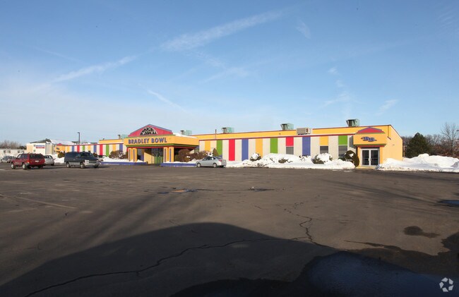
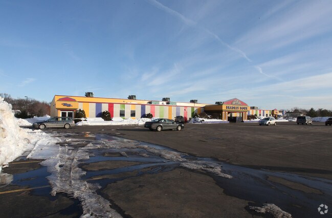
Property Record
129 Ella Grasso Tpke, Windsor Locks, CT 06096
NEARBY LISTINGS FOR SALE OR LEASE
Property Detail
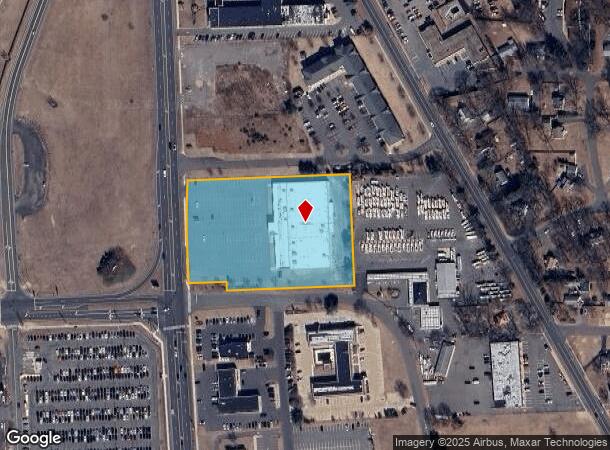
129 Ella Grasso Tpke
WINL-000032-000066-000020
Hartford
Bowlingalley
Connecticut
X
20
09003C0216F
2.95 AC
2024
Windsor Locks
2025
Hartford
476300
Hartford-West Hartford-East Hartford, CT
40,919 SF
DEMOGRAPHICS near 129 Ella Grasso Tpke
1 Mile
3 Mile
5 Mile
2024 Total Population
3,208
22,090
45,859
2029 Population
3,198
21,984
45,703
Pop Growth 2024-2029
(0.31%)
(0.48%)
(0.34%)
Average Age
45
44
44
2024 Total Households
1,420
9,406
18,964
HH Growth 2024-2029
(0.28%)
(0.54%)
(0.44%)
Median Household Inc
$79,359
$85,713
$89,730
Avg Household Size
2.30
2.30
2.30
2024 Avg HH Vehicles
2.00
2.00
2.00
Median Home Value
$221,983
$254,223
$264,865
Median Year Built
1959
1969
1972
Nearby Places
Map Layers
Map Styles
 Street
 Aerial
- Restaurants
- Banks
- Shops
- Fitness
- Groceries
PUBLIC TRANSPORTATION
COMMUTER RAIL
Windsor Locks (Hartford Line - CT Rail (CTRail))
DRIVE
WALK
Distance
Windsor Locks (Hartford Line - CT Rail (CTRail))
7 min
3.4 mi
DRIVE
WALK
Distance
14 min
8.2 mi
AIRPORT
Bradley International
DRIVE
WALK
Distance
Bradley International
14 min
4.2 mi
Nearby Properties
Address
Land Use
TOTAL SIZE
Lot Size
Zoning
Address
Land Use
TOTAL SIZE
Lot Size
Zoning
723,830 SF
160.79 AC
IND1
Address
Land Use
TOTAL SIZE
Lot Size
Zoning
Address
Land Use
TOTAL SIZE
Lot Size
Zoning
100,414 SF
93.10 AC
Address
Land Use
TOTAL SIZE
Lot Size
Zoning
130.99 AC
Address
Land Use
TOTAL SIZE
Lot Size
Zoning
6,000 SF
62.78 AC
IND1
Address
Land Use
TOTAL SIZE
Lot Size
Zoning
64.41 AC
IND3
Address
Land Use
TOTAL SIZE
Lot Size
Zoning
492,240 SF
40.80 AC
Address
Land Use
TOTAL SIZE
Lot Size
Zoning
164,765 SF
17.40 AC
Address
Land Use
TOTAL SIZE
Lot Size
Zoning
64,798 SF
1 AC
Address
Land Use
TOTAL SIZE
Lot Size
Zoning
143,800 SF
Address
Land Use
TOTAL SIZE
Lot Size
Zoning
269,325 SF
32.33 AC
IND3
Address
Land Use
TOTAL SIZE
Lot Size
Zoning
123,229 SF
4.08 AC
MFSD
Address
Land Use
TOTAL SIZE
Lot Size
Zoning
177,366 SF
61.60 AC
RESA
Address
Land Use
TOTAL SIZE
Lot Size
Zoning
334,788 SF
40.37 AC
IND3
Address
Land Use
TOTAL SIZE
Lot Size
Zoning
304,200 SF
58.46 AC
Address
Land Use
TOTAL SIZE
Lot Size
Zoning
52,811 SF
4.79 AC
BUS1
Address
Land Use
TOTAL SIZE
Lot Size
Zoning
12.14 AC
I
Address
Land Use
TOTAL SIZE
Lot Size
Zoning
2,867 SF
17.27 AC
R-2
Address
Land Use
TOTAL SIZE
Lot Size
Zoning
234,000 SF
16.50 AC
Address
Land Use
TOTAL SIZE
Lot Size
Zoning
124,964 SF
RESA
Address
Land Use
TOTAL SIZE
Lot Size
Zoning
11.65 AC
Address
Land Use
TOTAL SIZE
Lot Size
Zoning
25.92 AC
Address
Land Use
TOTAL SIZE
Lot Size
Zoning
Address
Land Use
TOTAL SIZE
Lot Size
Zoning
242,000 SF
20.30 AC
Address
Land Use
TOTAL SIZE
Lot Size
Zoning
451,937 SF
25.93 AC
IND3
Address
Land Use
TOTAL SIZE
Lot Size
Zoning
14,295 SF
24.45 AC
R-1
Address
Land Use
TOTAL SIZE
Lot Size
Zoning
14,864 SF
0.25 AC
IND1
Address
Land Use
TOTAL SIZE
Lot Size
Zoning
15.58 AC
RESA
Address
Land Use
TOTAL SIZE
Lot Size
Zoning
50,287 SF
1.74 AC
Address
Land Use
TOTAL SIZE
Lot Size
Zoning
150,000 SF
22.20 AC
M-1
The World's #1 Commercial Real Estate Marketplace
Connect with us
© 2026 CoStar Group
The information above has been obtained from sources believed reliable. While we do not doubt its accuracy we have not verified it and make no guarantee, warranty or representation about it. It is your responsibility to independently confirm its accuracy and completeness. Any projections, opinions, assumptions, or estimates used are for example only and do not represent the current or future performance of the property. The value of this transaction to you depends on tax and other factors which should be evaluated by your tax, financial, and legal advisors. You and your advisors should conduct a careful, independent investigation of the property to determine to your satisfaction the suitability of the property for your needs.